Roading/Streets
Reported Wednesday, 9 November 2016 at 5:23 pm, 2, Riccarton Avenue, Christchurch, 8011, Canterbury.
The reporter’s words
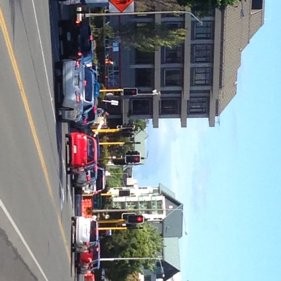
The photograph is of the Hagley Ave-Riccarton Ave corner looking from theCDHB car park towards the hospital. The traffic light shows a red turning arrow. This is obsolete and holds up traffic. The only traffic that comes fro Tuam Street on the right are buses. That part of Tuam St is closed to all other traffic. Therefore this red turning light is no longer needed. Please refer this to the proper authority and have the system conform to the new Road use reality.
The filing
- Filed
- Wednesday, 9 November 2016 at 5:23 pm
- Report number
- #191,905
- Filed under
- roads
- Coordinates
- the pin on the map →
The council’s work orders, near this pin
- Graffiti (OLD)10 m away · resolved 3 Apr 2023, took 25 hours
- Safety Improvements15 m away · resolved 3 Oct 2025, took 15 hours
- Graffiti - Sign, mural or public art18 m away · resolved 11 days ago, took 45 hours
- Graffiti - Road, footpath or bridge19 m away · resolved 29 Sept 2026, took 4 months
- Lighting19 m away · resolved 26 May 2025, took 3 weeks
- Graffiti (OLD)23 m away · resolved 3 Apr 2023, took 22 hours
- Manhole23 m away · resolved 27 May 2019, took 23 hours
- Graffiti23 m away · resolved 13 Aug 2019, took 21 hours
MyCouncilTicket is the council’s own work-order stream, a different door from the public report above, and the same job can stand in both. The whole ticket roll →
Where this sits
The suburbthe suburb, in depthThe problemRoading/Streetsevery filing of its kind on the city’s booksThe date9 Novemberthis date in the archive, across the yearsThe year2016the year’s shelf and ledgerThe mapOn the mapthe pin, among its neighboursBeforeWhat stood herewhat the archive knows of this ground
The feed listed this report when a sweep caught it 5 Sept 2026, it has not been listed since. The record here does not move.