Roading/Streets
Reported Tuesday, 2 May 2017 at 5:29 pm, lat/lng: (-43.53649487,172.64428956).
The reporter’s words
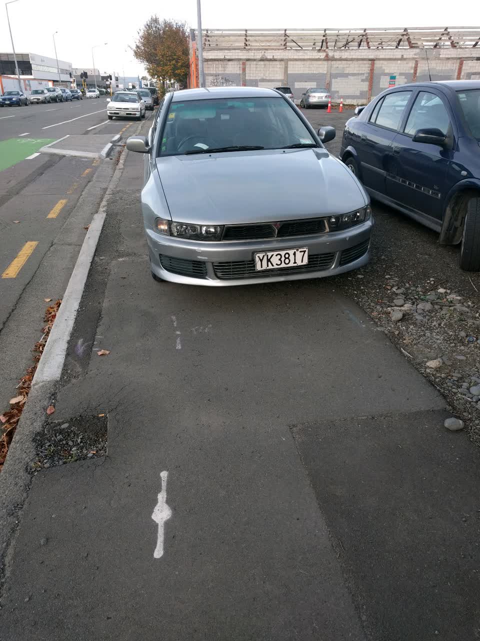
The carpark between St Asaph Street and Ferry Road often has cars over the footpath, but the one in the attached picture is completely over causing people to walk on the street to get around it.
The filing
- Filed
- Tuesday, 2 May 2017 at 5:29 pm
- Report number
- #253,161
- Filed under
- roads
- Coordinates
- the pin on the map →
The council’s work orders, near this pin
- Signs6 m away · open, filed 3 Oct 2025
- Garden (Road)9 m away · resolved 8 Jul 2019, took 13 days
- Graffiti - Fence, building or structure9 m away · open, filed 22 Sept 2026
- Garden (Road)10 m away · open, filed 12 Apr 2019
- Graffiti (OLD)10 m away · resolved 12 Jun 2023, took 3 weeks
- Graffiti12 m away · resolved 29 Apr 2022, took 42 hours
- Road/Hard Surface13 m away · resolved 8 Jul 2026, took 12 months
- Graffiti - Fence, building or structure13 m away · resolved 8 Sept 2026, took 3 days
MyCouncilTicket is the council’s own work-order stream, a different door from the public report above, and the same job can stand in both. The whole ticket roll →
Where this sits
The feed listed this report when a sweep caught it 5 Sept 2026, it has not been listed since. The record here does not move.