Wastewater/Stormwater
Reported Thursday, 19 April 2018 at 3:06 pm, 2/252, Salisbury Street, Christchurch, 8013, Canterbury.
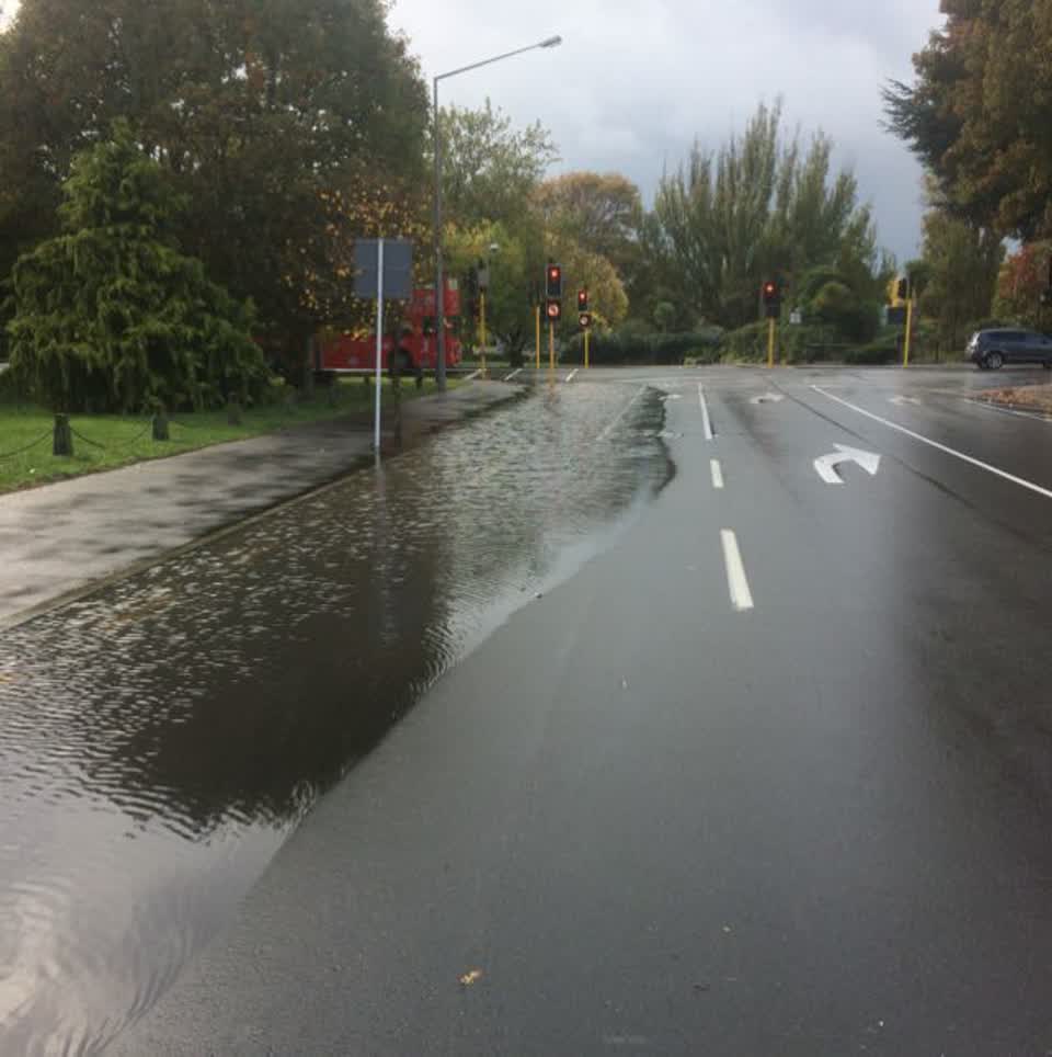
The reporter’s words
Whenever it rain a bit harder than usual, the kerbside lane on Salisbury St approaching Barbadoes St floods as per the attached photo. That’s rather surprising given the sump in that corner would presumably be connected to the massive brick barrel stormwater drain that runs along Salisbury and flows into the little pond in The Cambridge Green Reserve where one can see its size. Please investigate.
The filing
- Filed
- Thursday, 19 April 2018 at 3:06 pm
- Report number
- #409,499
- Filed under
- water
- Coordinates
- the pin on the map →
The council’s work orders, near this pin
- Litter1 m away · resolved 17 May 2024, took 3 weeks
- Graffiti - Utility box, pole, railway3 m away · resolved 30 Jul 2024, took 46 hours
- Graffiti - Fence, building or structure5 m away · resolved 8 Nov 2024, took 3 days
- Graffiti - Utility box, pole, railway6 m away · resolved 23 Jan 2025, took 38 hours
- Graffiti (OLD)6 m away · resolved 26 Feb 2024, took 2 days
- Graffiti - Utility box, pole, railway7 m away · resolved 16 Jun 2025, took 26 hours
- Blocked drain pipe or waterway (Road)7 m away · resolved 21 Jan 2022, took 3 days
- Leak (Water Supply)8 m away · resolved 14 Dec 2020, took 40 hours
MyCouncilTicket is the council’s own work-order stream, a different door from the public report above, and the same job can stand in both. The whole ticket roll →
Where this sits
The suburbthe suburb, in depthThe problemWastewater/Stormwaterevery filing of its kind on the city’s booksThe date19 Aprilthis date in the archive, across the yearsThe year2018the year’s shelf and ledgerThe mapOn the mapthe pin, among its neighboursBeforeWhat stood herewhat the archive knows of this ground
The feed listed this report when a sweep caught it 5 Sept 2026, it has not been listed since. The record here does not move.