Roading/Streets
Reported Monday, 4 June 2018 at 5:09 pm, 42, Saint Andrews Hill Road, Mount Pleasant, 8081, Canterbury.
The reporter’s words
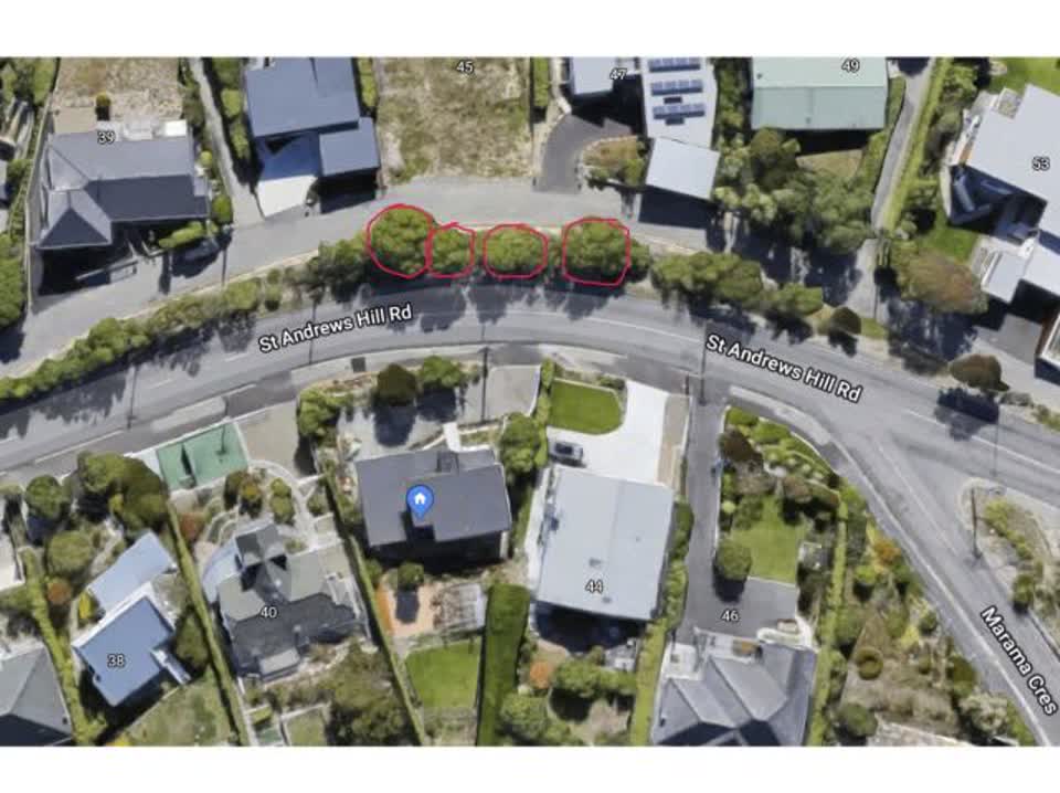
Hi there neighbour, There are 4 large trees in the road reserve opposite our property (42 St Andrews Hill Road) which are obstructing our view. We would love it if you would consider removing the trees. There are also some lovely native species underneath the larger trees which will flourish if the larger ones are removed. I have attached some images to help identify the trees we mean. There is a council owned access road on the downhill side of the trees off the main part of st Andrews Hill road - which is only used by half a dozen houses. I imagine only minimum (or possibly no) traffic management would be required. If you have any questions please don’t hesitate to get in touch. Cheers, George
The filing
- Filed
- Monday, 4 June 2018 at 5:09 pm
- Report number
- #440,082
- Filed under
- roads
- Coordinates
- the pin on the map →
The council’s work orders, near this pin
- Safety Improvements12 m away · resolved 19 Oct 2023, took 10 days
- Speed Limit Changes13 m away · open, filed 26 Mar 2024
- Lighting15 m away · resolved 18 Jan 2024, took 25 hours
- Channel/Kerb/Culvert16 m away · resolved 23 May 2023, took 7 weeks
- Channel/Kerb/Culvert19 m away · resolved 19 Jun 2025, took 42 hours
- Trees20 m away · resolved 20 Sept 2022, took 4 months
- Water Leak21 m away · resolved 18 Mar 2024, took 3 weeks
- Leak (Water Supply)22 m away · resolved 22 Feb 2022, took 3 weeks
MyCouncilTicket is the council’s own work-order stream, a different door from the public report above, and the same job can stand in both. The whole ticket roll →
Where this sits
The pin44 Saint Andrews Hill Roadlands 20 m from this filed address, its whole recordThe streetSaint Andrews Hill Roadthe street the pin lands nearest, its record, every report on itThe suburbMount Pleasantthe suburb, in depthThe problemRoading/Streetsevery filing of its kind on the city’s booksThe date4 Junethis date in the archive, across the yearsThe year2018the year’s shelf and ledgerThe mapOn the mapthe pin, among its neighboursBeforeWhat stood herewhat the archive knows of this ground
The feed listed this report when a sweep caught it 5 Sept 2026, it has not been listed since. The record here does not move.