Roading/Streets
Reported Friday, 2 November 2018 at 12:33 pm, 53, Edward Avenue, Edgeware, 8013, Canterbury.
The reporter’s words
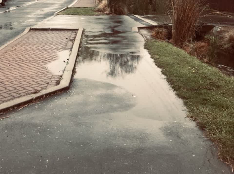
Sunken area of footpath due to EQ damage. Water depth approx 1 inch when photo taken.
The filing
- Filed
- Friday, 2 November 2018 at 12:33 pm
- Report number
- #534,722
- Filed under
- roads
- Coordinates
- the pin on the map →
The council’s work orders, near this pin
- Road Asset (e.g.footpathroadfurniture)5 m away · resolved 2 May 2019, took 6 months · probably the same job, filed through both doors
- Litter (Road)2 m away · resolved 18 Mar 2020, took 25 hours
- Road/Hard Surface4 m away · resolved 10 Jul 2025, took 9 months
- Flooding4 m away · resolved 11 May 2023, took 1 hours
- Channel/Kerb/Culvert5 m away · resolved 28 Feb 2025, took 3.0 years
- Road/Hard Surface7 m away · resolved 27 Mar 2024, took 8 months
- Footpath8 m away · resolved 17 May 2024, took 7 months
- Flooding (Road)8 m away · resolved 6 Apr 2022, took 1 hours
MyCouncilTicket is the council’s own work-order stream, a different door from the public report above, and the same job can stand in both. The whole ticket roll →
Where this sits
The pin53 Edward Avenuelands 4 m from this filed address, its whole recordThe streetEdward Avenuethe street the pin lands nearest, its record, every report on itThe suburbEdgewarethe suburb, in depthThe problemRoading/Streetsevery filing of its kind on the city’s booksThe date2 Novemberthis date in the archive, across the yearsThe year2018the year’s shelf and ledgerThe mapOn the mapthe pin, among its neighboursBeforeWhat stood herewhat the archive knows of this ground
The feed listed this report when a sweep caught it 5 Sept 2026, it has not been listed since. The record here does not move.