Roading/Streets
Reported Thursday, 8 November 2018 at 8:01 pm, lat/lng: (-43.49739800422297,172.62035033051606).
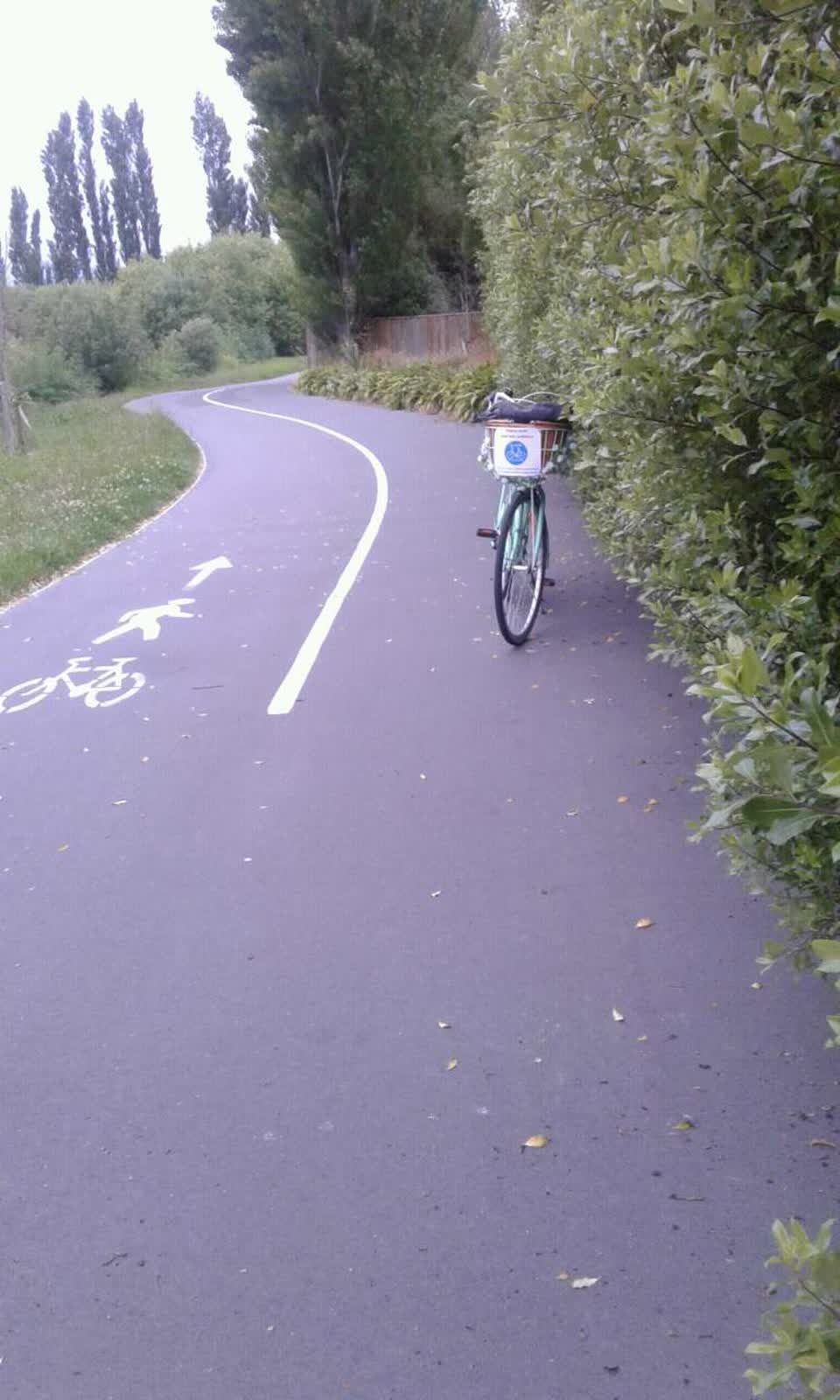
The reporter’s words
Dual direction cycle/walkway between Grassmere & Rutland Reserve overgrown. Northbound space reduced to 50%. Needs cutting back by minimum 1meter to allow for new growth of these large fasthrowing bushes.
The filing
- Filed
- Thursday, 8 November 2018 at 8:01 pm
- Report number
- #539,508
- Filed under
- roads
- Coordinates
- the pin on the map →
The council’s work orders, near this pin
- General Maintenance (Parks)1 m away · resolved 11 Jul 2019, took 8 months
- Trees6 m away · resolved 1 Oct 2025, took 3 weeks
- Tree (Park)6 m away · resolved 4 Feb 2019, took 11 days
- Trees8 m away · open, filed 1 Aug 2023
- Graffiti9 m away · resolved 6 Jan 2020, took 3 days
- Garden/Landscaped Area10 m away · resolved 8 Dec 2023, took 3 weeks
- Graffiti12 m away · resolved 6 Jan 2020, took 3 days
- Garden (Park)13 m away · resolved 7 Jan 2020, took 6 months
MyCouncilTicket is the council’s own work-order stream, a different door from the public report above, and the same job can stand in both. The whole ticket roll →
Where this sits
The suburbthe suburb, in depthThe problemRoading/Streetsevery filing of its kind on the city’s booksThe date8 Novemberthis date in the archive, across the yearsThe year2018the year’s shelf and ledgerThe mapOn the mapthe pin, among its neighboursBeforeWhat stood herewhat the archive knows of this ground
The feed listed this report when a sweep caught it 5 Sept 2026, it has not been listed since. The record here does not move.