1 Matai Street East, Riccarton
21 reports on record since June 2021 · 8 with photographs. The street’s heaviest record is 44 Matai Street East — 31 reports on file. Indicative rating valuation and school zones, hazards, bin day and what stood here before.
What gets reported here
- Roading/Streets — 6
- Pavement - General — 5
- Road Signage — 2
- Road Blockage — 2
- Traffic Signals — 1
- Overgrown Vegetation — 1
Photographed here 8 on record


Reported here
 Pavement - General —
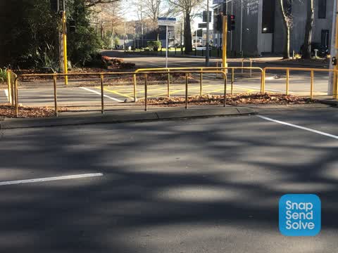
 Rail on centre crossing damaged
 Pavement - General —
 Ped crossing light not working
- Traffic Signals —
This intersection has pedestrian and bike lights that are not in sync. The pedestrian lights let you do half a road at a time. I have seen m
 Graffiti on a fence, building or structure —
 - Road Signage —
Green traffic light (for vehicle traffic) not working on Hagley side of pedestrian crossing
 Road Signage —
 The cycle crossing at Deans Ave outside Girls High is unmarked which means cars often stop on it and block it as they don’t realise it’s a c
 Pavement - General —
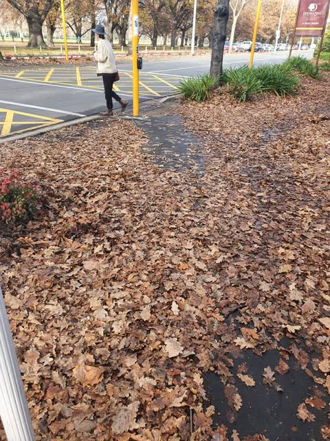
 Footpath has disappeared again. Perhaps a lot of the bark and leaf litter should be removed
 Overgrown Vegetation —
 Low branches are hiding the lights on the cycle and pedestrian crossing across Deans Ave at the end of Matai St East
- Pavement - General —
- Dumped Rubbish —
- Damaged Street Sign —
- Damaged Street Light —
- Road Blockage —
- Road Blockage —
- Pavement - General —
- Roading/Streets —
Car drove through a red light at the pedestrian/cyclist crossing, there were children admit to cross LRK635, bald prick in a black SUV styl
- Roading/Streets —
Car drove through a red light at the pedestrian/cyclist crossing, there were children admit to cross LRK635, bald prick in a black SUV styl
- Roading/Streets —
Car drove through a red light at the pedestrian/cyclist crossing, there were children admit to cross LRK635, bald prick in a black SUV styl
 Roading/Streets —
 Leaves in the pedestrian crossing mean that there is limited space to pass and can make tge area unsafe for prams/wheelchairs
- Roading/Streets —
On the west side of Uni-cycle at Dean's avei couldn't get any of the cycle or Pedestrian lights to activate
 Roading/Streets —
 This area hasn't had the fallen leaves removed for several weeks. it's very slippery and there's also one section where you can determine th
Also reported on Matai Street East
- 44 Matai Street East — 31 reports
- 10 Matai Street East — 13 reports
- 34 Matai Street East — 7 reports
- 10B Matai Street East — 6 reports
- 17 Matai Street East — 4 reports
- 5 Matai Street East — 3 reports
- 11 Matai Street East — 3 reports
- 17A Matai Street East — 2 reports
The street’s crash record
NZTA’s record names Matai Street East in 4 crashes that hurt somebody since 2006 — 1 seriously hurt, nobody killed.
The green nearby
- Hagley Park North — 56 m to the edge · Sports ground · 91 ha
- Little Hagley Park — 174 m to the edge · Botanic · 7 ha
- Mona Vale — 197 m to the edge · Botanic · 5 ha
- Millbrook Reserve — 414 m to the edge · Botanic
Parks within half a kilometre, measured to the boundary — the council’s open data.
On the doorstep
- The Chateau on the Park - DoubleTree by Hilton Hotel — 100 m away · Hotels
- The Den Bar - The Chateau on the Park — 113 m away · Restaurants
- The Garden Court Brasserie - The Chateau on the Park — 113 m away · Restaurants
- The Chateau On The Park Christchurch A Double Tree By Hilton — 119 m away · Hotels
Businesses within four hundred metres, measured at the pin — OpenStreetMap and the council directories.
The bus nearby
- Kilmarnock St near Deans Ave — 158 m away · route 130
- Kilmarnock St near Deans Ave — 174 m away · route 130
The closest Metro stops, within four hundred and fifty metres.
The tracks through here
- Walk and bike track through Riccarton — 29 m to the line · walk · bike
- Walk and bike track through Riccarton — 39 m to the line · walk · bike
- Walk and bike track through Riccarton — 57 m to the line · walk · bike
- Walk and bike track through Riccarton — 58 m to the line · walk · bike
- Walk and bike track through Riccarton — 140 m to the line · walk · bike
Tracks whose line passes within half a kilometre, measured to the line itself — the council’s open data.
The named ground
Named water within 500 m of this address, measured to the line or the edge; Named places within 1.5 km of this address; the council’s own structure register — bridges, boardwalks and steps standing nearby — the open map’s record.
Renting nearby
new bonds in Riccarton ran about $544 a week — about the city median — the suburb page keeps the rent record →.
What was here — Former Pumphouse and Setting, Pump No. 24.
74 m away · 5 Matai Street East · located to ±5 m · the place’s own record →
On the register. Nothing researched here yet.
The civic layer
This ground votes in Riccarton ward — the Halswell-Hornby-Riccarton community board. Ward lines don’t always follow suburb lines; this one is measured at the pin, not the suburb’s centre.
What stood on this ground → · On the map → · From the air — the Crown’s aerials back to 1936; search the address on RetroLens →
Questions, answered briefly
21 council reports on record since June 2021 — most often roading/streets (6), pavement - general (5), road signage (2).
Riccarton, Christchurch — on Matai Street East.
The heritage register names a place at or beside it — Former Pumphouse and Setting, Pump No. 24..
Hagley Park North — 56 m to its edge, 91 ha.