233 Riccarton Road, Riccarton
17 reports on record since March 2017 · 7 with photographs. The street’s heaviest record is 35 Riccarton Road — 45 reports on file. Indicative rating valuation and school zones, hazards, bin day and what stood here before.
What gets reported here
- Graffiti — 12
- Street Gutters / Storm Water — 1
- Poles and Signage - General — 1
- Graffiti on a fence, building or structure — 1
- Graffiti on a cabinet, pole or railway asset — 1
- General Request — 1
Photographed here 7 on record


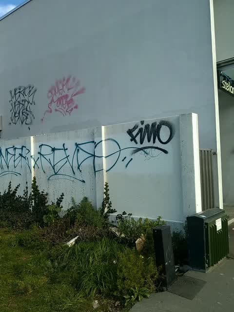
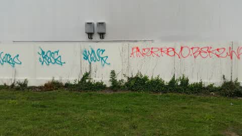
Reported here
 Graffiti on a fence, building or structure —
 Tagged rubbish bin
 Street Gutters / Storm Water —
 The drains in this area are all blocked
 Poles and Signage - General —
 Missing P30 parking sign at the end
 Graffiti on a cabinet, pole or railway asset —
  Graffiti —
 - Graffiti —
- Graffiti —
- Graffiti —
- Graffiti —
- Graffiti —
- Graffiti —
- Graffiti —
- General Request —
- Graffiti —
- Graffiti —
Graffiti —
Graffiti —
Also reported on Riccarton Road
- 35 Riccarton Road — 45 reports
- 71 Riccarton Road — 43 reports
- 102 Riccarton Road — 36 reports
- 116 Riccarton Road — 33 reports
- 57 Riccarton Road — 32 reports
- 33 Riccarton Road — 32 reports
- 112 Riccarton Road — 30 reports
- 123 Riccarton Road — 27 reports
The street’s crash record
NZTA’s record names Riccarton Road in 275 crashes that hurt somebody since 2006 — 1 person killed, 44 seriously hurt.
The green nearby
- Shand Crescent Reserve — 146 m to the edge
- Paeroa Reserve — 172 m to the edge
- Harrington Park — 278 m to the edge · Sports ground · 1 ha
- Milnebank Reserve — 328 m to the edge
- Riccarton Bush — 456 m to the edge · 12 ha
Parks within half a kilometre, measured to the boundary — the council’s open data.
On the doorstep
- Vegetarian World — 2 m away · Delis
- The Camden — 5 m away · Restaurants
- Crispy Chicken — 15 m away · Fast food
- Hello Vietnam Restaurant — 22 m away · Restaurants
Businesses within four hundred metres, measured at the pin — OpenStreetMap and the council directories.
The bus nearby
- Riccarton Rd near Paeroa St — 35 m away · route 3, route 5, route 80, route 86, route 100, route 120, route 130, the Orbiter (anticlockwise)
- Riccarton Rd near Paeroa St — 50 m away · route 3, route 5, route 80, route 86, route 100, route 120, route 130, the Orbiter (clockwise)
The closest Metro stops, within four hundred and fifty metres.
The tracks through here
- Walk and bike track through Riccarton — 11 m to the line · walk · bike
- Walk and bike track through Riccarton — 60 m to the line · walk · bike
- Walk and bike track through Riccarton — 72 m to the line · walk · bike
- Walk and bike track through Riccarton — 107 m to the line · walk · bike
- Walk and bike track through Riccarton — 377 m to the line · walk · bike
Tracks whose line passes within half a kilometre, measured to the line itself — the council’s open data.
The named ground
Named water within 500 m of this address, measured to the line or the edge; the council’s own structure register — bridges, boardwalks and steps standing nearby — the open map’s record.
The remembered names nearby
- Presented to the Borough of Riccarton on the Occasion — 215 m away ·
PRESENTED TO THE BOROUGH OF RICCARTON ON THE OCCASION OF THE BOROUGH GOLDEN JUBILEE 1973 B
· 2003 - Shand Reserve – John Shand, Arrived From Chester, England — 217 m away ·
SHAND RESERVE – John Shand, arrived from Chester, England on the Isabella Hercus in 1851 w
· 2003 - This Tree Was Planted by the Riccarton Wigram Community — 220 m away ·
THIS TREE WAS PLANTED BY THE RICCARTON WIGRAM COMMUNITY BOARD TO COMMEMORATE 100 YEARS OF
· 2003
Inscribed plaques within two hundred and fifty metres — the register’s pins, not surveyed spots. The whole roll is at /plaques.
Renting nearby
new bonds in Riccarton ran about $544 a week — about the city median — the suburb page keeps the rent record →.
The civic layer
This ground votes in Riccarton ward — the Halswell-Hornby-Riccarton community board. Ward lines don’t always follow suburb lines; this one is measured at the pin, not the suburb’s centre.
What stood on this ground → · On the map → · From the air — the Crown’s aerials back to 1936; search the address on RetroLens →
Questions, answered briefly
17 council reports on record since March 2017 — most often graffiti (12), street gutters / storm water (1), poles and signage - general (1).
Riccarton, Christchurch — on Riccarton Road.
Nothing on the heritage register at this exact spot — the record around this ground →
Shand Crescent Reserve — 146 m to its edge.