295 Stanmore Road, Richmond
42 reports on record since July 2016 · 33 with photographs. The street’s heaviest record is 277 Stanmore Road — 52 reports on file. Indicative rating valuation and school zones, hazards, bin day and what stood here before.
What gets reported here
Photographed here 33 on record





Reported here
 General Request —
 Tagging
 Dumped Rubbish —
 Pavitt Street park entrance
 Dumped Rubbish —
 South end of the park
 Dumped Rubbish —
 Opposite 45 Pavitt st Richmond
 Poles and Signage - General —
 Opposite Warwick st
 Street Gutters / Storm Water —
 Blocked drain in Stanmore Rd gutter
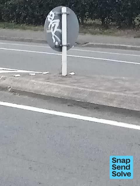
 Graffiti on a fence, building or structure —
 Graffiti on two signs centre island
 Rubbish and Bins - General —
 Bin over flowing. Rubbish scattered
 Graffiti on a fence, building or structure —
 By Richmond Park
 Street Gutters / Storm Water —
 This drain is totally blocked up , the water simply can not run away , blocked to the top of the grate , opposite Stanmore New World
 Park - General Request —
 Dumped old couch and general rubbish , South end of Richmond Village Park , by soccer goal net
 Pavement - General —
 Flash drainage isn't working after remodeling
 Poles and Signage - General —
 There has never been a mobile library here for years and years !!!! Please remove the outdated sign , opposite Stanmore Road New World, this
 Poles and Signage - General —
 There has never been a taxi stand here for years , perhaps remove the sign ??? Opposite Stanmore Road New World
 Playground Equipment —
 There's a lack of wood chips/bark under and around the play equipment at Richmond green. Under the swivel equipment, there is concrete visib
 Graffiti on a fence, building or structure —
 Outside 273 Stanmore Road by Manila Grill
 Graffiti somewhere else —
 Seat is near main hedge in park see pics
 Graffiti somewhere else —
 Ok lamp post no ladder required
 Graffiti on a fence, building or structure —
 EKOE yellow paint tag on concrete pole by 295 Stanmore Road
 Graffiti on a fence, building or structure —
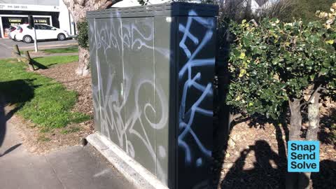
  Graffiti somewhere else —
 Large green cabinet
 Pavement - Damaged —
 Outside Stanmore New World , pedestrian barriers have been hit by motor vehicle
 Graffiti —
 Back of blue arrow sign in island next to entrance of Stanmore rd into new world
 Graffiti —
 - Graffiti —
- Graffiti —
- Graffiti —
- Pavement - Damaged —
- General Request —
- Damaged Road —
- Rubbish and Bins - General —
- Graffiti —
- Park - General Request —
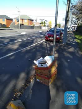 Rubbish/Recycling —
 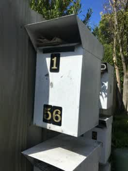 Roading/Streets —
 London st, richmond. Flimsy and dried out brittle and plastic cover. Potential hazard, especially for older folk. One picture is of my ankle
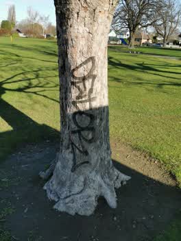 Graffiti —
 We have video footage of this guy, he's starting to tag trees now
Roading/Streets —
Graffiti —
Rubbish/Recycling —
Graffiti —
Graffiti —
Adshel bus stop
Rubbish/Recycling —
Also reported on Stanmore Road
- 277 Stanmore Road — 52 reports
- 213 Stanmore Road — 28 reports
- 211 Stanmore Road — 21 reports
- 337 Stanmore Road — 20 reports
- 249A Stanmore Road — 18 reports
- 240 Stanmore Road — 17 reports
- 319 Stanmore Road — 16 reports
- 230 Stanmore Road — 16 reports
The street’s crash record
NZTA’s record names Stanmore Road in 57 crashes that hurt somebody since 2006 — 1 person killed, 9 seriously hurt.
The green nearby
- Richmond Playground — you are in it
- Alexandra Park — 228 m to the edge
- Avebury Park — 305 m to the edge · Botanic
- Avon Riverbank True Right — 368 m to the edge · 11 ha
Parks within half a kilometre, measured to the boundary — the council’s open data.
On the doorstep
- Sun Ning Chinese Takeaways — 77 m away · Fast food
- New World — 79 m away · Supermarkets
- Sun Ning Takeaways — 82 m away · Fast food
- New World Stanmore — 82 m away · Supermarkets
Businesses within four hundred metres, measured at the pin — OpenStreetMap and the council directories.
The bus nearby
- Stanmore Rd near London St — 61 m away · route 60, the Orbiter (anticlockwise)
- Stanmore Rd near London St — 82 m away · route 60, the Orbiter (clockwise)
The closest Metro stops, within four hundred and fifty metres.
The tracks through here
- Walk and bike track through Richmond — 19 m to the line · walk · bike
- Walk and bike track through Richmond — 291 m to the line · walk · bike
- Walk and bike track through Richmond — 340 m to the line · walk · bike
- Walk and bike track through Richmond — 341 m to the line · walk · bike
- Walk and bike track through Richmond — 365 m to the line · walk · bike
Tracks whose line passes within half a kilometre, measured to the line itself — the council’s open data.
The named ground
Named water within 500 m of this address, measured to the line or the edge — the open map’s record.
The remembered names nearby
- In Commemoration of the Centenary of Women’S Suffrage — 7 m away ·
In Commemoration of the Centenary of Women’s Suffrage Hagley Ferrymead Community Board Nov
· 2009
Inscribed plaques within two hundred and fifty metres — the register’s pins, not surveyed spots. The whole roll is at /plaques.
Renting nearby
new bonds in Richmond ran about $499 a week — $51 below the city median of $550 — the suburb page keeps the rent record →.
The civic layer
This ground votes in Central ward — the Papanui-Innes-Central community board. Ward lines don’t always follow suburb lines; this one is measured at the pin, not the suburb’s centre.
What stood on this ground → · On the map → · From the air — the Crown’s aerials back to 1936; search the address on RetroLens →
Questions, answered briefly
42 council reports on record since July 2016 — most often graffiti (10), graffiti on a fence, building or structure (5), rubbish/recycling (3).
Richmond, Christchurch — on Stanmore Road.
Nothing on the heritage register at this exact spot — the record around this ground →
Richmond Playground — the address is inside it.