319 Stanmore Road, Richmond
16 reports on record since July 2016 · 12 with photographs. The street’s heaviest record is 277 Stanmore Road — 52 reports on file. Indicative rating valuation and school zones, hazards, bin day and what stood here before.
What gets reported here
- Graffiti on a fence, building or structure — 5
- Graffiti — 3
- Overgrown Vegetation — 2
- General Request — 2
- Roading/Streets — 1
- Poles and Signage - General — 1
Photographed here 12 on record



Reported here
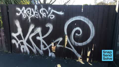
 Graffiti on a fence, building or structure —
 Graffiti
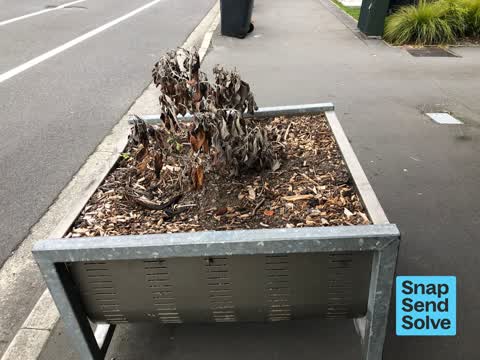
 Overgrown Vegetation —
 Corner of Forth St and Stanmore road
 Graffiti on a fence, building or structure —
  General Request —
  Graffiti on a fence, building or structure —
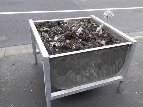
 graffiti on planter
 Graffiti on a traffic light pole or cabinet, or wa —
 Outside Richmond Club
 Graffiti on a fence, building or structure —
 See pic
 Graffiti on a fence, building or structure —
 By the bus stop opposite the Richmond Club on Stanmore Road
 Poles and Signage - General —
 Rear p30 pole and sign missing. Parking has received complaint and we can not enforce.
 General Request —
 Please please please do something about these stupid planter boxes on Stanmore Road, as you can see , there is nothing like looking at dead
- Graffiti —
- Graffiti —
- Overgrown Vegetation —
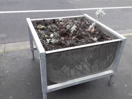 Parks —
 All planter boxes need attention
- Graffiti —
FLOAT tagged on red brick under front left window of Ruedis Cafe
Roading/Streets —
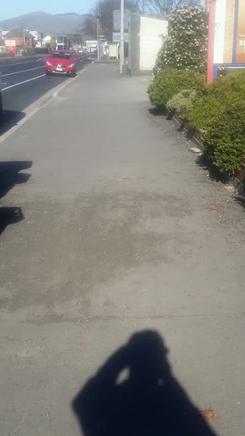
Shingle etc on Stanmore Rd footpath West side between London & Avalon Sts. Left over from contractors re-sealing roadway some months ago.
Also reported on Stanmore Road
- 277 Stanmore Road — 52 reports
- 295 Stanmore Road — 42 reports
- 213 Stanmore Road — 28 reports
- 211 Stanmore Road — 21 reports
- 337 Stanmore Road — 20 reports
- 249A Stanmore Road — 18 reports
- 240 Stanmore Road — 17 reports
- 230 Stanmore Road — 16 reports
The street’s crash record
NZTA’s record names Stanmore Road in 57 crashes that hurt somebody since 2006 — 1 person killed, 9 seriously hurt.
The green nearby
- Richmond Playground — 74 m to the edge
- Avebury Park — 297 m to the edge · Botanic
- Alexandra Park — 369 m to the edge
- Avon Riverbank True Right — 436 m to the edge · 11 ha
Parks within half a kilometre, measured to the boundary — the council’s open data.
On the doorstep
- Sections Cafe — 22 m away · Cafés
- Meepleopolis — 27 m away · Fast food
- Bahn Thai — 33 m away · Restaurants
- Stanmore Discounter — 42 m away · Dairies & convenience
Businesses within four hundred metres, measured at the pin — OpenStreetMap and the council directories.
The bus nearby
- Stanmore Rd near London St — 67 m away · route 60, the Orbiter (clockwise)
- Stanmore Rd near London St — 85 m away · route 60, the Orbiter (anticlockwise)
The closest Metro stops, within four hundred and fifty metres.
The tracks through here
- Walk and bike track through Richmond — 10 m to the line · walk · bike
- Walk and bike track through Richmond — 318 m to the line · walk · bike
- Walk and bike track through Richmond — 406 m to the line · walk · bike
- Walk and bike track through Richmond — 410 m to the line · walk · bike
- Walk and bike track through Richmond — 421 m to the line · walk · bike
Tracks whose line passes within half a kilometre, measured to the line itself — the council’s open data.
The named ground
Named water within 500 m of this address, measured to the line or the edge — the open map’s record.
The remembered names nearby
- In Commemoration of the Centenary of Women’S Suffrage — 138 m away ·
In Commemoration of the Centenary of Women’s Suffrage Hagley Ferrymead Community Board Nov
· 2009
Inscribed plaques within two hundred and fifty metres — the register’s pins, not surveyed spots. The whole roll is at /plaques.
Renting nearby
new bonds in Richmond ran about $499 a week — $51 below the city median of $550 — the suburb page keeps the rent record →.
The civic layer
This ground votes in Central ward — the Papanui-Innes-Central community board. Ward lines don’t always follow suburb lines; this one is measured at the pin, not the suburb’s centre.
What stood on this ground → · On the map → · From the air — the Crown’s aerials back to 1936; search the address on RetroLens →
Questions, answered briefly
16 council reports on record since July 2016 — most often graffiti on a fence, building or structure (5), graffiti (3), overgrown vegetation (2).
Richmond, Christchurch — on Stanmore Road.
Nothing on the heritage register at this exact spot — the record around this ground →
Richmond Playground — 74 m to its edge.