30 Ansonby Street
8 council reports since April 2022, 7 carrying a photograph. The most-reported address on Ansonby Street.
From the air, then
Sourced from Canterbury Maps and partners. LINZ, CC BY 3.0 NZ. Each frame is cut from Environment Canterbury’s historic imagery MapServer for that decade, only where the Footprints layer names a CC BY survey (NZAM-covered spots stay out). RetroLens holds more Crown aerials →
The green nearby
- Calbreath Reserve, 38 m to the edge · playground, 17 pieces
- Karnak Reserve, 146 m to the edge
- Avonhead Park, 186 m to the edge · Sports ground · 23 ha
- Greystoke Reserve, 228 m to the edge
- Pinehurst Reserve, 265 m to the edge · playground, 5 pieces
Parks within half a kilometre, measured to the boundary, the council’s open data. The whole roll is at /parks.
On the doorstep
- Ryman Healthcare Christchurch, 302 m away · Company
- Passengers + Co, 310 m away · Cafés
- Pioneers Cafe - Russley Road, 327 m away · Restaurants
- Plunket, 333 m away · Centre
Businesses within four hundred metres, measured at the pin, OpenStreetMap and the council directories.
The bus nearby
- Apsley Drive, 264 m away · route 130
- Hyde Park, 274 m away · route 130
The closest Metro stops, within four hundred and fifty metres.
The named ground
Named water within 500 m of this address, measured to the line or the edge; the council’s own structure register, bridges, boardwalks and steps standing nearby, the open map’s record.
What gets reported here
Photographed here 7 on record


What’s on record
 Pit and Equipment - General, 25 Sept 2024
A new water tap cover and within a couple of weeks it is broken and dangerous at night!
 Trees - General, 4 Sept 2024
The trees outside our home drop thorny seeds onto the ground. They dull the motor mower blade, clog gutters and drains, blow onto lawns and
 Pit and Equipment - General, 10 Aug 2024
Lid for box won't fit into place, hole in footpath is a hazard
- Pavement - General, 20 Jul 2023
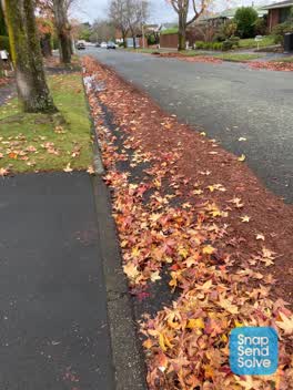 Roading/Streets, 3 Jun 2022
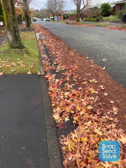
During the autumn, when the street sweeper comes down Ansonby Street they usually miss the section between Calbraith and Karkoch Streets. Th
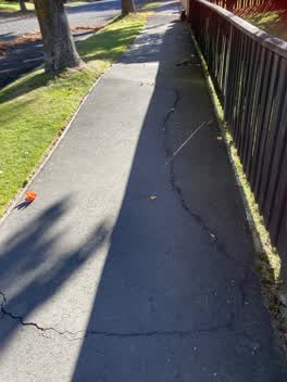 Roading/Streets, 23 Apr 2022
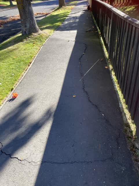
The roots of the trees outside 30 and 32 are pushing the footpath up and the cracks in the footpath are getting wider and longer
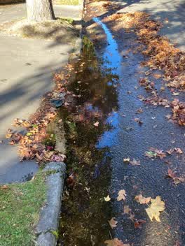 Roading/Streets, 23 Apr 2022
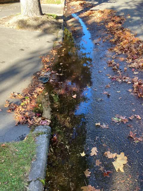
The roots of the tree outside 28b & 26 are causing the water to pond and together with the leaves this time of year the water stagnants.
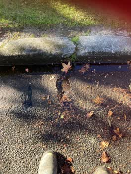 Roading/Streets, 23 Apr 2022
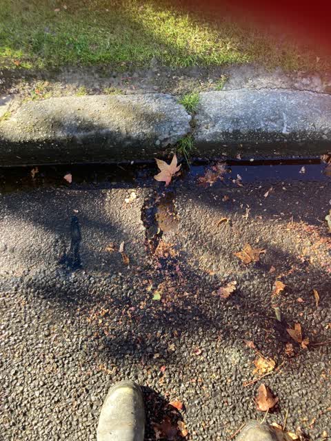
The kerb outside 28a and 30 are start to create potholes
Elsewhere on Ansonby Street
- 26 Ansonby Street, 5 reports
- 38 Ansonby Street, 3 reports
- 29 Ansonby Street, 2 reports
- 27 Ansonby Street, 2 reports
- 8A Ansonby Street, 1 report
- 7 Ansonby Street, 1 report
- 5-7 Ansonby Street, 1 report
- 5 Ansonby Street, 1 report
The street’s crash record
NZTA’s record names Ansonby Street in 1 crash that hurt somebody since 2006, 0 seriously hurt, nobody killed.
The civic layer
This ground votes in Waimairi ward, the Fendalton-Waimairi-Harewood community board is its local layer. Ward lines don’t always follow suburb lines; this one is measured at the pin, not the suburb’s centre. The whole roll is at /wards.
Ansonby Street, the whole record → · Everything about Russley → · What stood on this ground → · On the map → · From the air, RetroLens holds the Crown’s aerials back to 1936; search the address there →
Questions, answered briefly
8 council reports on record since April 2022, most often roading/streets (4), pit and equipment - general (2), trees - general (1).
Russley, Christchurch, on Ansonby Street.
Nothing on the heritage register at this exact spot, the record around this ground →
Calbreath Reserve, 38 m to its edge.