22 Gosset Street, Saint Albans
12 reports on record since April 2022 · 9 with photographs. The most-reported address on Gosset Street. Indicative rating valuation and school zones, hazards, bin day and what stood here before.
What gets reported here
Photographed here 9 on record


Reported here
 Rubbish and Bins - General —
 Green bin not collected today. Very frustration leading in to weekend when we need to use it. City care water workers were supposed to ensur
 Rubbish and Bins - General —
 Red bin only half emptied today . Suspect our bags are very lightweight and don’t fall out easy because we are strict on recycling and compo
 Rubbish and Bins - General —
 Red rubbish bin not fully emptied.
 Rubbish and Bins - General —
 Whole 240L green bin lid got ripped of by truck this morning. There was no previous damage or cracks on it. Tried to report through CCC web
 Fallen Tree —
  Water General —
 A bit concerned about our mains water quality today in Gosset St. Very yellow. Yes I flush the taps through at full blast for a long time to
 Overgrown Vegetation —
 Furniture removal truck today was unable to access our property due to two branches from council street trees that overhang our driveway. T
- Pavement - Damaged —
- Rubbish and Bins - General —
- Hazard — vehicle —
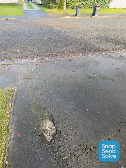
 Pavement - Damaged —
 Pothole opening up in driveway due to council tree root damage cracks post quake never fixed.
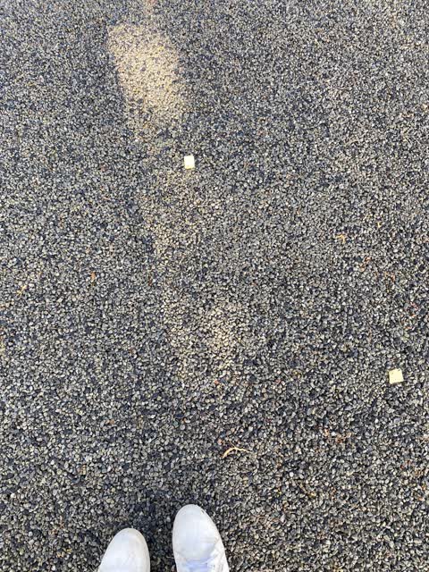
 Wastewater/Stormwater —
 Our road had its metal put down in a big rush one Friday afternoon between 4.30 & 5pm before clocking off the job. The surface has lots of v
Also reported on Gosset Street
- 41 Gosset Street — 5 reports
- 43 Gosset Street — 4 reports
- 26 Gosset Street — 2 reports
- 17 Gosset Street — 2 reports
- 9 Gosset Street — 1 report
- 39 Gosset Street — 1 report
- 38 Gosset Street — 1 report
- 37 Gosset Street — 1 report
The green nearby
- Malvern Park — 192 m to the edge · Sports ground · 3 ha
- Knowles Plantation — 357 m to the edge
- English Park — 389 m to the edge · Sports ground · 3 ha
- St Albans Tennis Club — 488 m to the edge · Sports ground
Parks within half a kilometre, measured to the boundary — the council’s open data.
On the doorstep
- Pacific Radiology — 177 m away · Doctors & clinics
- Rutland Fish n' Chips — 190 m away · Fast food
- Meshino Espresso — 221 m away · Cafés
- Meshino Cafe — 226 m away · Restaurants
Businesses within four hundred metres, measured at the pin — OpenStreetMap and the council directories.
The bus nearby
- Springfield Rd near St Albans St — 304 m away · route 100
- Springfield Rd near St Albans St — 313 m away · route 100
The closest Metro stops, within four hundred and fifty metres.
The tracks through here
- Walk and bike track through Saint Albans — 110 m to the line · walk · bike
- Walk and bike track through Saint Albans — 247 m to the line · walk · bike
- Walk and bike track through Saint Albans — 282 m to the line · walk · bike
- Walk and bike track through Saint Albans — 330 m to the line · walk · bike
- Walk and bike track through Saint Albans — 349 m to the line · walk · bike
Tracks whose line passes within half a kilometre, measured to the line itself — the council’s open data.
The named ground
Named water within 500 m of this address, measured to the line or the edge — the open map’s record.
Renting nearby
new bonds in Saint Albans ran about $514 a week — $36 below the city median of $550 — the suburb page keeps the rent record →.
The civic layer
This ground votes in Innes ward — the Papanui-Innes-Central community board. Ward lines don’t always follow suburb lines; this one is measured at the pin, not the suburb’s centre.
What stood on this ground → · On the map → · From the air — the Crown’s aerials back to 1936; search the address on RetroLens →
Questions, answered briefly
12 council reports on record since April 2022 — most often rubbish and bins - general (5), pavement - damaged (2), water general (1).
Saint Albans, Christchurch — on Gosset Street.
Nothing on the heritage register at this exact spot — the record around this ground →
Malvern Park — 192 m to its edge, 3 ha.