7 Rutland Street, Saint Albans
14 reports on record since January 2022 · 8 with photographs. The most-reported address on Rutland Street. Indicative rating valuation and school zones, hazards, bin day and what stood here before.
What gets reported here
- Roads - General — 4
- Damaged Street Sign — 2
- Water Leak — 1
- Road Signage — 1
- Road Blockage — 1
- Pothole — 1
Photographed here 8 on record


Reported here
 Roads - General —
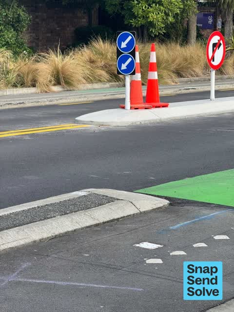
 Remove road cones. Work is complete.
 Roads - General —
 Before Rutland St was resealed recently there was a black and yellow barrier to stop drivers making illegal right hand turn manoeuvres at Ru
 Water Leak —
 Water leak from water meter
 Damaged Road —
 The road divider is damaged and dangerous.
 Roads - General —
 Multiple reports on this issue starting when the barriers were there and going missing. Be about 2 years now. As there are no barriers the
 Road Signage —
 Hi You will see I first reported this on 16 May 2023 and almost a year later there is still nothing done. There is now only 1 lone sign/div
 Pothole —
 Pothole corner of Rutland St and Westminster St.
- Damaged Street Sign —
- Poles and Signage - General —
- Roads - General —
- Damaged Street Sign —
- Road Blockage —
- Overgrown Vegetation —
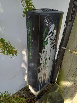 Graffiti —
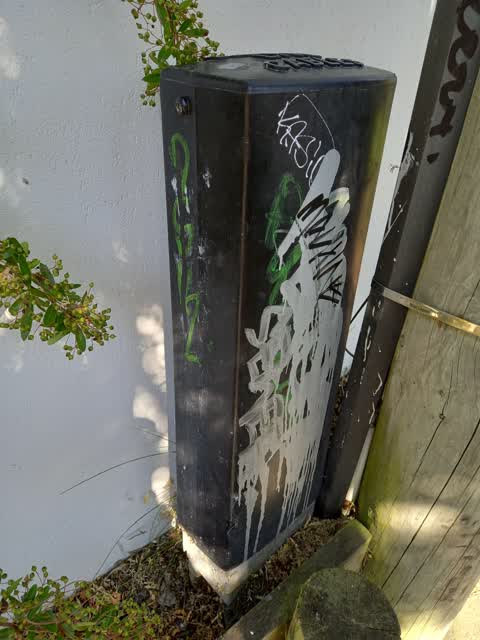
 7 Rutland St - multiple Graffiti on utility box near property boundary with stream
Also reported on Rutland Street
- 69 Rutland Street — 12 reports
- 75 Rutland Street — 10 reports
- 13 Rutland Street — 7 reports
- 19 Rutland Street — 6 reports
- 174 Rutland Street — 6 reports
- 198 Rutland Street — 5 reports
- 146 Rutland Street — 5 reports
- 65 Rutland Street — 4 reports
The street’s crash record
NZTA’s record names Rutland Street in 30 crashes that hurt somebody since 2006 — 4 seriously hurt, nobody killed.
The green nearby
- St Albans Tennis Club — 357 m to the edge · Sports ground
- English Park — 358 m to the edge · Sports ground · 3 ha
- Malvern Park — 362 m to the edge · Sports ground · 3 ha
- Abberley Park — 476 m to the edge · Botanic · 2 ha
Parks within half a kilometre, measured to the boundary — the council’s open data.
On the doorstep
- Pacific Radiology — 27 m away · Doctors & clinics
- Holloway Builders — 87 m away · Company
- Kesgrove Dairy & Flowers — 92 m away · Dairies & convenience
- St Albans Medical Centre — 104 m away · Doctors & clinics
Businesses within four hundred metres, measured at the pin — OpenStreetMap and the council directories.
The bus nearby
- Springfield Rd near St Albans St — 132 m away · route 100
- Springfield Rd near St Albans St — 139 m away · route 100
The closest Metro stops, within four hundred and fifty metres.
The tracks through here
- Walk and bike track through Saint Albans — 4 m to the line · walk · bike
- Walk and bike track through Saint Albans — 193 m to the line · walk · bike
- Walk and bike track through Saint Albans — 391 m to the line · walk · bike
- Walk and bike track through Saint Albans — 391 m to the line · walk · bike
- Walk and bike track through Saint Albans — 461 m to the line · walk · bike
Tracks whose line passes within half a kilometre, measured to the line itself — the council’s open data.
The named ground
Named water within 500 m of this address, measured to the line or the edge — the open map’s record.
Renting nearby
new bonds in Saint Albans ran about $514 a week — $36 below the city median of $550 — the suburb page keeps the rent record →.
The civic layer
This ground votes in Innes ward — the Papanui-Innes-Central community board. Ward lines don’t always follow suburb lines; this one is measured at the pin, not the suburb’s centre.
What stood on this ground → · On the map → · From the air — the Crown’s aerials back to 1936; search the address on RetroLens →
Questions, answered briefly
14 council reports on record since January 2022 — most often roads - general (4), damaged street sign (2), water leak (1).
Saint Albans, Christchurch — on Rutland Street.
Nothing on the heritage register at this exact spot — the record around this ground →
St Albans Tennis Club — 357 m to its edge.