57 Beckford Road, Saint Martins
13 reports on record since October 2018 · 10 with photographs. The street’s heaviest record is 56 Beckford Road — 22 reports on file. Indicative rating valuation and school zones, hazards, bin day and what stood here before.
What gets reported here
Photographed here 10 on record


Reported here
 Graffiti on a road, footpath or bridge —
 Plaque stolen last year. Not sure if there's any record anywhere or photos of what it used to say. The year the bridge was built and who ded
 Graffiti on a road, footpath or bridge —
 Plaque missing from bridge. Was there. Is not anymore!
 Trees - General —
 Broken branches at top of tree on Fifield tce
- Pavement - General —
- Accessibility —
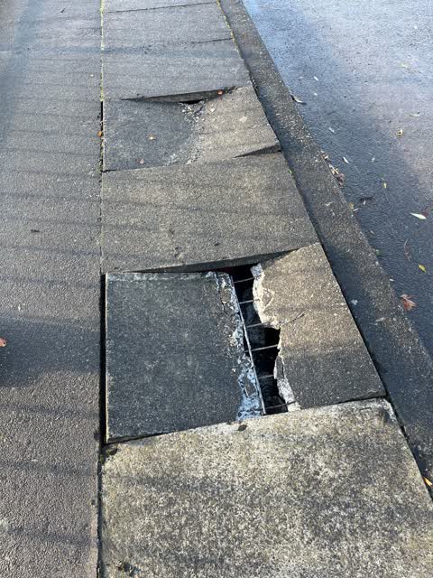
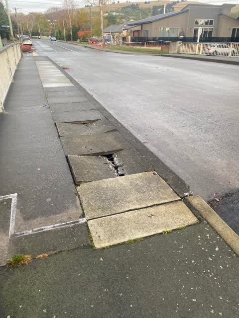
- Pavement - Damaged —
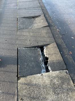 Roading/Streets —
 Very dangerous
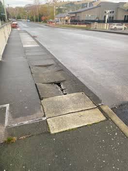 Roading/Streets —
 Broken paver
Roading/Streets —
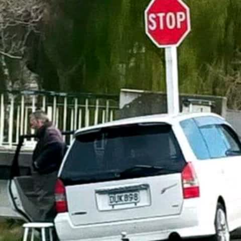
Person illegally parked blocking riverbank walkway and too close to the stop sign. there is a council bylaw which states that it is not perm
Facility - General Request —
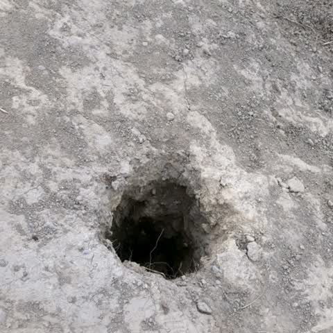
big holes beside river which are quite dangerous. there are 3 of them in a.row. they need to be filled
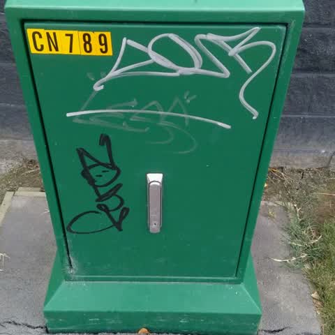
Graffiti —
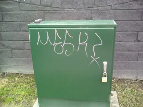
Both photos taken on Fifield Tce on boundary of 57 Beckford Road.
Graffiti —
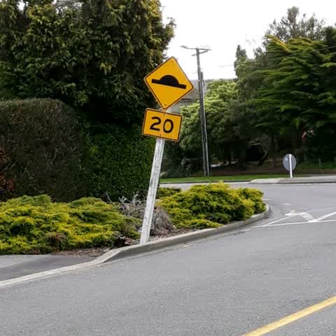
Roading/Streets —
Road sign leaning out into road.
Also reported on Beckford Road
- 56 Beckford Road — 22 reports
- 50 Beckford Road — 8 reports
- 31 Beckford Road — 8 reports
- 40 Beckford Road — 5 reports
- 23 Beckford Road — 5 reports
- 47 Beckford Road — 4 reports
- 18 Beckford Road — 4 reports
- 55 Beckford Road — 3 reports
The street’s crash record
NZTA’s record names Beckford Road in 2 crashes that hurt somebody since 2006 — 0 seriously hurt, nobody killed.
The green nearby
- Fifield Reserve — 94 m to the edge
- Hansen Park — 225 m to the edge · Sports ground · 12 ha
- Risingholme Park — 348 m to the edge · Botanic · 2 ha
- St Martins Park — 446 m to the edge · Sports ground · 2 ha
Parks within half a kilometre, measured to the boundary — the council’s open data.
On the doorstep
- Beckford Health — 218 m away · Doctors & clinics
- Helios Integrative Medical Centre — 228 m away · Doctors & clinics
- Willows Cafe — 236 m away · Cafés
- New World St Martins — 256 m away · Supermarkets
Businesses within four hundred metres, measured at the pin — OpenStreetMap and the council directories.
The bus nearby
- Wilsons Rd near Koromiko St — 323 m away · route 27
- Wilsons Rd near Beckford Rd — 336 m away · route 27
The closest Metro stops, within four hundred and fifty metres.
The tracks through here
- Walk and bike track through Saint Martins — 8 m to the line · walk · bike
- Walk and bike track through Saint Martins — 44 m to the line · walk · bike
- Walk and bike track through Saint Martins — 49 m to the line · walk · bike
- Walk and bike track through Saint Martins — 58 m to the line · walk · bike
- Walk and bike track through Saint Martins — 67 m to the line · walk · bike
Tracks whose line passes within half a kilometre, measured to the line itself — the council’s open data.
The named ground
Named water within 500 m of this address, measured to the line or the edge; the council’s own structure register — bridges, boardwalks and steps standing nearby — the open map’s record.
Renting nearby
new bonds in Saint Martins ran about $640 a week — $90 above the city median of $550 — the suburb page keeps the rent record →.
The civic layer
This ground votes in Cashmere ward — the Spreydon-Cashmere-Heathcote community board. Ward lines don’t always follow suburb lines; this one is measured at the pin, not the suburb’s centre.
What stood on this ground → · On the map → · From the air — the Crown’s aerials back to 1936; search the address on RetroLens →
Questions, answered briefly
13 council reports on record since October 2018 — most often roading/streets (4), graffiti on a road, footpath or bridge (2), graffiti (2).
Saint Martins, Christchurch — on Beckford Road.
Nothing on the heritage register at this exact spot — the record around this ground →
Fifield Reserve — 94 m to its edge.