1 Whitewash Head Road, Scarborough
12 reports on record since October 2020 · 11 with photographs. The most-reported address on Whitewash Head Road. Indicative rating valuation and school zones, hazards, bin day and what stood here before.
What gets reported here
Photographed here 11 on record



Reported here
 Roads - General —
 Hole in the Stone wall for about two months dangerous
 Street Gutters / Storm Water —
 Stormwater drain / sump is blocked
 Accessibility —
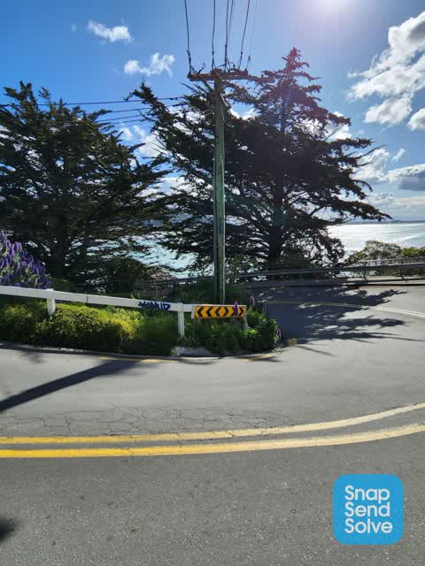
 Pole sticking out over footpath
 Graffiti on a sign, mural or public art —
 Hi , there is a sign on the track at flowers track... Walkers can not read it and so end up walking down Scarborough track onto the road whi
 Water Leak —
 F115 Small leak on FH flange approx 1lpm Submitted by Detection Services
 Water Leak —
 Leaking water main. Can here hissing at first hairpin on flowers track
 Water Leak —
 Water leaking down rock face
- Fallen Tree —
 Graffiti —
 Thanks, a tricky one to achieve but worthwhile doing so
 Litter —
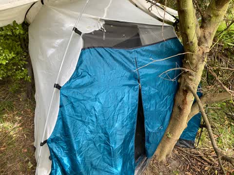
 Maybe toilet litter under trees to the left of the track to Sumner Bay.. Behind the Sumner lifeboat building
 Parks —
 No one here when visited at 2.45pm on Weds 16/3
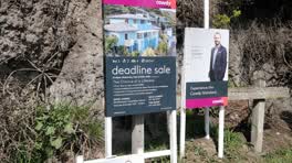 Graffiti - Signage —
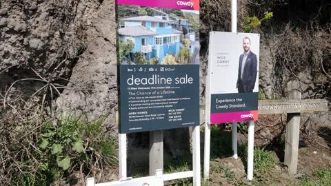
 I would really like to be able to view council signage without open home signs being screwed to them
Also reported on Whitewash Head Road
- 18 Whitewash Head Road — 5 reports
- 8 Whitewash Head Road — 4 reports
- 22 Whitewash Head Road — 3 reports
- 17RR Whitewash Head Road — 3 reports
- 6 Whitewash Head Road — 2 reports
- 36 Whitewash Head Road — 2 reports
- 16 Whitewash Head Road — 2 reports
- 4 Whitewash Head Road — 1 report
The green nearby
- Whitewash Reserve — 7 m to the edge · Regional · 9 ha
- Scarborough Beach — 43 m to the edge · Regional · 5 ha
- Nicholson Park — 109 m to the edge · 4 ha
- Scarborough Park — 255 m to the edge · Botanic
Parks within half a kilometre, measured to the boundary — the council’s open data.
On the doorstep
- Sumner Boating & Fishing Club — 68 m away · Association
- Slipway Office - Sumner Boating & Fishing Club — 70 m away · Harbour Master
- Scarborough Fare Cafe — 315 m away · Cafés
- Ocean Cafe & Bar — 318 m away · Restaurants
Businesses within four hundred metres, measured at the pin — OpenStreetMap and the council directories.
The tracks through here
- Walk and bike track through Scarborough — 333 m to the line · walk · bike
Tracks whose line passes within half a kilometre, measured to the line itself — the council’s open data.
The named ground
Named places within 1.5 km of this address; the council’s own structure register — bridges, boardwalks and steps standing nearby — the open map’s record.
The remembered names nearby
- To the Memory of / Gilbert W. Lewis / 1921 - 1995 — 25 m away ·
TO THE MEMORY OF / GILBERT W. LEWIS / 1921 - 1995 / 'I must go down to the sea again'
· 2000 - This Seat Was Donated by the / Sumner Senior Citizens Club — 30 m away ·
THIS SEAT WAS DONATED BY THE / SUMNER SENIOR CITIZENS CLUB / TO COMMEMORATE THEIR / 25TH A
· 1998 - World War Ii Road Blocks / 1942 — 34 m away ·
WORLD WAR II ROAD BLOCKS / 1942 / THESE CONCRETE BLOCKS WERE ORIGINALLY SITUATED / ON THE
· 2000
Inscribed plaques within two hundred and fifty metres — the register’s pins, not surveyed spots. The whole roll is at /plaques.
Renting nearby
new bonds in Scarborough ran about $620 a week — $70 above the city median of $550 — the suburb page keeps the rent record →.
The civic layer
This ground votes in Heathcote ward — the Spreydon-Cashmere-Heathcote community board. Ward lines don’t always follow suburb lines; this one is measured at the pin, not the suburb’s centre.
What stood on this ground → · On the map → · From the air — the Crown’s aerials back to 1936; search the address on RetroLens →
Questions, answered briefly
12 council reports on record since October 2020 — most often water leak (3), street gutters / storm water (1), roads - general (1).
Scarborough, Christchurch — on Whitewash Head Road.
Nothing on the heritage register at this exact spot — the record around this ground →
Whitewash Reserve — 7 m to its edge, 9 ha.