7 Marshland Road, Shirley
31 reports on record since November 2018 · 30 with photographs. The most-reported address on Marshland Road. Indicative rating valuation and school zones, hazards, bin day and what stood here before.
What gets reported here
Photographed here 30 on record


Reported here
 Graffiti on a traffic light pole or cabinet, or wa —
 graffiti on traffic control cabinet
 Traffic Signals —
 The traffic signal appears to be misaligned.
 Graffiti on a bus stop or public toilet —
  Graffiti on a fence, building or structure —
 graffiti on rubbish bin
 Graffiti on a traffic light pole or cabinet, or wa —
 graffiti on traffic control cabinet
 Graffiti on a traffic light pole or cabinet, or wa —
 graffiti on traffic light control box
 Park - General Request —
 this appears to be masses of California thistle, probably brought in via ccc plantings. they need to be removed
 Graffiti on a traffic light pole or cabinet, or wa —
 2 cabinets with graffiti
 Graffiti on a fence, building or structure —
 See pic
 Graffiti on a traffic light pole or cabinet, or wa —
 See pic
 Overgrown Vegetation —
 Not sure if this is a footpath or roading issue. The garden area created in the intersection upgrade a number of months ago, has not yet bee
 Water Leak —
  Graffiti on a sign, mural or public art —
 Traffic Signal boc
 Overgrown Vegetation —
 Weeds and overgrown council verge
 General Request —
 Graffiti on power box infront of EV chargers at Z Shirley
 Graffiti on a fence, building or structure —
 graffeti chorus box
 Graffiti somewhere else —
  Graffiti somewhere else —
 I don't know what infrastructure asset this is. It's been like this for a number of weeks.
 Graffiti —
  Graffiti —
 Unsure who owns box, outside z petrol station on corner Marshlands Road and Shirley Road
- Roading/Streets —
Pot hole. Marshland road, headed to the city, by Amos place. Has recently been 'fixed' but not really at all. Every time I hit it I have a m
 Graffiti —
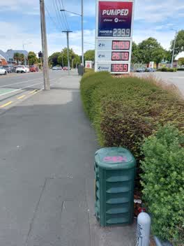
 Tagging on green telecommunications box outside Z petrol station. ID: C313A174
 Graffiti —
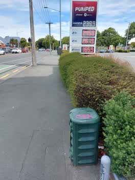
 Tagging on green telecommunications box outside Z petrol station. ID: C313A174
 Graffiti —
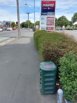
 Tagging on green telecommunications box outside Z petrol station. ID: C313A174
 Graffiti —
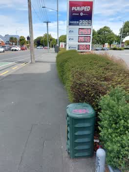
 Tagging on green telecommunications box outside Z petrol station. ID: C313A174
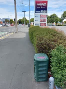 Graffiti —
 Tagging on green telecommunications box outside Z petrol station. ID: C313A174
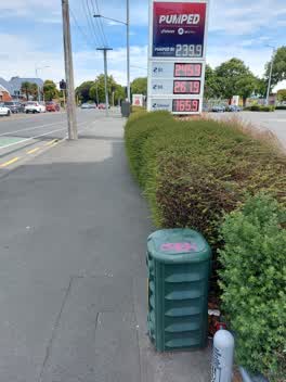 Graffiti —
 Tagging on green telecommunications box outside Z petrol station. ID: C313A174
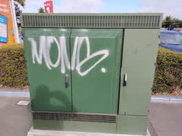 Graffiti —
 cabinet on Marshland Rd beside Z Shirley fuel station, at intersection of Marshland Rd and Shirley Rd.
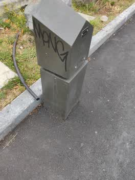 Graffiti —
 Roading/Streets —
Abandoned traffic management
Roading/Streets —
Pot hole in cycle lane outside the Z Station.
Also reported on Marshland Road
- 36 Marshland Road — 24 reports
- 220 Marshland Road — 22 reports
- 241 Marshland Road — 17 reports
- 73 Marshland Road — 14 reports
- 11 Marshland Road — 11 reports
- 69 Marshland Road — 10 reports
- 30 Marshland Road — 9 reports
- 195A Marshland Road — 9 reports
The street’s crash record
NZTA’s record names Marshland Road in 120 crashes that hurt somebody since 2006 — 1 person killed, 16 seriously hurt.
The green nearby
- Dudley Creek Riverbank — 334 m to the edge
- Sabina Playground — 376 m to the edge
- Richmond Park — 465 m to the edge · Sports ground · 4 ha
Parks within half a kilometre, measured to the boundary — the council’s open data.
The civic shelf nearby
- Shirley Library — 278 m away · Library · 36 Marshland Road, Christchurch 8061
- Shirley Service Centre — 278 m away · Service centre
Libraries, halls and the rest within half a kilometre — the council’s open data.
On the doorstep
- Z — 20 m away · Petrol stations
- Z2O — 36 m away · Car washes
- Z Espress - Shirley — 44 m away · Fast food
- Burger King — 49 m away · Fast food
Businesses within four hundred metres, measured at the pin — OpenStreetMap and the council directories.
The bus nearby
- The Palms (Marshland Rd mall side) — 42 m away · route 60, route 135
- North Parade — 107 m away · route 60, the Orbiter (clockwise)
The closest Metro stops, within four hundred and fifty metres.
The tracks through here
- Walk and bike track through Shirley — 12 m to the line · walk · bike
- Walk and bike track through Shirley — 48 m to the line · walk · bike
- Walk and bike track through Shirley — 91 m to the line · walk · bike
- Walk and bike track through Shirley — 98 m to the line · walk · bike
- Walk and bike track through Shirley — 195 m to the line · walk · bike
Tracks whose line passes within half a kilometre, measured to the line itself — the council’s open data.
The named ground
Named water within 500 m of this address, measured to the line or the edge — the open map’s record.
Renting nearby
new bonds in Shirley ran about $575 a week — $25 above the city median of $550 — the suburb page keeps the rent record →.
The civic layer
This ground votes in Innes ward — the Papanui-Innes-Central community board. Ward lines don’t always follow suburb lines; this one is measured at the pin, not the suburb’s centre.
What stood on this ground → · On the map → · From the air — the Crown’s aerials back to 1936; search the address on RetroLens →
Questions, answered briefly
31 council reports on record since November 2018 — most often graffiti (10), graffiti on a traffic light pole or cabinet, or wa (5), roading/streets (3).
Shirley, Christchurch — on Marshland Road.
Nothing on the heritage register at this exact spot — the record around this ground →
Dudley Creek Riverbank — 334 m to its edge.