1 Sparks Road, Somerfield
12 reports on record since August 2017 · 7 with photographs. The street’s heaviest record is 2 Sparks Road — 22 reports on file. Indicative rating valuation and school zones, hazards, bin day and what stood here before.
What gets reported here
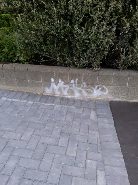
- Graffiti — 4
- General Request — 2
- Street Light Outage — 1
- Sewer Odour — 1
- Roads - General — 1
- Poles and Signage - General — 1
Photographed here 7 on record


Reported here
 Litter —
 Black Honda seen dumping a plastic takeaway container from the back seat window at the corner of Lyttelton St and Frankleigh Streets while d
- General Request —
Traffic lights need resetting only letting 3 cars through short cycle probably from all the road works recently
- Damaged Road —
There is a significant amount of broken glass on the road at intersection
 Roads - General —
 Bike sensor southwest of the intersection approach is still not working and the only way to trigger the bike signal is to push the bouton at
 General Request —
  Graffiti —
  Graffiti —
 Traffic Solutions box
- Street Light Outage —
- Poles and Signage - General —
- Sewer Odour —
Smell has veen tgere all day. But worse tonjght
Graffiti —
On the concrete fence
Graffiti —
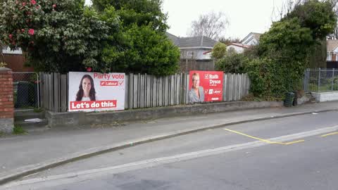
Illegal Signage (Political parties )
Also reported on Sparks Road
- 2 Sparks Road — 22 reports
- 48 Sparks Road — 9 reports
- 52 Sparks Road — 7 reports
- 29 Sparks Road — 7 reports
- 27–29 Sparks Road — 6 reports
- 39A Sparks Road — 5 reports
- 25 Sparks Road — 4 reports
- 50 Sparks Road — 3 reports
The street’s crash record
NZTA’s record names Sparks Road in 18 crashes that hurt somebody since 2006 — 5 seriously hurt, nobody killed.
The green nearby
- Centennial Park — 183 m to the edge · Sports ground · 10 ha
- Hoon Hay Scouts Reserve — 380 m to the edge
Parks within half a kilometre, measured to the boundary — the council’s open data.
The civic shelf nearby
- Pioneer — 325 m away · Recreation centre · 61 Lyttelton Street
Libraries, halls and the rest within half a kilometre — the council’s open data.
On the doorstep
- Lyttelton Street Dairy — 317 m away · Dairies & convenience
- Stourbridge Fish & Chips — 317 m away · Fast food
- Plunge Cafe — 333 m away · Cafés
- Pioneer Recreation and Sport Centre — 345 m away · Sports centres
Businesses within four hundred metres, measured at the pin — OpenStreetMap and the council directories.
The bus nearby
- Lyttelton St near Glue Pl — 52 m away · the Orbiter (clockwise)
- Lyttelton St — 59 m away · the Orbiter (anticlockwise)
The closest Metro stops, within four hundred and fifty metres.
The tracks through here
- Walk and bike track through Somerfield — 8 m to the line · walk · bike
- Walk and bike track through Somerfield — 221 m to the line · walk · bike
Tracks whose line passes within half a kilometre, measured to the line itself — the council’s open data.
The named ground
Named water within 500 m of this address, measured to the line or the edge — the open map’s record.
Renting nearby
new bonds in Somerfield ran about $567 a week — $17 above the city median of $550 — the suburb page keeps the rent record →.
The civic layer
This ground votes in Spreydon ward — the Spreydon-Cashmere-Heathcote community board. Ward lines don’t always follow suburb lines; this one is measured at the pin, not the suburb’s centre.
What stood on this ground → · On the map → · From the air — the Crown’s aerials back to 1936; search the address on RetroLens →
Questions, answered briefly
12 council reports on record since August 2017 — most often graffiti (4), general request (2), street light outage (1).
Somerfield, Christchurch — on Sparks Road.
Nothing on the heritage register at this exact spot — the record around this ground →
Centennial Park — 183 m to its edge, 10 ha.