19 Leitch Street, Somerfield
15 reports on record since August 2016 · 13 with photographs. The most-reported address on Leitch Street. Indicative rating valuation and school zones, hazards, bin day and what stood here before.
What gets reported here
- Roading/Streets — 5
- Flooding — 3
- Wastewater/Stormwater — 2
- Pothole — 2
- Parks — 2
- Damaged Road — 1
Photographed here 13 on record



Reported here
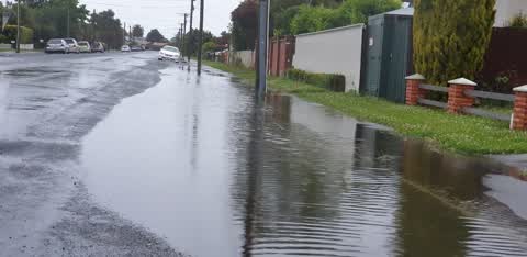
 Flooding —
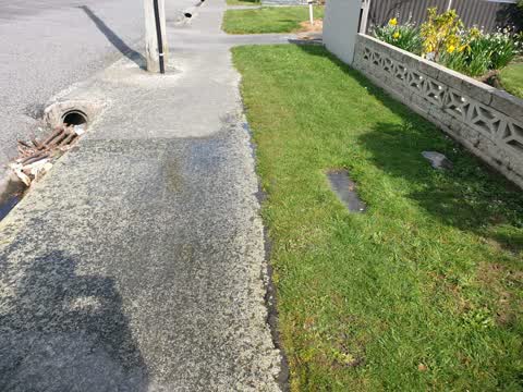
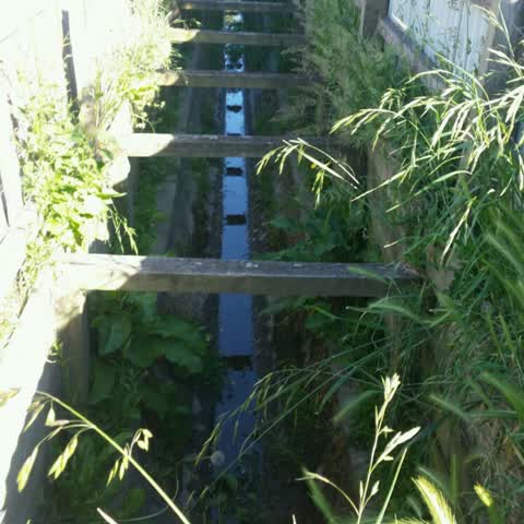
 Rubbish needs clearing from the deep gutter systems in Leitch St prone to recurrent flooding & old gutter / metal channels. Nearby houses of
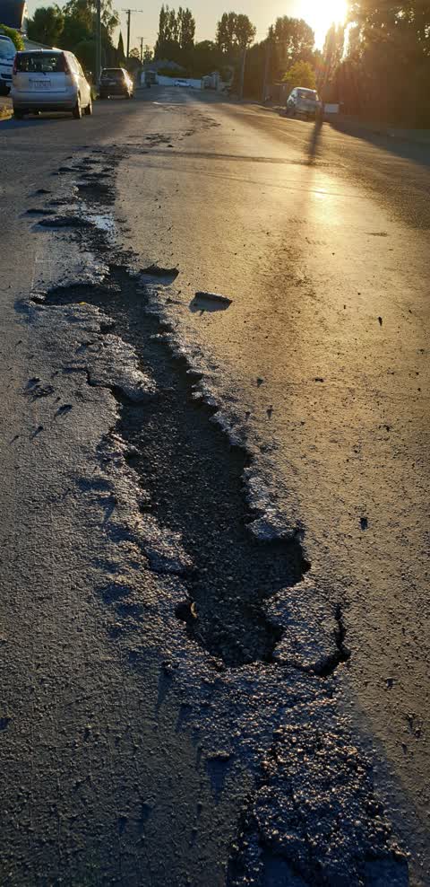
 Damaged Road —
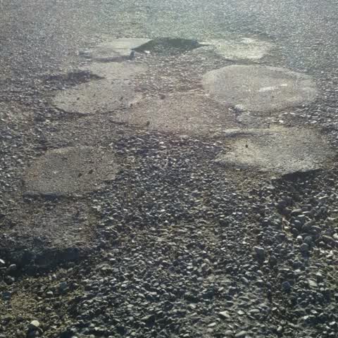
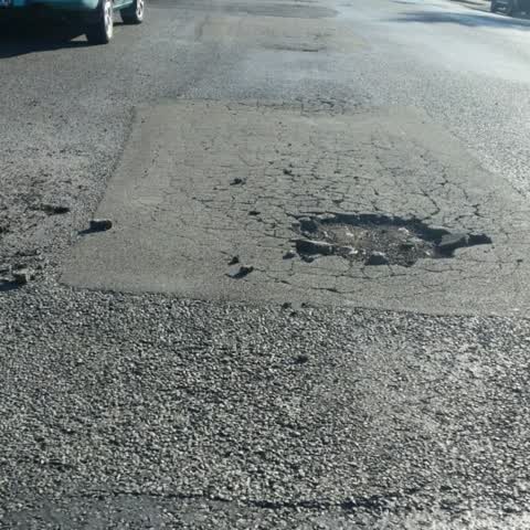
 3x potholes closest to house numbers 1, 8 & 14.
- Pothole —
New pothole found in Leitch St outside number 14- unable to attach the photo within the application therefore not included currently. Please
- Pothole —
New pothole developed in front of 14 Leitch Street needs to be fixed please.
 Flooding —
 Leitch Street has flooded numerous times & will flood even more with new developments proposed within the street. An upgrade or major impro
 Roading/Streets —
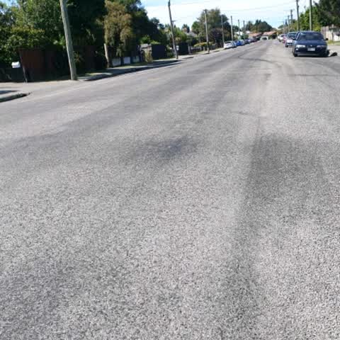
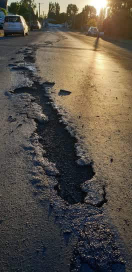
 Leitch St has multiple potholes & full of wet tar patches related to never been properly upgraded since originally constructed early 1900s a
Flooding —
Leaking water main tap onto footpath - needs fixing please. This appears to be a concern for many local residents- is the Council aware? Th
Roading/Streets —
Leitch Street road surfaces continued to be completely unacceptable - especially on hot days when it mainly /all consists of melted tar & lo
Wastewater/Stormwater —
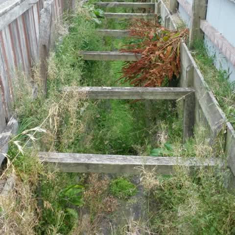
Between 13-19 Leitch Street - needs weeding please as weeds too high & will become a fire risk over summer especially. Thanks Julie.
Roading/Streets —
Leitch Street needs potholes fixed Again! ALL of Our street needs to be properly resurfaced as the asphalt used is only a very temporary fix
Roading/Streets —
Leitch Street needs potholes fixed Again! A Full street makeover or renovation is really needed please -after 4 petitions over 20 yrs!The St
Parks —
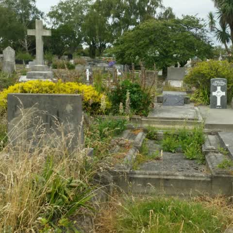
Sydenham Cemetery needs much more attention & regularly please. Our community is also very happy to assist with weeding. Please let me know
Wastewater/Stormwater —
Storm water drain needs attention & clean up please.Hasn't been attended to in a long time. It also attracts?Mosquitos & other insects due t
Roading/Streets —
Leitch Street road conditions are constantly deteriorating & Needs to be considered for a full upgrade & resurfacing. Our street is starting
Parks —
Sydenham Cemetery - please collect weeds from Japan University students clean up event last Monday. Thanks.
Also reported on Leitch Street
- 14 Leitch Street — 7 reports
- 1 Leitch Street — 6 reports
- 8 Leitch Street — 5 reports
- 28 Leitch Street — 5 reports
- 26 Leitch Street — 5 reports
- 22 Leitch Street — 5 reports
- 2 Leitch Street — 5 reports
- 13 Leitch Street — 5 reports
The green nearby
- Somerfield Park — 323 m to the edge · Sports ground · 3 ha
- Bradford Park — 334 m to the edge · Sports ground · 3 ha
Parks within half a kilometre, measured to the boundary — the council’s open data.
The civic shelf nearby
- Sydenham Cemetery — 326 m away · Cemetery
Libraries, halls and the rest within half a kilometre — the council’s open data.
On the doorstep
- Hairpins Hairstylists — 252 m away · Hairdressers
- Milton Street Dairy — 329 m away · Dairies & convenience
- Challenge — 376 m away · Petrol stations
Businesses within four hundred metres, measured at the pin — OpenStreetMap and the council directories.
The bus nearby
The closest Metro stops, within four hundred and fifty metres.
The tracks through here
- Walk and bike track through Somerfield — 275 m to the line · walk · bike
- Walk and bike track through Somerfield — 338 m to the line · walk · bike
- Walk and bike track through Somerfield — 400 m to the line · walk · bike
- Walk and bike track through Somerfield — 435 m to the line · walk · bike
- Walk and bike track through Somerfield — 447 m to the line · walk · bike
Tracks whose line passes within half a kilometre, measured to the line itself — the council’s open data.
Renting nearby
new bonds in Somerfield ran about $567 a week — $17 above the city median of $550 — the suburb page keeps the rent record →.
The civic layer
This ground votes in Cashmere ward — the Spreydon-Cashmere-Heathcote community board. Ward lines don’t always follow suburb lines; this one is measured at the pin, not the suburb’s centre.
What stood on this ground → · On the map → · From the air — the Crown’s aerials back to 1936; search the address on RetroLens →
Questions, answered briefly
15 council reports on record since August 2016 — most often roading/streets (5), flooding (3), wastewater/stormwater (2).
Somerfield, Christchurch — on Leitch Street.
Nothing on the heritage register at this exact spot — the record around this ground →
Somerfield Park — 323 m to its edge, 3 ha.