1 Halsey Street, South New Brighton
20 reports on record since July 2020 · 15 with photographs. The street’s heaviest record is 59A Halsey Street — 29 reports on file. Indicative rating valuation and school zones, hazards, bin day and what stood here before.
What gets reported here
- Dumped Rubbish — 7
- Pavement - Damaged — 2
- General Request — 2
- Street Light Outage — 1
- Roading/Streets — 1
- Poles and Signage - General — 1
Photographed here 15 on record


Reported here
 Abandoned Vehicle —
 Stolen vehicle
 General Request —
 someone has set up a tent and is camping in the side of the road. Marine parade where it meets Halsey st.
 Pavement - Damaged —
 a couple of broken steps with up the dune deep hole on one
 Dumped Rubbish —
 boxes with rubbish and orange cone
 Dumped Rubbish —
 Corner of Halsey and Marine Parade. 2 boxes of rubbish, boxes have a delivery address!!
 Dumped Rubbish —
 scumbag
- Dumped Rubbish —
2 large boxes with name and address still on it!!!
 Pavement - Damaged —
 Board walk damaged
 Poles and Signage - General —
 The size of the power pole after replacing it on corner Marine Parade/Halsey Street made it unfit for mounting the street signs onto the new
 Dumped Rubbish —
 Dumped rubbish on Marine Parade opposite 1 Halsey Street
 Litter —
 Boxes left here
 Dumped Rubbish —
 Corner of Halsey and Marine parade
 General Request —
 No sign on this beach Street Post, I think Halsey St
 Facility - General Request —
 Beach bins at Halsey st and Beatty st are both overflowing.
 Accessibility —
 The well used footpath/ steps that lead over the sand dunes are a GTEAT NEED OF MAINTENANCE AND REPAIR, please can you mark this as high pri
- Animal - Deceased —
- Dumped Rubbish —
- Park - General Request —
- Street Light Outage —
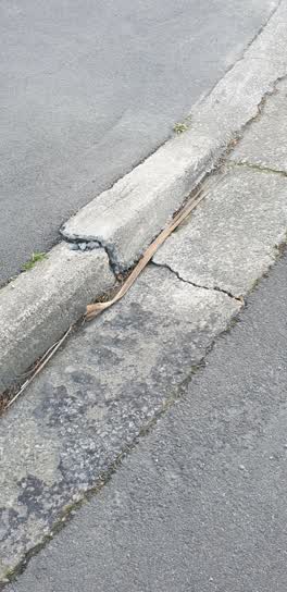 Roading/Streets —
 fix
Also reported on Halsey Street
- 59A Halsey Street — 29 reports
- 59 Halsey Street — 9 reports
- 57 Halsey Street — 4 reports
- 70 Halsey Street — 3 reports
- 35 Halsey Street — 3 reports
- 2 Halsey Street — 3 reports
- 59B Halsey Street — 1 report
- 45 Halsey Street — 1 report
The street’s crash record
NZTA’s record names Halsey Street in 2 crashes that hurt somebody since 2006 — 0 seriously hurt, nobody killed.
The green nearby
- South New Brighton Park — 410 m to the edge · Sports ground · 30 ha
Parks within half a kilometre, measured to the boundary — the council’s open data.
The bus nearby
The closest Metro stops, within four hundred and fifty metres.
The named ground
Named places within 1.5 km of this address; the council’s own structure register — bridges, boardwalks and steps standing nearby — the open map’s record.
Renting nearby
new bonds in South New Brighton ran about $640 a week — $90 above the city median of $550 — the suburb page keeps the rent record →.
The civic layer
This ground votes in Coastal ward — the Coastal-Burwood-Linwood community board. Ward lines don’t always follow suburb lines; this one is measured at the pin, not the suburb’s centre.
What stood on this ground → · On the map → · From the air — the Crown’s aerials back to 1936; search the address on RetroLens →
Questions, answered briefly
20 council reports on record since July 2020 — most often dumped rubbish (7), pavement - damaged (2), general request (2).
South New Brighton, Christchurch — on Halsey Street.
Nothing on the heritage register at this exact spot — the record around this ground →
South New Brighton Park — 410 m to its edge, 30 ha.