143 Bridge Street, South New Brighton
17 reports on record since June 2015 · 16 with photographs. The street’s heaviest record is 200 Bridge Street — 24 reports on file. Indicative rating valuation and school zones, hazards, bin day and what stood here before.
What gets reported here
Photographed here 16 on record



Reported here
 Park - General Request —
 Tagging on picnic table
 Graffiti on a fence, building or structure —
 Tagging on power box and dumped rubbish alongside
 Graffiti on a sign, mural or public art —
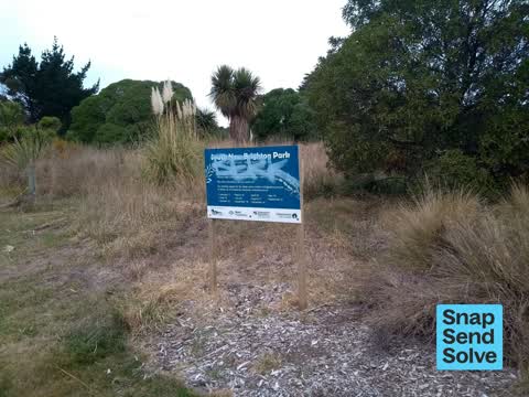
 Sign at entrance to estuary walkway
 Graffiti on a fence, building or structure —
 Not far from road
 Graffiti on a fence, building or structure —
  Graffiti on a cabinet, pole or railway asset —
  Graffiti somewhere else —
 On picnic table at start of Estuary walkway
 Graffiti somewhere else —
 On picnic table and on sign at New Brighton Park
 Graffiti on a sign, mural or public art —
  Graffiti somewhere else —
 On sign at entrance to S New Brighton Park
 Graffiti on a sign, mural or public art —
 Tag on estuary trust sign by bridge st
- Overgrown Vegetation —
 Parks —
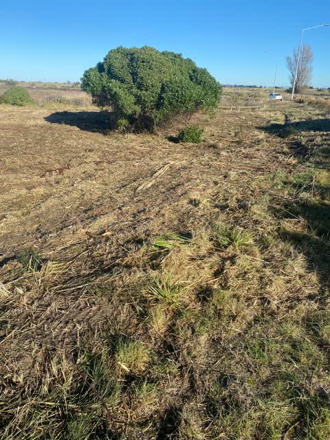
 Absolutely brutal - your contractors or a someone thinking this was a ‘good’ idea?
Parks —
plantings that were installed as part of the new bund are now getting overgrown and need weed control urgently. I'm assuming plantings are s
Graffiti —
Parks —
Reserve beside 127 bridge st. No pathways are maintained. There used to be a (grassed) pathway right beside 127 which now reaches hip height
Graffiti —
White graffiti on green box under lamppost.
Also reported on Bridge Street
- 200 Bridge Street — 24 reports
- 131 Bridge Street — 6 reports
- 51 Bridge Street — 4 reports
- 151 Bridge Street — 4 reports
- 59 Bridge Street — 1 report
- 57 Bridge Street — 1 report
- 3 Bridge Street — 1 report
- 198 Bridge Street — 1 report
The green nearby
- Bridge Reserve — you are in it · 7 ha
- Blighs Garden — 277 m to the edge · 6 ha
- Rat Island Reserve — 312 m to the edge · 2 ha
- Bexley Wetland — 467 m to the edge · Regional · 15 ha
Parks within half a kilometre, measured to the boundary — the council’s open data.
The tracks through here
- Walk and bike track through South New Brighton — 50 m to the line · walk · bike
- Walk and bike track through South New Brighton — 84 m to the line · walk · bike
- Walk and bike track through South New Brighton — 84 m to the line · walk · bike
- Walk and bike track through South New Brighton — 314 m to the line · walk · bike
- Walk and bike track through South New Brighton — 483 m to the line · walk · bike
Tracks whose line passes within half a kilometre, measured to the line itself — the council’s open data.
The named ground
Named water within 500 m of this address, measured to the line or the edge; Named places within 1.5 km of this address; the council’s own structure register — bridges, boardwalks and steps standing nearby — the open map’s record.
The remembered names nearby
- Arbor Day 1993 / Planted by Members / of the Second — 133 m away ·
ARBOR DAY 1993 / PLANTED BY MEMBERS / OF THE SECOND / BURWOOD/PEGASUS / COMMUNITY BOARD
· 2003
Inscribed plaques within two hundred and fifty metres — the register’s pins, not surveyed spots. The whole roll is at /plaques.
Renting nearby
new bonds in South New Brighton ran about $640 a week — $90 above the city median of $550 — the suburb page keeps the rent record →.
The civic layer
This ground votes in Coastal ward — the Coastal-Burwood-Linwood community board. Ward lines don’t always follow suburb lines; this one is measured at the pin, not the suburb’s centre.
What stood on this ground → · On the map → · From the air — the Crown’s aerials back to 1936; search the address on RetroLens →
Questions, answered briefly
17 council reports on record since June 2015 — most often parks (3), graffiti somewhere else (3), graffiti on a sign, mural or public art (3).
South New Brighton, Christchurch — on Bridge Street.
Nothing on the heritage register at this exact spot — the record around this ground →
Bridge Reserve — the address is inside it, 7 ha.