179 Pine Avenue
9 council reports since December 2015, 8 carrying a photograph. The street’s heaviest record is 237 Pine Avenue, 12 reports on file.
From the air, then
Sourced from Canterbury Maps and partners. RNZAF, CC BY 3.0 NZ. Each frame is cut from Environment Canterbury’s historic imagery MapServer for that decade, only where the Footprints layer names a CC BY survey (NZAM-covered spots stay out). RetroLens holds more Crown aerials →
The green nearby
- South New Brighton Beach, 153 m to the edge · Regional · 37 ha
- Te Karoro Karoro Reserve, 183 m to the edge · 2 ha · playground, 12 pieces
- South New Brighton Park, 246 m to the edge · Sports ground · 30 ha · playground, 69 pieces
- Bridge Reserve, 342 m to the edge · 7 ha
Parks within half a kilometre, measured to the boundary, the council’s open data. The whole roll is at /parks.
On the doorstep
- South New Brighton Community Centre, 295 m away · Venues & events
- Common Ground - South Brighton, 387 m away · Fast food
- Dune Cafe, 387 m away · Cafés
Businesses within four hundred metres, measured at the pin, OpenStreetMap and the council directories.
The bus nearby
- Estuary Rd near Beatty St, 186 m away · route 60
- Estuary Rd near Cradock St, 192 m away · route 60
The closest Metro stops, within four hundred and fifty metres.
The tracks through here
- Walk and bike track through South New Brighton, 358 m to the line · walk · bike
Tracks whose line passes within half a kilometre, the council’s open data.
The named ground
Named places within 1.5 km of this address; the council’s own structure register, bridges, boardwalks and steps standing nearby, the open map’s record.
Renting nearby
new bonds in South New Brighton ran about $640 a week, $90 above the city median of $550, the suburb page keeps the rent record →.
What gets reported here
Photographed here 8 on record
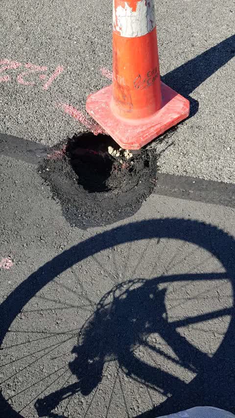
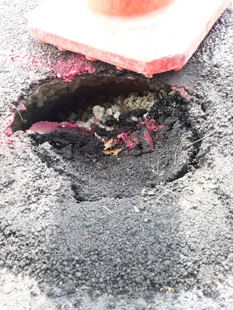
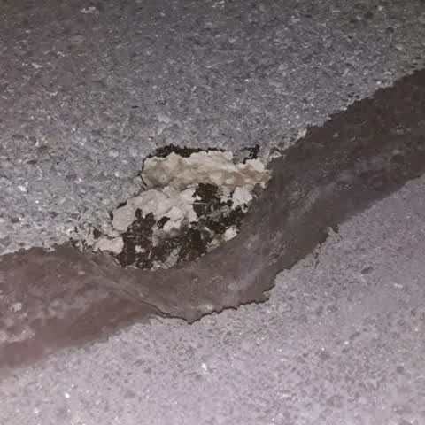
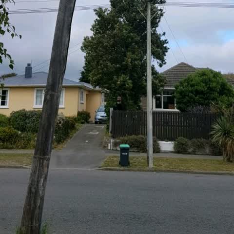
What’s on record
- Roading/Streets, 17 Nov 2018
Follow up to existing slumping issue - the pump has started making very loud noises
Roading/Streets, 13 Nov 2018
pls fix b4 car falls in it
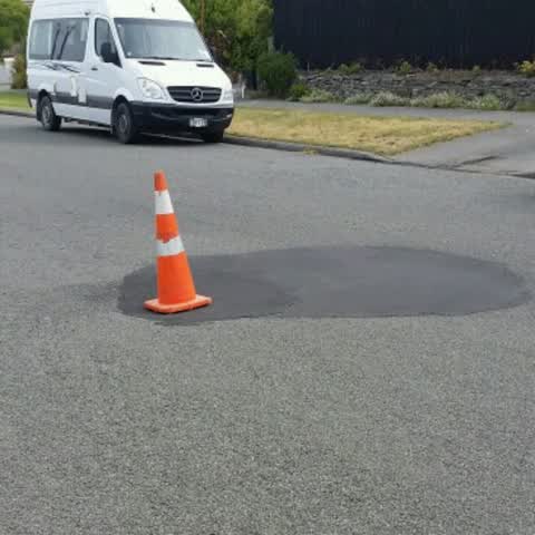
Roading/Streets, 11 Nov 2018
I reported this pothole and slump of the road patch last week. The pothole got filled in, but has already sunk back in - erosion behind the
Roading/Streets, 4 Nov 2018
Same area of road that has slumped and been repaired several times in the past. It has been slumping again for the past few weeks in the mid
Roading/Streets, 27 Jan 2018
The services pole outside our house is cracked and bending.
Roading/Streets, 12 Jan 2017
A hole has appeared in the road outside our house.
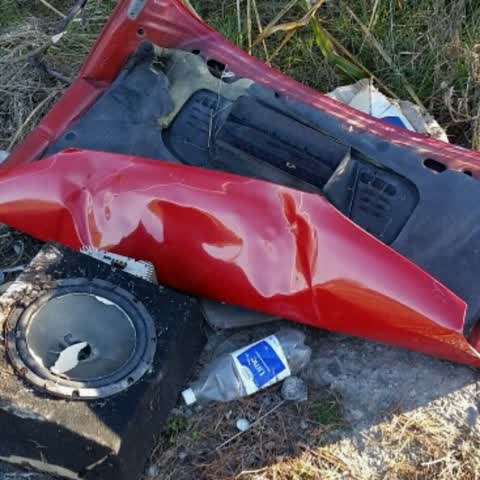
Rubbish/Recycling, 2 Aug 2016
On the entrance to New Brighton, on Bridge street just at the end of the Bridge on the left. A thoughtful soul has left a suban amp and a ca
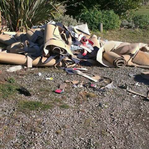
Rubbish/Recycling, 1 Aug 2016
It seems this lot has been dumped by a lazy tradie/diy-er. on Waitaki St in South Brighton domain.
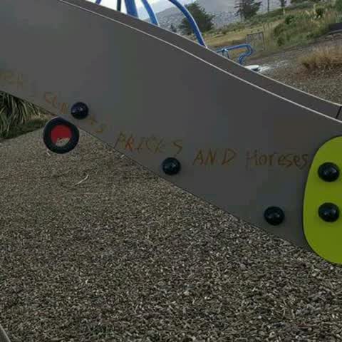
Graffiti, 14 Dec 2015
Some idiots graffiti'd the new slide at South Brighton domain
Elsewhere on Pine Avenue
- 237 Pine Avenue, 12 reports
- 389 Pine Avenue, 9 reports
- 370 Pine Avenue, 7 reports
- 287 Pine Avenue, 5 reports
- 183 Pine Avenue, 5 reports
- 219 Pine Avenue, 4 reports
- 202 Pine Avenue, 4 reports
- 110 Pine Avenue, 4 reports
The street’s crash record
NZTA’s record names Pine Avenue in 5 crashes that hurt somebody since 2006, 2 seriously hurt, nobody killed.
The civic layer
This ground votes in Coastal ward, the Coastal-Burwood-Linwood community board is its local layer. Ward lines don’t always follow suburb lines; this one is measured at the pin, not the suburb’s centre. The whole roll is at /wards.
Pine Avenue, the whole record → · Everything about South New Brighton → · What stood on this ground → · On the map → · From the air, RetroLens holds the Crown’s aerials back to 1936; search the address there →
Questions, answered briefly
9 council reports on record since December 2015, most often roading/streets (6), rubbish/recycling (2), graffiti (1).
South New Brighton, Christchurch, on Pine Avenue.
Nothing on the heritage register at this exact spot, the record around this ground →
South New Brighton Beach, 153 m to its edge, 37 ha.