Country Place
2 council reports at 2 addresses on Country Place, Burwood, on record since April 2021.
Where it runs
Each report dot is the average of the spots reports were filed from, where reporters stood on Country Place, not the street’s surveyed line. The strong outline is Burwood.
From the air, then
Sourced from Canterbury Maps and partners. LINZ, CC BY 3.0 NZ. Each frame is cut from Environment Canterbury’s historic imagery MapServer for that decade, only where the Footprints layer names a CC BY survey (NZAM-covered spots stay out). RetroLens holds more Crown aerials →
The numbered spots
- 9 Country Place, 1 report
- 15 Country Place, 1 report
What got reported
- Roads & footpaths, 1 report
- Trees & parks, 1 report
Year by year
- 2021, 1 report
- 2024, 1 report
Documents that name it
Records on the shelf that name Country Place, 22 in total; the 1 earliest:
- Page 5 Advertisements Column 4 (Lyttelton Times, 21 April 1860) · Papers Past ·
…active steady vv woman as general servant in a t-f you like an easy chair go to mr quiet country place about three miles from christ j heslop store and you will get church apply at l times union offi…
The rest are a search away, the whole shelf, for the name →
The named ground
Named water within 150 m of a reported pin, measured to the line or the edge; Named places within 350 m of a reported pin, the open map’s record.
As it was reported

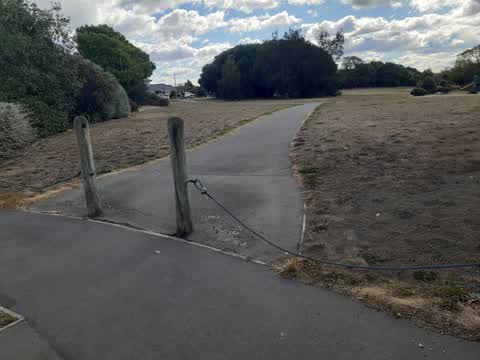
Latest on record
- Playground Equipment at 15 Country Place, 14 May 2024
- Roading/Streets at 9 Country Place, 14 Apr 2021
Questions, answered briefly
In Burwood, Christchurch, New Zealand.
2 reports at 2 addresses, most often roads & footpaths (1), trees & parks (1).
2021, the record covers 2 separate days somebody filed something about it, through 2024.
Everything about Burwood → · Every street the archive knows → · the whole A–Z → · This street as a feed →