Queensbury Street
47 reports at 23 addresses in Burwood, the first in 2016, the latest 2026. 43 separate days somebody filed something about it.
Where it runs
Each report dot is the average of the spots reports were filed from, where reporters stood on Queensbury Street, not the street’s surveyed line. The strong outline is Burwood.
From the air, then
Sourced from Canterbury Maps and partners. LINZ, CC BY 3.0 NZ. Each frame is cut from Environment Canterbury’s historic imagery MapServer for that decade, only where the Footprints layer names a CC BY survey (NZAM-covered spots stay out). RetroLens holds more Crown aerials →
The addresses on it
- 142 Queensbury Street, 9 reports
- 143 Queensbury Street, 8 reports
- 202 Queensbury Street, 4 reports
- 147 Queensbury Street, 4 reports
- 232 Queensbury Street, 2 reports
- 231 Queensbury Street, 2 reports
- 144 Queensbury Street, 2 reports
- 242 Queensbury Street, 1 report
- 238 Queensbury Street, 1 report
- 236 Queensbury Street, 1 report
- 227 Queensbury Street, 1 report
- 222 Queensbury Street, 1 report
- 220 Queensbury Street, 1 report
- 219 Queensbury Street, 1 report
- 215 Queensbury Street, 1 report
- 201A Queensbury Street, 1 report
- 175 Queensbury Street, 1 report
- 172 Queensbury Street, 1 report
- 167 Queensbury Street, 1 report
- 159 Queensbury Street, 1 report
- 155 Queensbury Street, 1 report
- 149 Queensbury Street, 1 report
- 140 Queensbury Street, 1 report
What got reported
- Rubbish & dumping, 17 reports
- Graffiti & vandalism, 11 reports
- Trees & parks, 8 reports
- Animals & pests, 5 reports
- Roads & footpaths, 2 reports
- Everything else, 2 reports
- Water & drains, 1 report
- Vehicles & parking, 1 report
Year by year
- 2016, 1 report
- 2017, 2 reports
- 2020, 9 reports
- 2021, 8 reports
- 2022, 9 reports
- 2023, 2 reports
- 2024, 3 reports
- 2025, 8 reports
In the written record
Archive documents carrying the street’s name: leads and citations, not verified history.
- ROLL OF HONOUR (Evening Post, 28 December 1944)
· Papers Past,
…pte mr j d hawker 94 grafton st llnwood christchurch f higham arthur pte mr j higham 246 queensbury st bunvood christchurch hughes john a lsgt mr j hughes 92 farnham st mornington wellington f hunia…
- Effects of the Canterbury earthquakes of 2010 and 2011, particularly of aerial views of Christchurch City CBD and suburbs
· TAPUHI,
…treet, Kingsford Street, Alice Street, Viscount Place, Jean Batten Place, Liggins Street, Queensbury Street, New Brighton Road, Bottle Lake Reserve, Donnell Park, Anzac Drive Reserve, New Brighton pie…
The rest are a search away, the whole shelf, for the name →
The crash record on it
NZTA’s record names Queensbury Street in 1 crash that hurt somebody since 2006, 1 seriously hurt, nobody killed.
Its file in the papers
Papers Past records that surfaced when the archive searched for the street’s name, they answered the search; whether they are about this street is a reader’s call, at the link.
As it was reported

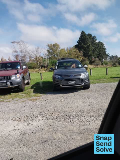

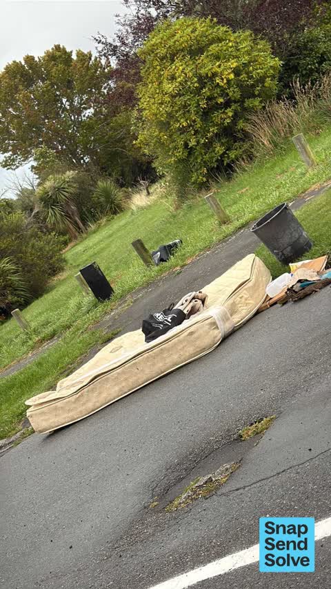


The latest on it
- Accessibility, 147 Queensbury St,
- Dumped Rubbish, 142 Queensbury St,
- Animal - Domestic, 155 Queensbury Street,
- Dumped Rubbish, 143 Queensbury Street,
- Dumped Rubbish, 143 Queensbury St,
- Dumped Rubbish, 142 Queensbury Street,
- Dumped Rubbish, 143 Queensbury St,
- Dumped Rubbish, 142 Queensbury St,
- Dumped Rubbish, 175 Queensbury St,
- Dumped Rubbish, 147 Queensbury Street,
- Litter, 144 Queensbury Street,
- Graffiti somewhere else, 143 Queensbury Street,
- Graffiti somewhere else, 159 Queensbury Street,
- Graffiti somewhere else, 142 Queensbury Street,
- Animal - General, 172 Queensbury Street,
Questions, answered briefly
In Burwood, Christchurch, New Zealand.
47 reports at 23 addresses, most often rubbish & dumping (17), graffiti & vandalism (11), trees & parks (8).
2016, the record covers 43 separate days somebody filed something about it, through 2026.
Every street the archive knows → · Burwood → · This street as a feed →