Chancery Lane
3 council reports at 1 address on Chancery Lane, Christchurch Central City, on record since November 2016.
Where it runs
Each report dot is the average of the spots reports were filed from, where reporters stood on Chancery Lane, not the street’s surveyed line. The strong outline is Christchurch Central City.
From the air, then
Sourced from Canterbury Maps and partners. LINZ, CC BY 3.0 NZ. Each frame is cut from Environment Canterbury’s historic imagery MapServer for that decade, only where the Footprints layer names a CC BY survey (NZAM-covered spots stay out). RetroLens holds more Crown aerials →
The numbered spots
- 7 Chancery Lane, 3 reports
What got reported
- Graffiti & vandalism, 2 reports
- Water & drains, 1 report
Year by year
- 2016, 1 report
- 2018, 2 reports
Documents that name it
Records on the shelf that name Chancery Lane, 209 in total; the 12 earliest:
- Page 2 Advertisements Column 1 (Star, 16 August 1884) · Papers Past ·
…k and ross 237 money accommodation for all classes private loan and discount offices no 7 chancery lane near j t boll corner the undersized has opened the above most private and centrally situated off…
- Page 2 Advertisements Column 6 (Star, 19 August 1884) · Papers Past ·
…accepted 5134 money accommodation for all classes private loan aud discount offices no 7 chancery lane near j t beu corner the undersigned has opened the above most private and centrally situated off…
- Page 2 Advertisements Column 2 (Star, 13 February 1885) · Papers Past ·
…358 9265 money accommodation for all classes the loan and discount business late of no 7 chancery lane is removed to my old established place of business no 186 colombo street next door to city hotel…
- Page 2 Advertisements Column 4 (Star, 12 May 1885) · Papers Past ·
…5798 wafitkd to bell theodolite troughton and simms splendid instrument bargain f adams 7 chancery lane 3754 wanted a few men to dig potatoes also weekly man apply to henry tisch opposite belfast nort…
- Page 4 Advertisements Column 4 (Star, 13 August 1886) · Papers Past ·
…mation can be obtainod fom john i carter representative for christchnroh or from office 7 chancery lane cathedral square po box 381 properties for sale or to let for sale by ji jj j3owker lajtd akd es…
- Page 4 Advertisements Column 2 (Star, 28 August 1886) · Papers Past ·
…mation can be obtained fom john i caetee baprosentative fot chriatohorch or from offlco 7 chancery lane oatliedral bqnaro po box 381 properties for sale or to let chbistchuhch and ��bubban pin d bopeb…
- Page 4 Advertisements Column 3 (Star, 03 November 1886) · Papers Past ·
…aims sir frederick whi t akerkcmg mlc honjavcks wl liamson mlc dr logan campbell office 7 chancery lane cathedral square po box 381 phcenix fire office tw e t lohaed 7y alton of cashel street christoh…
- Page 2 Advertisements Column 6 (Star, 03 November 1886) · Papers Past ·
…sy for an agent to work for the equitable and difficult to work against it apply offlce 7 chancery lane betwee and 5 pm 3160…
- Page 4 Advertisements Column 3 (Star, 11 December 1886) · Papers Past ·
…y claims sir frederick whitakeekcmgmlc honjamks williamson mlc dr logan campbell office 7 chancery lane cathedral square po box 381 phcenix piee oliice jttb o ichaed yrt alton of cashel street christc…
- Page 4 Advertisements Column 3 (Star, 22 December 1886) · Papers Past ·
…s sir fjskdjsuiok wht t akfcrkomg mlc bonjacfcw williamson mlc dr logan campbell office 7 chancery lane cathedral square po box 381 the norwich unlon itibe insurance society bad office norwich england…
- Page 4 Advertisements Column 2 (Star, 23 December 1886) · Papers Past ·
…claims sir fbedebick whitakebkcmg mlc hon james williamson mlc dr logan campbell office 7 chancery lane cathedral square po box 381 fropexties for sale or to let choice properties for sale by h l bowk…
- Page 4 Advertisements Column 3 (Star, 10 January 1887) · Papers Past ·
…ms sir frederick whitakkbkcmg mlc hon james williamson mlc f dr logan campbell offioe t 7 chancery lane cathedral square po box 881…
The rest are a search away, the whole shelf, for the name →
The named ground
Named water within 150 m of a reported pin, measured to the line or the edge; Named places within 350 m of a reported pin; the council’s own structure register, bridges, boardwalks and steps standing nearby, the open map’s record.
As it was reported
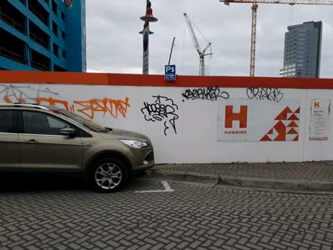
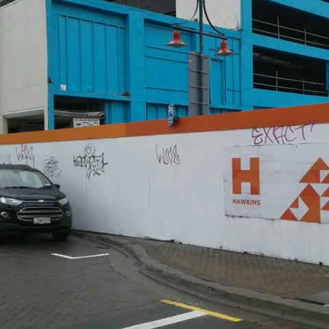
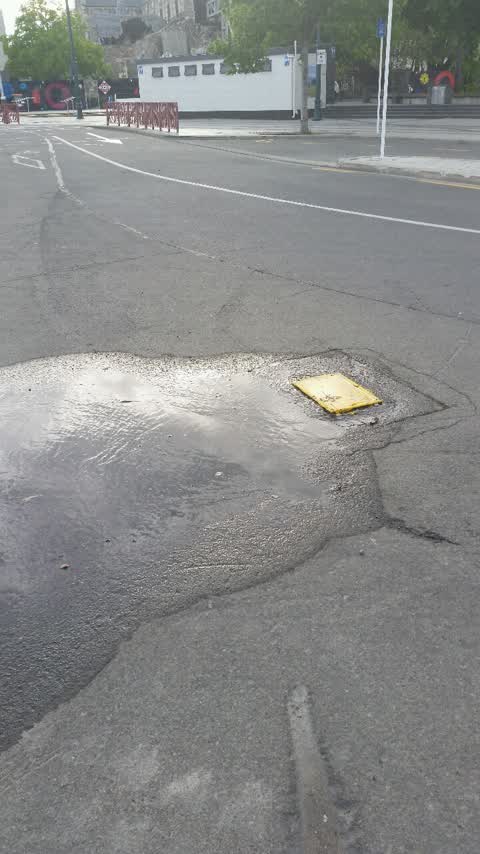
Latest on record
- Graffiti at 7 Chancery Ln, 31 Jul 2018
- Graffiti at 7 Chancery Ln, 26 Feb 2018
- Water Supply at 7 Chancery Lane, 23 Nov 2016
Questions, answered briefly
In Christchurch Central City, Christchurch, New Zealand.
3 reports at 1 address, most often graffiti & vandalism (2), water & drains (1).
2016, the record covers 3 separate days somebody filed something about it, through 2018.
Everything about Christchurch Central City → · Every street the archive knows → · the whole A–Z → · This street as a feed →