Summit Road
8 reports at 1 address in Mount Pleasant, the first in 2018, the latest 2025. 8 separate days somebody filed something about it.
Where it runs
Each report dot is the average of the spots reports were filed from, where reporters stood on Summit Road, not the street’s surveyed line. The strong outline is Mount Pleasant.
From the air, then
Sourced from Canterbury Maps and partners. RNZAF, CC BY 3.0 NZ. Each frame is cut from Environment Canterbury’s historic imagery MapServer for that decade, only where the Footprints layer names a CC BY survey (NZAM-covered spots stay out). RetroLens holds more Crown aerials →
The addresses on it
- 575 Summit Road, 8 reports
What got reported
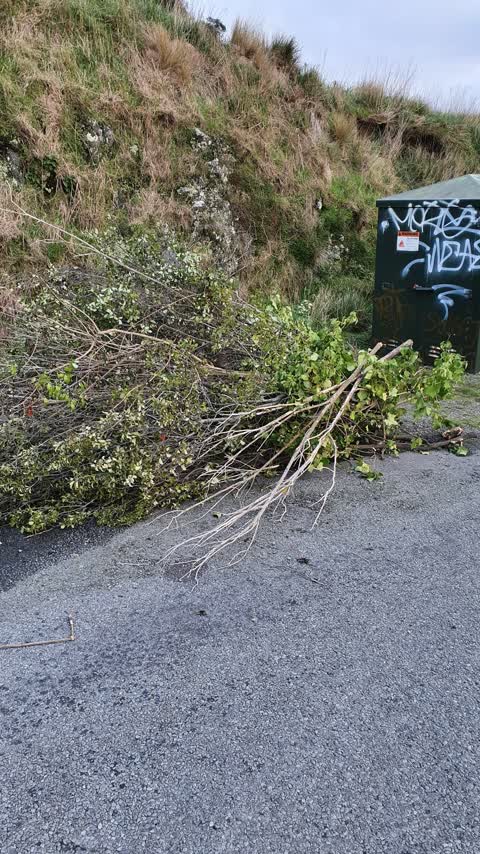
- Rubbish & dumping, 3 reports
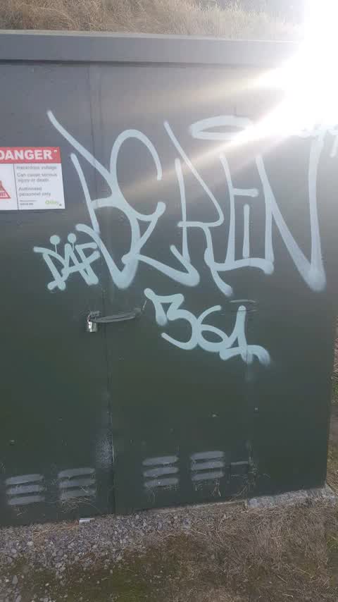
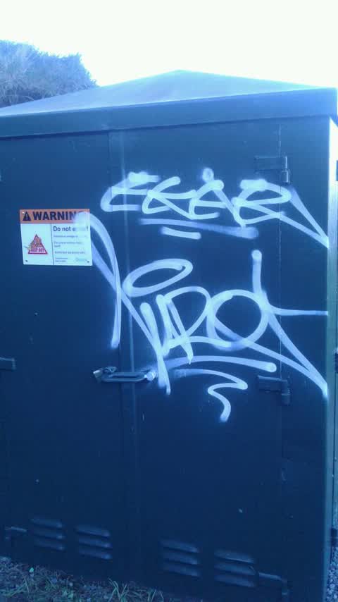
- Graffiti & vandalism, 3 reports
- Roads & footpaths, 1 report
- Trees & parks, 1 report
Year by year
- 2018, 1 report
- 2019, 1 report
- 2021, 1 report
- 2022, 1 report
- 2023, 1 report
- 2024, 2 reports
- 2025, 1 report
In the written record
Archive documents carrying the street’s name: leads and citations, not verified history. 137 on the shelf; the 12 earliest:
- AKAROA AND WAINUI ROAD BOARD. (Akaroa Mail and Banks Peninsula Advertiser, 21 January 1879)
· Papers Past,
…ended he thought the roads connecting the harbor with okain bay and little akaloa and the summit road were very necessary works mr mdonald thought a portion of these funds should be allotted to wainui…
- Page 3 Advertisements Column 3 (Akaroa Mail and Banks Peninsula Advertiser, 21 September 1880)
· Papers Past,
…years dating from the ist of november next no acreage locality 1220 130 head of bay next summit road 1225 114 okairfs bay 122g 104 le bon bay 1228 107 okain bay 1229 144 little river 1231 12g price v…
- AKAROA AND WAINUI ROAD BOARD. (Akaroa Mail and Banks Peninsula Advertiser, 04 October 1881)
· Papers Past,
…veyor the request was granted from messrs snndys co calling attention to the state of the summit road from the long bay road to their iand at waikorakikari valley and asking to have it put in repair h…
- AKAROA AND WAINUI ROAD BOARD. (Akaroa Mail and Banks Peninsula Advertiser, 15 November 1881)
· Papers Past,
…a stewart 10 10s john gunning 25 p shadbolt co 18 mrstewartstender was accepted long bay summit roadl p johnston 28 osullivan wanl 23 it was resolved to accept osullivan ward tender waimii valley bus…
- AKAROA COUNTY COUNCIL. (Akaroa Mail and Banks Peninsula Advertiser, 27 December 1882)
· Papers Past,
…asking if he would accept the position as defined by the council mr mcgregor accepted the summit road the chairman said that the council owned a deht of gratitude to mr wilkin for the work he had done…
- Peninsula News. (Akaroa Mail and Banks Peninsula Advertiser, 06 February 1883)
· Papers Past,
…heathcote und wisoccupijd by these gentlemen and d mccullouh they were all at work on the summit road some distance away and had no idea of the catastrophe that was occurring some maoris who wen passi…
- AKAROA COUNTY COUNCIL. (Akaroa Mail and Banks Peninsula Advertiser, 13 March 1883)
· Papers Past,
…rate for what was a district road for by the government circular they would see that the summit road was hot considered a main road and therefore the county funds should not be devoted to that purpos…
- Page 3 Advertisements Column 2 (Akaroa Mail and Banks Peninsula Advertiser, 03 April 1883)
· Papers Past,
…near mount bossu 3rd pigeon bay new road-from birdling junction to saddle at junction of summit roads 4th loag bay roadfrom german i bay saddle to grass hill beyond geoige bush sth onuku roadfrom aka…
- Page 3 Advertisements Column 3 (Akaroa Mail and Banks Peninsula Advertiser, 06 April 1883)
· Papers Past,
…e near mount bossu 3rd pigeon bay new roadfrom birdling junction to saddle at junction of summit roads 4th long bay roadfrom german bay saddle to grass hill beyond george bush 5 th onuku roadfrom akar…
- Page 3 Advertisements Column 3 (Akaroa Mail and Banks Peninsula Advertiser, 10 April 1883)
· Papers Past,
…e near mount bossu 3rd pigeon bay new roadfrom birdling junction to saddle at junction of summit roads 4th long bay roadfrom german bay saddle to grass hill beyond george bush sth onuku roadfrom akaro…
- Page 3 Advertisements Column 2 (Akaroa Mail and Banks Peninsula Advertiser, 13 April 1883)
· Papers Past,
…e n ar mount boppu 3rd pigeon bay new roadfrom birdling junction to saddle at junction of summit roads 4th long bay roadfrom german bay saddle to grass hill beyond george bash sth onuku roadfrom akaro…
- Original Correspondence (Akaroa Mail and Banks Peninsula Advertiser, 04 September 1883)
· Papers Past,
…epared to acquit itself of that responsibility the action it has taken in relation to the summit road will i believe eventuate in the prosecution of that work this will provide access to the railway f…
The rest are a search away, the whole shelf, for the name →
The named ground
Named places within 350 m of a reported pin, the open map’s record.
As it was reported


The latest on it
Questions, answered briefly
In Mount Pleasant, Christchurch, New Zealand.
8 reports at 1 address, most often rubbish & dumping (3), graffiti & vandalism (3), roads & footpaths (1).
2018, the record covers 8 separate days somebody filed something about it, through 2025.
Dyers Pass Road and Summit Road, 166 police-reported crashes at the pairing, 6 of them fatal.
Every street the archive knows → · Mount Pleasant → · This street as a feed →