Mccormacks Bay Road
156 reports at 30 addresses in Redcliffs, the first in 2015, the latest 2026. 131 separate days somebody filed something about it.
Where it runs
Each report dot is the average of the spots reports were filed from, where reporters stood on Mccormacks Bay Road, not the street’s surveyed line. The strong outline is Redcliffs.
From the air, then
Sourced from Canterbury Maps and partners. RNZAF, CC BY 3.0 NZ. Each frame is cut from Environment Canterbury’s historic imagery MapServer for that decade, only where the Footprints layer names a CC BY survey (NZAM-covered spots stay out). RetroLens holds more Crown aerials →
The addresses on it
- 120 McCormacks Bay Road, 24 reports
- 156 McCormacks Bay Road, 21 reports
- 150 McCormacks Bay Road, 21 reports
- 157 McCormacks Bay Road, 10 reports
- 134 McCormacks Bay Road, 9 reports
- 154 McCormacks Bay Road, 6 reports
- 141 McCormacks Bay Road, 6 reports
- 124 McCormacks Bay Road, 6 reports
- 122 McCormacks Bay Road, 6 reports
- 3B McCormacks Bay Road, 4 reports
- 130 McCormacks Bay Road, 4 reports
- 128 McCormacks Bay Road, 4 reports
- 118–132 McCormacks Bay Road, 4 reports
- 3A McCormacks Bay Road, 3 reports
- 135 McCormacks Bay Road, 3 reports
- 134 Mccormacks Bay Road, 3 reports
- 130 Mccormacks Bay Road, 3 reports
- 156 Mccormacks Bay Road, 2 reports
- 150 Mccormacks Bay Road, 2 reports
- 145 McCormacks Bay Road, 2 reports
- 132 McCormacks Bay Road, 2 reports
- 124 Mccormacks Bay Road, 2 reports
- 108–110 McCormacks Bay Road, 2 reports
- 142–154 McCormacks Bay Road, 1 report
- 138–140 McCormacks Bay Road, 1 report
- 138 McCormacks Bay Road, 1 report
- 136 McCormacks Bay Road, 1 report
- 123 McCormacks Bay Road, 1 report
- 116 McCormacks Bay Road, 1 report
- 112–116 McCormacks Bay Road, 1 report
What got reported
- Water & drains, 54 reports
- Trees & parks, 32 reports
- Roads & footpaths, 24 reports
- Graffiti & vandalism, 21 reports
- Rubbish & dumping, 15 reports
- Vehicles & parking, 5 reports
- Everything else, 4 reports
- Animals & pests, 1 report
Year by year
- 2015, 1 report
- 2017, 1 report
- 2018, 3 reports
- 2019, 3 reports
- 2020, 9 reports
- 2021, 13 reports
- 2022, 15 reports
- 2023, 36 reports
- 2024, 20 reports
- 2025, 48 reports
In the written record
Archive documents carrying the street’s name: leads and citations, not verified history.
- Basic services information for quake residents
· Radio New Zealand,
…splanade, Sumner Avonside Girls High School 24 Cowlishaw St, Avonside McCormacks Bay* 130 McCormacks Bay Rd, McCormacks Bay Lyttelton Recreation Centre 25 Winchester St, Lyttelton Trade Aid 174 Gayhur…
The rest are a search away, the whole shelf, for the name →
The named ground
Named water within 150 m of a reported pin, measured to the line or the edge; the council’s own structure register, bridges, boardwalks and steps standing nearby, the open map’s record.
The crash record on it
NZTA’s record names Mccormacks Bay Road in 5 crashes that hurt somebody since 2006, 1 seriously hurt, nobody killed.
As it was reported


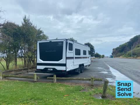


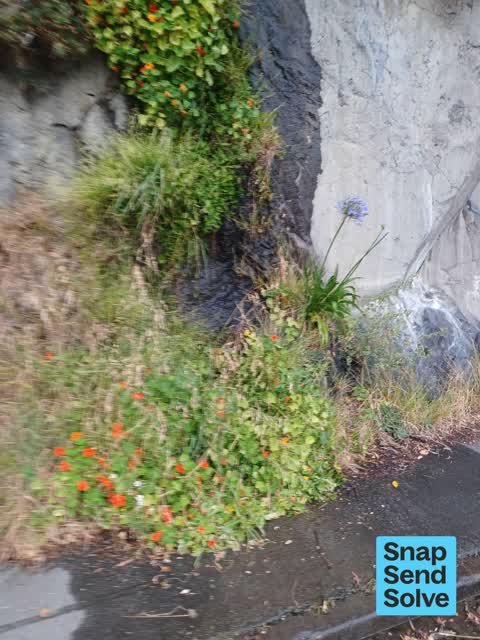


The latest on it
- Public Toilet, 138–140 McCormacks Bay Rd,
- Street Gutters / Storm Water, 150 McCormacks Bay Rd,
- Water Leak, 128 McCormacks Bay Road,
- Dumped Rubbish, 3B McCormacks Bay Road,
- Graffiti on a fence, building or structure, 156 McCormacks Bay Rd,
- Dumped Rubbish, 3A McCormacks Bay Road,
- Hazard, vehicle, 118–132 McCormacks Bay Rd,
- Overgrown Vegetation, 142–154 McCormacks Bay Rd,
- Trees - General, 150 McCormacks Bay Rd,
- Water Leak, 150 McCormacks Bay Road,
- Graffiti on a fence, building or structure, 3A McCormacks Bay Road,
- Trees - General, 112–116 McCormacks Bay Rd,
- Overgrown Vegetation, 157 McCormacks Bay Road,
- Dumped Rubbish, 118–132 McCormacks Bay Rd,
- Fallen Tree, 108–110 McCormacks Bay Rd,
Questions, answered briefly
In Redcliffs, Christchurch, New Zealand.
156 reports at 30 addresses, most often water & drains (54), trees & parks (32), roads & footpaths (24).
2015, the record covers 131 separate days somebody filed something about it, through 2026.
Every street the archive knows → · Redcliffs → · This street as a feed →