Gebbies Pass Road
9 reports at 7 addresses in Governors Bay, the first in 2019, the latest 2026. 8 separate days somebody filed something about it.
Where it runs
Each report dot is the average of the spots reports were filed from, where reporters stood on Gebbies Pass Road, not the street’s surveyed line. Register places with a known pin sit on it too. The strong outline is Governors Bay.
From the air, then
Sourced from Canterbury Maps and partners. LINZ, CC BY 3.0 NZ. Each frame is cut from Environment Canterbury’s historic imagery MapServer for that decade, only where the Footprints layer names a CC BY survey (NZAM-covered spots stay out). RetroLens holds more Crown aerials →
The addresses on it
- 703 Gebbies Pass Road, 3 reports
- 794-688 Gebbies Pass Road, 1 report
- 743 Gebbies Pass Road, 1 report
- 736 Gebbies Pass Road, 1 report
- 689-785 Gebbies Pass Road, 1 report
- 572–690 Gebbies Pass Road, 1 report
- 556 Gebbies Pass Road, 1 report
What got reported
- Animals & pests, 4 reports
- Roads & footpaths, 3 reports
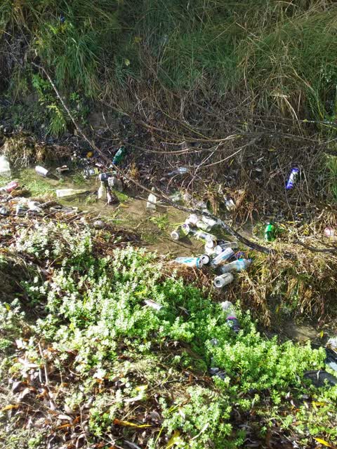
- Rubbish & dumping, 2 reports
Year by year
- 2019, 2 reports
- 2023, 2 reports
- 2024, 1 report
- 2025, 1 report
On the register
- St Peter's Church and Setting, 834 Gebbies Pass Road
On foot, The bay and the hill walks this street.
In the written record
Archive documents carrying the street’s name: leads and citations, not verified history.
- looking up McQueens Valley (on right) and Gebbi... (PB0611/165)
· V.C. Browne & Son NZ Aerial Photograph Collection,
…hristchurch various. looking up McQueens Valley (on right) and Gebbies Valley (on Left) - Gebbies Pass Road to Godley Heads V.C. Browne & Son NZ Aerial Photograph Collection…
- Weather: What you need to know about road closures, flights, ferries, schools and evacuations
· Radio New Zealand,
…errace. Banks Peninsula is also riddled with road closures: SH75 from Tai Tapu to Akaroa. Gebbies Pass Road from SH75 to Charteris Bay Road. Kinloch Road from Okuiti Valley Road to Bossu Road. Reynold…
The rest are a search away, the whole shelf, for the name →
The named ground
Named water within 150 m of a reported pin, measured to the line or the edge, the open map’s record.
The crash record on it
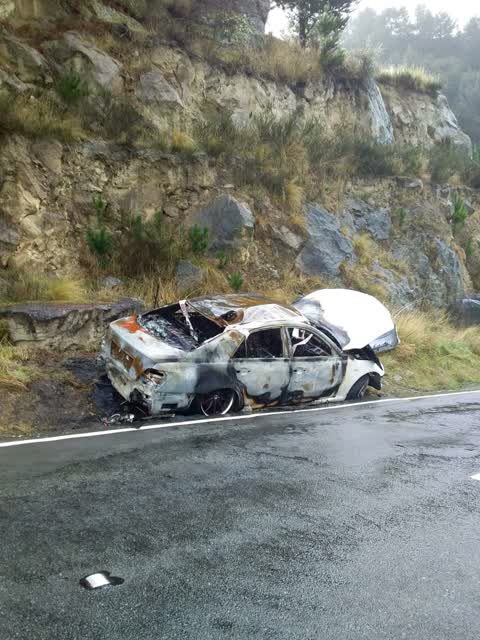
NZTA’s record names Gebbies Pass Road in 42 crashes that hurt somebody since 2006, 2 people killed, 20 seriously hurt.
The corner the record returns to: Gebbies Pass Road & Summit Road, 62 crashes pinned to the pairing.
Heard on the wire
Public posts that name the street: relayed, not verified.
- Police seek witnesses after Gebbies Pass Road crash · The news · Chris Lynch Media,
As it was reported


The latest on it
- Animal - General, 703 Gebbies Pass Road,
- Damaged Road, 689-785 Gebbies Pass Road,
- Damaged Road, 572–690 Gebbies Pass Rd,
- Animal - General, 743 Gebbies Pass Rd,
- Animal - General, 703 Gebbies Pass Road,
- Dumped Rubbish, 556 Gebbies Pass Road,
- Animal - General, 703 Gebbies Pass Road,
- Roading/Streets, 736 Gebbies Pass Rd,
- Rubbish/Recycling, 794-688 Gebbies Pass Rd,
Questions, answered briefly
In Governors Bay, Christchurch, New Zealand.
9 reports at 7 addresses, most often animals & pests (4), roads & footpaths (3), rubbish & dumping (2).
2019, the record covers 8 separate days somebody filed something about it, through 2026.
Gebbies Pass Road and Summit Road, 62 police-reported crashes at the pairing.
Every street the archive knows → · Governors Bay → · This street as a feed →