The bay and the hill
Twelve register entries, and they tell the shape of the place on their own: ten of them sit along the shore road or just off it, the church, the school, the vicarage, the lock-up, and the last two are the Sign of the Kiwi at the top of the Port Hills. Flat along the bay, then the long climb. Bike or drive the hill if your legs object.
The walk, as a line
Straight between pins, the streets run longer. Every numbered pin opens that place’s own record.
The stops, in order
- St Peter's Church and Setting, 834 Gebbies Pass Road · 21 unread leads · a Wikipedia entry
St Peter’s Church, the southernmost entry, where the shore road runs on.
- Former Quarry Stables · 20 unread leads
The former quarry stables, the bay’s old quarry kept its buildings on the roll.
- Former Governors Bay Lock-up · 21 unread leads
The former lock-up, the bay kept its own tiny jail.
- Dwelling and Setting, Ohinetahi, 31 Governors Bay - Teddington Road · Heritage NZ list 3349 · 13 unread leads
Ohinetahi, the named dwelling and its setting, on the roll.
- Bridge/Culvert and Setting
A listed bridge and culvert, even the roadworks are heritage here.
- St Cuthberts Vicarage, 8 Governors Bay - Teddington Road · 22 unread leads
St Cuthbert’s vicarage, the vicarage listed beside its church.
- St Cuthbert's Church and Setting · Heritage NZ list 281 · 20 unread leads
St Cuthbert’s Church, the bay’s listed church.
- Former Governors Bay School and Setting, 112 Main Road · Heritage NZ list 5434 · 38 unread leads
The former Governors Bay school.
- Former Governors Bay School Master's House and Setting, 112 Main Road · Heritage NZ list 5435 · 39 unread leads
The former school master’s house, the school’s companion entry.
- Bridge/Culvert and Setting
Another listed bridge on the way up, the road to the hill was worth listing too.
- Sign of the Kiwi and Setting, 1700 Summit Road · Heritage NZ list 1930 · 30 unread leads · a Wikipedia entry
Sign of the Kiwi, the refreshment stop at the summit, on the roll in its own right.
- Sign of the Kiwi Grounds and Setting, 1700 Summit Road · 29 unread leads
The Kiwi’s grounds, listed separately from the building itself.
What the register built on the way
Council structures within about 30 m of the stop-to-stop line, the bridges, steps and shelters the route passes. Site names are the register’s own.
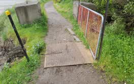 A footbridge at Old Coach Road, 2.65 m long · built 2008 · rated accessible
 A set of steps at Coronation Hill Reserve, 9 steps · built 1998
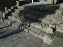 A set of steps at Coronation Hill Reserve, 5 steps · built 1998
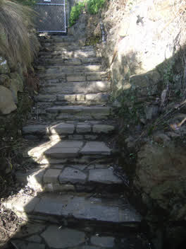 A set of steps at Coronation Hill Reserve, 17 steps · built 1998 1 m off the line
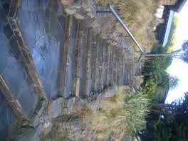 A set of steps at Coronation Hill Reserve, 26 steps · built 1998 2 m off the line
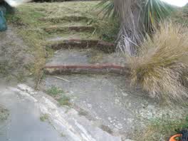 A set of steps at Cholmondeley Reserve, 4 m long · built 2008 8 m off the line
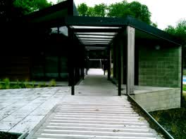 A shelter at Governors Bay Community Centre, built 2017 20 m off the line
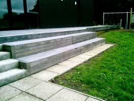 A set of steps at Governors Bay Community Centre, 2 steps · built 2017 21 m off the line
The reports along it
452 council reports pinned within 150 m of the line, most often Roads & footpaths and Trees & parks, 361 with a photograph. A pin is where a reporter stood, not a claim about the place itself.
 Rubbish and Bins - General
 Pothole
 Public Toilet
 Public Toilet
 Public Toilet
 Playground Equipment
 Public Toilet
 Public Toilet
 Public Toilet
 Road Blockage
 Public Toilet
Questions, answered briefly
Twelve register entries, and they tell the shape of the place on their own: ten of them sit along the shore road or just off it, the church, the school, the vicarage, the lock-up, and the last two are the Sign of the Kiwi at the top of the Port Hills. 12 listed places, 8.0 km as the line runs, Governors Bay.
St Peter's Church and Setting (834 Gebbies Pass Road) to Sign of the Kiwi Grounds and Setting (1700 Summit Road), the order is a suggestion, not the only way round.
Every one, each pin is a row in the district plan’s heritage schedule, and each opens the place’s own sourced record here.
8.0 km measured straight between the pins, the streets run longer, and the stops deserve a pause each.
The record behind this
Every stop is a row in the district plan’s heritage schedule, held here as the register’s own layer. The order and the notes are ours, the listings are the council’s and Heritage New Zealand’s. "Setting" is the register’s word for the ground a listing covers.
The rest of the register here: Governors Bay
The same ground today: Governors Bay
This page as markdown: /walks/governors-bay-and-the-hill.md · the route as data: /walks/governors-bay-and-the-hill.geojson · on the live map: the walks layer.