2 Orkney Street, Strowan
16 reports on record since April 2022 · 8 with photographs. The most-reported address on Orkney Street. Indicative rating valuation and school zones, hazards, bin day and what stood here before.
What gets reported here
Photographed here 8 on record


Reported here
 Damaged Street Light —
 Damaged Street lamp posts with black tape holding the cracked concrete together. These posts have been like this for over a year. There are
 General Request —
 Broken bollard at the end of the street. Near railway. Please repair
 Graffiti somewhere else —
 On kiwi rail sign attached to fence along railway corridor
 Abandoned Vehicle —
 Car has smashed rear window and looks to have been hot wired. Reported to police but it seems they inspected it and left it at that as no ev
- Rubbish and Bins - General —
- Graffiti —
- Rubbish and Bins - General —
- Rubbish and Bins - General —
- Graffiti —
- Rubbish and Bins - General —
- Trees - General —
- Graffiti —
 Dumped Rubbish —
  Dumped Rubbish —
 Dumped vacuum cleaners and bits and pieces, at end of Plynlimon Rd at railway.
 Graffiti —
 Lamppost on walkway by plynlimon park.
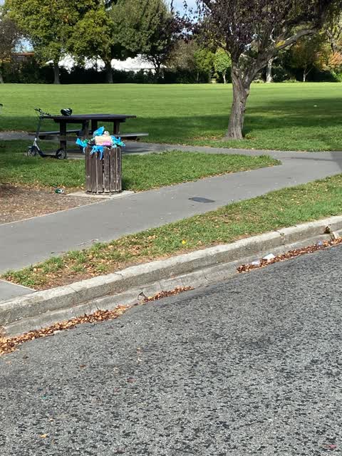
 Rubbish/Recycling —
 Bin overflowing. This is common. It really needs the emptied before the weekend and straight after (if not during).
Also reported on Orkney Street
- 15 Orkney Street — 4 reports
- 6 Orkney Street — 2 reports
- 5A Orkney Street — 2 reports
- 4 Orkney Street — 2 reports
- 10 Orkney Street — 2 reports
- 14-12 Orkney Street — 1 report
- 11 Orkney Street — 1 report
The green nearby
- Plynlimon Park — 10 m to the edge · Sports ground · 1 ha
- Elmwood Park — 267 m to the edge · Sports ground · 7 ha
Parks within half a kilometre, measured to the boundary — the council’s open data.
On the doorstep
- Z Espress - Bryndwr — 195 m away · Fast food
- Z — 206 m away · Petrol stations
- Elmwood Mini Market — 238 m away · Dairies & convenience
- The Elmwood Bar & Bistro — 245 m away · Restaurants
Businesses within four hundred metres, measured at the pin — OpenStreetMap and the council directories.
The bus nearby
The closest Metro stops, within four hundred and fifty metres.
The tracks through here
- Walk and bike track through Strowan — 5 m to the line · walk · bike
- Walk and bike track through Strowan — 156 m to the line · walk · bike
- Walk and bike track through Strowan — 210 m to the line · walk · bike
- Walk and bike track through Strowan — 230 m to the line · walk · bike
- Walk and bike track through Strowan — 230 m to the line · walk · bike
Tracks whose line passes within half a kilometre, measured to the line itself — the council’s open data.
The named ground
Named water within 500 m of this address, measured to the line or the edge; Named places within 1.5 km of this address — the open map’s record.
Renting nearby
new bonds in Strowan ran about $620 a week — $70 above the city median of $550 — the suburb page keeps the rent record →.
The civic layer
This ground votes in Fendalton ward — the Fendalton-Waimairi-Harewood community board. Ward lines don’t always follow suburb lines; this one is measured at the pin, not the suburb’s centre.
What stood on this ground → · On the map → · From the air — the Crown’s aerials back to 1936; search the address on RetroLens →
Questions, answered briefly
16 council reports on record since April 2022 — most often rubbish and bins - general (4), graffiti (4), dumped rubbish (2).
Strowan, Christchurch — on Orkney Street.
Nothing on the heritage register at this exact spot — the record around this ground →
Plynlimon Park — 10 m to its edge, 1 ha.