6 Elgin Street, Sydenham
18 reports on record since May 2017 · 17 with photographs. The street’s heaviest record is 2 Elgin Street — 20 reports on file. Indicative rating valuation and school zones, hazards, bin day and what stood here before.
What gets reported here
Photographed here 17 on record




Reported here
 Hazard — vehicle —
 Black SUV 'Chariswater irrigation solutions' is often parked in the 60 minute park all day. It doesn't move as we can see from our office wi
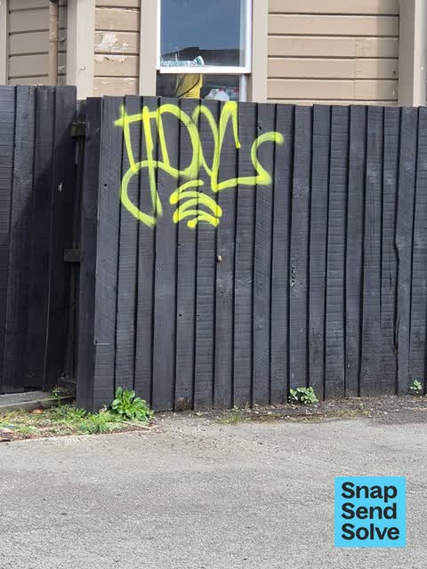
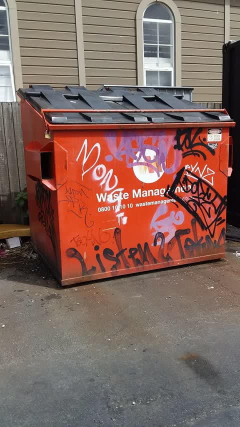
 Graffiti on a fence, building or structure —
 In Colombo car park
 Graffiti on a fence, building or structure —
 On wall and container alongside, the Colombo carpark, by Smith's City
 Dumped Rubbish —
 Hi, this is at the back of the Colombo Mall today, I’m concerned it will attract rodents, it smells! This is a health hazard.
 Rubbish and Bins - General —
 We consider this a health hazard, The Colombo mall are now dumping their rubbish, right next to ‘Hello Sunday’ a restaurant, we consider thi
 Pavement - General —
 Abandoned Trent’s Cash n Carry Trolley- 36 Orbell Street - 0800 555 130. Trolley is on the footpath at 6 Elgin Street.
 Pavement - Damaged —
 Tree roots on driveway entrance which are lifting path & potholes running across driveway entrance to business to level fill @ seal
 Damaged Road —
 Potholes on road surface to level fill & seal
 Pavement - Damaged —
 Missing berm over damaged storm water outlet pipe
 Pavement - Damaged —
 Pothole on footpath to level fill & seal
 Graffiti —
 - General - Abandoned Trolley —
Graffiti —
this graffiti is situated in the Colombo car park
Graffiti —
Graffiti —
Graffiti —
Parking entrance attention board
Roading/Streets —
Large pothole on footpath at entranceway to the colombo shop precinct
Roading/Streets —
Path collapsing. Pedestrian risk
Also reported on Elgin Street
- 2 Elgin Street — 20 reports
- 33 Elgin Street — 18 reports
- 29 Elgin Street — 12 reports
- 5 Elgin Street — 11 reports
- 13 Elgin Street — 11 reports
- 27a Elgin Street — 7 reports
- 19 Elgin Street — 7 reports
- 23 Elgin Street — 4 reports
The street’s crash record
NZTA’s record names Elgin Street in 16 crashes that hurt somebody since 2006 — 2 seriously hurt, nobody killed.
The green nearby
- Sydenham Park — 195 m to the edge · Sports ground · 5 ha
- Buchan Playground — 236 m to the edge
Parks within half a kilometre, measured to the boundary — the council’s open data.
On the doorstep
- Hello Sunday — 31 m away · Restaurants
- Coffee Culture Roastery on Durham — 42 m away · Cafés
- Belgian Beer Cafe Torenhof — 54 m away · Restaurants
- 5th Street — 55 m away · Restaurants
Businesses within four hundred metres, measured at the pin — OpenStreetMap and the council directories.
The bus nearby
- Sydenham Shops — 177 m away · route 1, route 8, route 44
- Colombo St near Wordsworth St — 199 m away · route 1, route 8, route 44
The closest Metro stops, within four hundred and fifty metres.
The tracks through here
- Walk and bike track through Sydenham — 172 m to the line · walk · bike
Tracks whose line passes within half a kilometre, measured to the line itself — the council’s open data.
The named ground
Named water within 500 m of this address, measured to the line or the edge; Named places within 1.5 km of this address — the open map’s record.
The remembered names nearby
- Sydenham Park plaque — 239 m away
- This Fountain Was Moved and Resited by the City Council — 244 m away ·
THIS FOUNTAIN WAS MOVED AND RESITED BY THE CITY COUNCIL ON THE HUNDREDTH ANNIVERSARY OF TH
· 2009
Inscribed plaques within two hundred and fifty metres — the register’s pins, not surveyed spots. The whole roll is at /plaques.
Renting nearby
new bonds in Sydenham ran about $518 a week — $32 below the city median of $550 — the suburb page keeps the rent record →.
What was here — Former Dwellings and Setting, Blackheath Place
194 m away · 71 Durham Street South · located to ±30 m · the place’s own record →
On the register. Nothing researched here yet.
What was here — King Edward VII Coronation Memorial Lamp and Drinking Fountain and Setting
244 m away · located to ±1 m · the place’s own record →
On the register. Nothing researched here yet.
The civic layer
This ground votes in Heathcote ward — the Spreydon-Cashmere-Heathcote community board. Ward lines don’t always follow suburb lines; this one is measured at the pin, not the suburb’s centre.
What stood on this ground → · On the map → · From the air — the Crown’s aerials back to 1936; search the address on RetroLens →
Questions, answered briefly
18 council reports on record since May 2017 — most often graffiti (5), pavement - damaged (3), roading/streets (2).
Sydenham, Christchurch — on Elgin Street.
The heritage register names 2 places at or beside it — Former Dwellings and Setting, Blackheath Place, King Edward VII Coronation Memorial Lamp and Drinking Fountain and Setting.
Sydenham Park — 195 m to its edge, 5 ha.