25 Clyde Road, Upper Riccarton
12 reports on record since October 2021 · 9 with photographs. The most-reported address on Clyde Road. Indicative rating valuation and school zones, hazards, bin day and what stood here before.
What gets reported here
- Overgrown Vegetation — 4
- Roading/Streets — 2
- Graffiti — 2
- Pothole — 1
- Poles and Signage - General — 1
- Dumped Rubbish — 1
Photographed here 9 on record


Reported here
 Overgrown Vegetation —
 Again these ridiculous flaxes are over the footpath. I have raised this so many times and I am sick of the owner not taking responsibility f
 Overgrown Vegetation —
 Please cut vegetation, very annoying crashing into it around the corner especially
 Overgrown Vegetation —
 25 Clyde Road - flax bushes growing out over the footpath, annoying to have to walk on wet grass to avoid them particularly when many studen
- Pothole —
HUGE pothole on Clyde Road just south of the university in northbound lane. Approximate location only
 Overgrown Vegetation —
 Overgrown flaxes are particularly annoying when it's wet and you either go on wet grass or get wet from the flaxes
 Poles and Signage - General —
 P120 sign and pole missing from rear of restriction. Pls replace. P120 Mon to fri 9am to 5pm, with arrow points right.
 Dumped Rubbish —
 A car wheel has been dumped in the garden at the corner of Kirkwood and Clyde.
 Accessibility —
 My elderly mother was walking and tripped and fell over the bumps caused by tree roots . Luckily it was a graze and sprain only. Can it plea
- Graffiti —
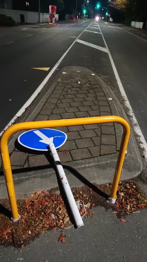
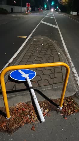 Roading/Streets —
 Sign nocked over.
- Roading/Streets —
Over hanging maple tree obsures view of oncoming traffic when exiting Kirkwood Avenue. I suspect it is also difficult to walk along the foot
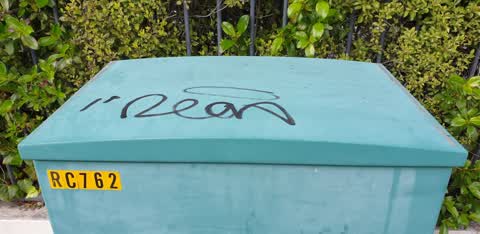
 Graffiti —
 Outside Kirkwood ave hall
Also reported on Clyde Road
- 6 Clyde Road — 8 reports
- 1 Clyde Road — 8 reports
- 15 Clyde Road — 6 reports
- 2 Clyde Road — 5 reports
- 11 Clyde Road — 4 reports
- 9 Clyde Road — 3 reports
- 7 Clyde Road — 3 reports
- 5 Clyde Road — 3 reports
The street’s crash record
NZTA’s record names Clyde Road in 17 crashes that hurt somebody since 2006 — 1 seriously hurt, nobody killed.
The green nearby
- Milnebank Reserve — 312 m to the edge
- Shand Crescent Reserve — 339 m to the edge
- Paeroa Reserve — 457 m to the edge
- Riccarton Bush — 458 m to the edge · 12 ha
Parks within half a kilometre, measured to the boundary — the council’s open data.
On the doorstep
- The Est@blishment Boutique Accommodation — 147 m away · B&Bs
- UC Print & Copy Centre — 186 m away · Printers & copy shops
- Anstice Optometrists — 210 m away · Optometrists
- Crockford's Bridge Club — 235 m away · Clubs
Businesses within four hundred metres, measured at the pin — OpenStreetMap and the council directories.
The bus nearby
- Clyde Rd near Hinau St — 55 m away · route 100, route 120
- Clyde Rd near Totara St — 85 m away · route 100, route 120
The closest Metro stops, within four hundred and fifty metres.
The tracks through here
- Walk and bike track through Upper Riccarton — 14 m to the line · walk · bike
- Walk and bike track through Upper Riccarton — 93 m to the line · walk · bike
- Walk and bike track through Upper Riccarton — 219 m to the line · walk · bike
- Walk and bike track through Upper Riccarton — 248 m to the line · walk · bike
- Walk and bike track through Upper Riccarton — 284 m to the line · walk · bike
Tracks whose line passes within half a kilometre, measured to the line itself — the council’s open data.
The named ground
Named water within 500 m of this address, measured to the line or the edge — the open map’s record.
The civic layer
This ground votes in Riccarton ward — the Halswell-Hornby-Riccarton community board. Ward lines don’t always follow suburb lines; this one is measured at the pin, not the suburb’s centre.
What stood on this ground → · On the map → · From the air — the Crown’s aerials back to 1936; search the address on RetroLens →
Questions, answered briefly
12 council reports on record since October 2021 — most often overgrown vegetation (4), roading/streets (2), graffiti (2).
Upper Riccarton, Christchurch — on Clyde Road.
Nothing on the heritage register at this exact spot — the record around this ground →
Milnebank Reserve — 312 m to its edge.