The factory garden
Nine entries between the Edmonds factory’s garden and the Avonside churchyard, the town board’s offices, an MED substation, and the named dwellings of the flat in between. Flat, short, and all on the register.
The walk, as a line
Straight between pins, the streets run longer. Every numbered pin opens that place’s own record.
The stops, in order
- Edmonds Factory Garden · 20 unread leads
The Edmonds Factory Garden, the factory’s grounds are the first entry.
- Dwelling and Setting, 14 Bass Street · Heritage NZ list 1876 · 20 unread leads
A listed dwelling on the way south.
- Dwelling and Setting, 63 Aldwins Road · Heritage NZ list 579 · 20 unread leads
Another, the flat kept its houses.
- Former Linwood Town Board Offices and Setting, 388 Worcester Street · Heritage NZ list 5382 · 39 unread leads
The former Linwood Town Board offices, local government’s own building.
- Dwelling and Setting, 196 Fitzgerald Avenue · Heritage NZ list 5292 · 20 unread leads
A listed dwelling mid-walk.
- MED Substation, 70E Linwood Avenue · 27 unread leads
The MED substation, infrastructure on the register.
- Dwelling and Setting, Englefield, 230 Fitzgerald Avenue · Heritage NZ list 1867 · 20 unread leads
Englefield, the walk’s named dwelling.
- Holy Trinity Avonside Graveyard and Setting, 168 Stanmore Road · 28 unread leads
Holy Trinity Avonside’s graveyard, the churchyard is its own entry.
- Holy Trinity Avonside Lychgate and Setting, 168 Stanmore Road · 26 unread leads
And its lychgate, the last stop, at the gate.
What the register built on the way
Council structures within about 30 m of the stop-to-stop line, the bridges, steps and shelters the route passes. Site names are the register’s own.
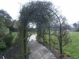 A shelter at Beverley Park, built 2009
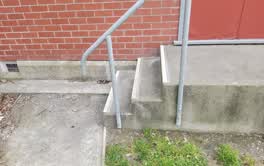 A set of steps at Linwood Community Arts Centre, 3 steps · built 1899 1 m off the line
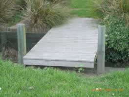 A boardwalk at Edmonds Park, 2 m long · built 2009 1 m off the line
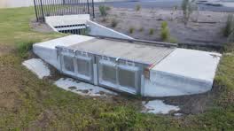 A footbridge at Edmonds Park, 3.8 m long · built 2018 5 m off the line
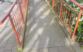 A ramp at Linwood Community Arts Centre, 8.8 m long · built 1899 6 m off the line
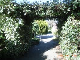 A shelter at Edmonds Factory Garden, built 2009 6 m off the line
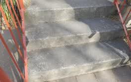 A set of steps at Linwood Community Arts Centre, 3 steps · built 1899 8 m off the line
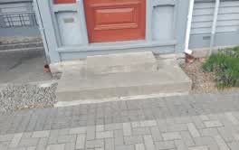 A set of steps at Linwood Community Arts Centre, 2 steps · built 1899 8 m off the line
The reports along it
5,188 council reports pinned within 150 m of the line, most often Rubbish & dumping and Graffiti & vandalism, 4,266 with a photograph. A pin is where a reporter stood, not a claim about the place itself.
 Abandoned Vehicle
 Park - General Request
 Dumped Rubbish
 Dumped Rubbish
 Water General
 Dumped Rubbish
 Graffiti on a bus stop or public toilet
 Dumped Rubbish
 Water Leak
 Park - General Request
 Graffiti on a traffic light pole or cabinet, or wa
 Damaged Road
Questions, answered briefly
Nine entries between the Edmonds factory’s garden and the Avonside churchyard, the town board’s offices, an MED substation, and the named dwellings of the flat in between. 9 listed places, 4.9 km as the line runs, Linwood.
Edmonds Factory Garden to Holy Trinity Avonside Lychgate and Setting (168 Stanmore Road), the order is a suggestion, not the only way round.
Every one, each pin is a row in the district plan’s heritage schedule, and each opens the place’s own sourced record here.
4.9 km measured straight between the pins, the streets run longer, and the stops deserve a pause each.
The record behind this
Every stop is a row in the district plan’s heritage schedule, held here as the register’s own layer. The order and the notes are ours, the listings are the council’s and Heritage New Zealand’s. "Setting" is the register’s word for the ground a listing covers.
The rest of the register here: Linwood
The same ground today: Linwood
This page as markdown: /walks/linwood-factory-garden.md · the route as data: /walks/linwood-factory-garden.geojson · on the live map: the walks layer.