The houses the avenues kept
Fifteen register entries, most of them the named dwellings of a leafy nineteenth-century suburb, plus a church, a war memorial, a park and a bridge. The walk strings them into one loop north to south, about two kilometres under the trees.
The walk, as a line
Straight between pins, the streets run longer. Every numbered pin opens that place’s own record.
The stops, in order
- Bridge and Setting · Heritage NZ list 1798 · 22 unread leads
A listed bridge first, Merivale’s entries start with infrastructure.
- Dwelling and Setting, 2 Helmores Lane · 15 unread leads
A listed dwelling on the bridge’s street.
- Dwelling and Setting, 16 Helmores Lane · 2 unread leads
And another beside it.
- Former Dwelling and Setting, Te Koroaha, 59P Hewitts Road · Heritage NZ list 3130 · 15 unread leads
Te Koroaha, the first of the named houses.
- St Andrew's Church and Setting, 16 Merivale Lane · Heritage NZ list 304 · 35 unread leads · a Wikipedia entry
St Andrew’s Church, the suburb’s listed church.
- Former Dwelling and Setting, Acland House, 85 Papanui Road · 20 unread leads
Acland House, a named former dwelling.
- Dwelling and Setting, Long Cottage, 10/142 Rugby Street · Heritage NZ list 1900 · 14 unread leads
Long Cottage, the name says the shape.
- Dwelling and Setting, 41 Leinster Road · Heritage NZ list 3717 · 15 unread leads
Two listed dwellings a street apart, this is the first.
- Dwelling and Setting, 61 Leinster Road · Heritage NZ list 3718 · 11 unread leads
And the second.
- Elmwood School War Memorial and Setting, 1/76 Leinster Road · 19 unread leads
The Elmwood School war memorial, the school ground carries the names.
- Dwelling and Setting, 70 Heaton Street · Heritage NZ list 3713 · 11 unread leads
A listed dwelling near the park.
- Dwelling and Setting, 74 Heaton Street · Heritage NZ list 3716 · 13 unread leads
And its neighbour, the roll keeps them in pairs here.
- Elmwood Park · 18 unread leads
Elmwood Park, listed ground again.
- Dwelling and Setting, 98 Heaton Street · Heritage NZ list 3714 · 10 unread leads
One more dwelling on the way south.
- Dwelling and Setting, Damsels, 283 Papanui Road · Heritage NZ list 1884 · 20 unread leads
Damsels, the last named house on the walk.
What the register built on the way
Council structures within about 30 m of the stop-to-stop line, the bridges, steps and shelters the route passes. Site names are the register’s own.
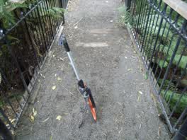 A footbridge at Millbrook Reserve, 2 m long · built 2009 16 m off the line
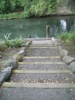 A set of steps at Millbrook Reserve, 8 steps · built 2009 17 m off the line
The reports along it
1,934 council reports pinned within 150 m of the line, most often Roads & footpaths and Water & drains, 1,558 with a photograph. A pin is where a reporter stood, not a claim about the place itself.
 Water General
 Rubbish and Bins - General
 Rubbish and Bins - General
 Pavement - General
 Roads - General
 Water Leak
 Water Leak
 Hazard, vehicle
 Pavement - Damaged
 Hazard, vehicle
 Poles and Signage - General
 Hazard, vehicle
Questions, answered briefly
Fifteen register entries, most of them the named dwellings of a leafy nineteenth-century suburb, plus a church, a war memorial, a park and a bridge. 15 listed places, 3.6 km as the line runs, Merivale.
Bridge and Setting to Dwelling and Setting, Damsels (283 Papanui Road), the order is a suggestion, not the only way round.
Every one, each pin is a row in the district plan’s heritage schedule, and each opens the place’s own sourced record here.
3.6 km measured straight between the pins, the streets run longer, and the stops deserve a pause each.
The record behind this
Every stop is a row in the district plan’s heritage schedule, held here as the register’s own layer. The order and the notes are ours, the listings are the council’s and Heritage New Zealand’s. "Setting" is the register’s word for the ground a listing covers.
The rest of the register here: Merivale
The same ground today: Merivale
This page as markdown: /walks/merivale-houses.md · the route as data: /walks/merivale-houses.geojson · on the live map: the walks layer.