The bush and the great houses
The oldest ground the roll holds, Riccarton Bush’s remnant kahikatea, and the big houses the early families built along the river flat: Riccarton House, Deans Cottage, Mona Vale.
The walk, as a line
Straight between pins, the streets run longer. Every numbered pin opens that place’s own record.
The stops, in order
- Former dwelling and setting, Riccarton, 16 Kahu Road · 20 unread leads
Riccarton House, the Deans family’s third house, the one that stayed.
- Former dwelling and setting, Deans Cottage · Heritage NZ list 3679
Deans Cottage, the 1843 original, the oldest building on the Canterbury roll.
- Former Dwelling and Setting, Okeover
Okeover’s grounds edge the river bend across Kahu Road.
- Christchurch Boys' High School Main Building and Setting, 39 Kahu Road · Heritage NZ list 3658 · 34 unread leads
Christchurch Boys' High’s main block on Kahu Road.
- Former Dwelling and Setting, Mona Vale, 63 Fendalton Road · Heritage NZ list 283 · 21 unread leads
Mona Vale, the homestead the city owns, on the Fendalton Road bend.
- Mona Vale Gatehouse and Setting, 65 Fendalton Road · Heritage NZ list 1799 · 23 unread leads
Mona Vale’s gatehouse, the lodge at the drive’s mouth is its own listing.
What the register built on the way
Council structures within about 30 m of the stop-to-stop line, the bridges, steps and shelters the route passes. Site names are the register’s own.
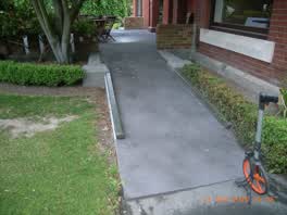 A ramp at Mona Vale, 5 m long · built 2009 3 m off the line
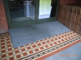 A ramp at Mona Vale, 1 m long · built 2009 6 m off the line
- A jetty 6 m off the line
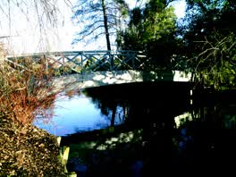 A footbridge at Mona Vale, 13.2 m long · built 2018 · rated accessible 7 m off the line
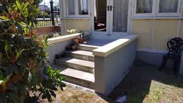 A set of steps at Mona Vale, 4 steps · built 1899 7 m off the line
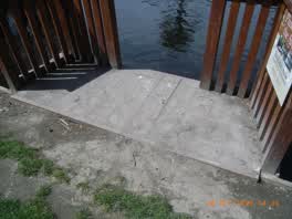 A viewing platform at Mona Vale, built 2009 8 m off the line
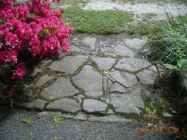 A set of steps at Mona Vale, 2 m long · built 2009 9 m off the line
- A jetty 16 m off the line
The reports along it
1,101 council reports pinned within 150 m of the line, most often Roads & footpaths and Graffiti & vandalism, 884 with a photograph. A pin is where a reporter stood, not a claim about the place itself.
 Pavement - Damaged
 Graffiti on a fence, building or structure
 Animal - Deceased
 Graffiti on a traffic light pole or cabinet, or wa
 Facility - General Request
 Pavement - Damaged
 Damaged Street Light
 Damaged Street Light
 Sediment - Construction
 Dumped Rubbish
 Pothole
 Pest / Vermin
Questions, answered briefly
The oldest ground the roll holds, Riccarton Bush’s remnant kahikatea, and the big houses the early families built along the river flat: Riccarton House, Deans Cottage, Mona Vale. 6 listed places, 4.0 km as the line runs, Riccarton & Fendalton.
Former dwelling and setting, Riccarton (16 Kahu Road) to Mona Vale Gatehouse and Setting (65 Fendalton Road), the order is a suggestion, not the only way round.
Every one, each pin is a row in the district plan’s heritage schedule, and each opens the place’s own sourced record here.
4.0 km measured straight between the pins, the streets run longer, and the stops deserve a pause each.
The record behind this
Every stop is a row in the district plan’s heritage schedule, held here as the register’s own layer. The order and the notes are ours, the listings are the council’s and Heritage New Zealand’s. "Setting" is the register’s word for the ground a listing covers.
The rest of the register here: Fendalton · Ilam
The same ground today: Riccarton · Fendalton
This page as markdown: /walks/riccarton-bush.md · the route as data: /walks/riccarton-bush.geojson · on the live map: the walks layer.