29 Asheridge Place, Wigram
43 reports on record since March 2021 · 33 with photographs. The most-reported address on Asheridge Place. Indicative rating valuation and school zones, hazards, bin day and what stood here before.
What gets reported here
Photographed here 33 on record




Reported here
 Overgrown Vegetation —
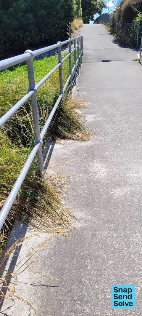
 bike trail blind intersection due to overgrown vegetation. main bike path has limited line of sight as the trail on both ends drops down t
 Overgrown Vegetation —
 They stopped mowing in photo #1.They don't bother mowing along the side of the walkway. Why? There is no visible boundary. It's a disgrace.
 Damaged Street Sign —
 graffiti
 Graffiti on a road, footpath or bridge —
 graffiti under motorway bridge
 Overgrown Vegetation —
 Safety concerns around blind intersection of motorway bike path and the path under the motorway Heathcote bridge. No visibility when enterin
 Graffiti on a fence, building or structure —
 Motorway Underpass between broken Run reserve and Aidenfield
 Overgrown Vegetation —
 Please cut back the shrubs etc behind the fence (council land) to give visibility to cyclists and pedestrians giving way coming out if tunne
 Graffiti somewhere else —
 Motor way under pass. Between broken run reserve and Aidenfield
 Overgrown Vegetation —
 The bridge along the southern motorway has overgrown flax a trip hazard for both foot passengers and cyclists
 Graffiti somewhere else —
 Underpass between broken run reserve and Aidenfield on brick wall
 Facility - General Request —
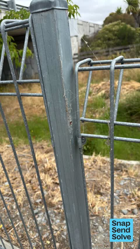
 Fence broken. Needs brackets to secure. By motorway underpass. Broken Run reserve and Aidenfield underpass
 Graffiti on a road, footpath or bridge —
 Graffiti on underpass on Christchurch Southern Motorway. The path that goes under where Heathcote river is. Goes between Broken Run subdivis
 Graffiti on a road, footpath or bridge —
  Graffiti somewhere else —
 Underpass. Between Broken run reserve and Aidenfield
 Graffiti somewhere else —
 Graffiti appears to have been attempted to cover. And unfortunately unsuccessful Broken run reserve underpass
 Graffiti on a road, footpath or bridge —
  Graffiti somewhere else —
 On underpass between broken run and Aidenfield
 Graffiti somewhere else —
 Graffiti on broken run reserve underpass Southern Motorway. Both sides and under bridge.
 Graffiti on a road, footpath or bridge —
 There is graffiti under the bridge and at both ends where the walk way goes under the bridge on the southern motorway over the hearhcote Riv
 Graffiti on a road, footpath or bridge —
  Accessibility —
 This intersection of shared use pathways is a significant hazard due to the downhill slope approaching it from two directions, and the very
 Dumped Rubbish —
 Polystyrene dumped under bridge
- Park - General Request —
- Street Light Outage —
- Graffiti —
- Graffiti —
- Graffiti —
- Overgrown Vegetation —
- Graffiti —
- Graffiti —
- Graffiti —
- Flooding —
 Litter —
 Glass
 Street Light Outage —
 Under bridge lamps have failed again (x2)
 Graffiti —
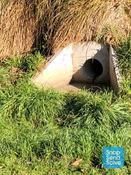
 Close to Aidenfield/ Broken Run underpass . Broken run reserve
 Graffiti —
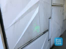
 Aidenfield/ Broken Run underpass
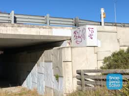 Graffiti —
 Aidenfield/ broken Run. Underpass
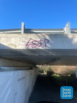 Graffiti —
 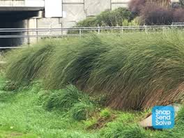 Graffiti —
 Next to cycle way by Aidenfield motor way underpass. Broken run reserve
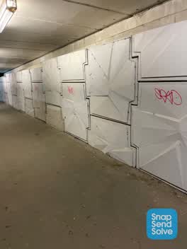 Graffiti —
 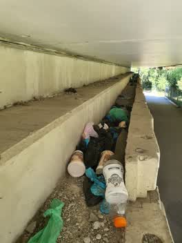 Rubbish/Recycling —
 Rubbish and what looks like bags of dog poo have been up here for a long time, lovely walk way under the motorway but covered in trash
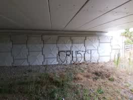 Graffiti —
 under bridge on the southern motorway
Parks —
Also reported on Asheridge Place
- 23 Asheridge Place — 13 reports
- 22 Asheridge Place — 3 reports
- 16 Asheridge Place — 3 reports
- 3 Asheridge Place — 2 reports
- 2 Asheridge Place — 2 reports
- 7 Asheridge Place — 1 report
- 27 Asheridge Place — 1 report
- 25 Asheridge Place — 1 report
The green nearby
- Broken Run Reserve — 26 m to the edge · 3 ha
- Nash Reserve — 45 m to the edge · 9 ha
- Somerville Corridor Reserve — 51 m to the edge
- Wigram Road Landscape Reserve — 204 m to the edge
- Somerville Reserve — 235 m to the edge
Parks within half a kilometre, measured to the boundary — the council’s open data.
The civic shelf nearby
- Mt Magdala Cemetery — 486 m away · Cemetery
Libraries, halls and the rest within half a kilometre — the council’s open data.
The bus nearby
- Aidenfield (near McMahon Dr) — 448 m away · route 60
The closest Metro stops, within four hundred and fifty metres.
The tracks through here
- Walk and bike track through Wigram — 425 m to the line · walk · bike
Tracks whose line passes within half a kilometre, measured to the line itself — the council’s open data.
The named ground
Named water within 500 m of this address, measured to the line or the edge; Named places within 1.5 km of this address; the council’s own structure register — bridges, boardwalks and steps standing nearby — the open map’s record.
Renting nearby
new bonds in Wigram ran about $697 a week — $147 above the city median of $550 — the suburb page keeps the rent record →.
The civic layer
This ground votes in Halswell ward — the Halswell-Hornby-Riccarton community board. Ward lines don’t always follow suburb lines; this one is measured at the pin, not the suburb’s centre.
What stood on this ground → · On the map → · From the air — the Crown’s aerials back to 1936; search the address on RetroLens →
Questions, answered briefly
43 council reports on record since March 2021 — most often graffiti (13), overgrown vegetation (6), graffiti somewhere else (6).
Wigram, Christchurch — on Asheridge Place.
Nothing on the heritage register at this exact spot — the record around this ground →
Broken Run Reserve — 26 m to its edge, 3 ha.