1 Clarendon Terrace, Woolston
40 reports on record since December 2018 · 34 with photographs. The street’s heaviest record is 91A Clarendon Terrace — 101 reports on file. Indicative rating valuation and school zones, hazards, bin day and what stood here before.
What gets reported here
Photographed here 34 on record



Reported here
 Graffiti on a road, footpath or bridge —
 graffiti on bridge
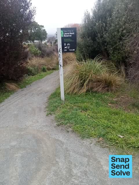
 Graffiti on a playground or in a park —
 graffiti on reserve sign
 Damaged Street Sign —
 Street sign is hanging down
 Damaged Street Sign —
 Dumped road sign
 Pavement - General —
 Storm has blocked the whole walking path outside 1 Clarendon Terrace and jas blocked me being able to leave my front gate
 Graffiti on a road, footpath or bridge —
 graffiti on east side of bridge near grass facing towards river
 Graffiti on a road, footpath or bridge —
 graffiti on bridge
 Graffiti on a fence, building or structure —
 graffiti on light lamp post pole
 Graffiti on a fence, building or structure —
 graffiti on steel railing
 Graffiti on a road, footpath or bridge —
 tagging on the Radley St bridge on the east side
 Graffiti on a road, footpath or bridge —
 Offensive Graffiti on bridge
 Damaged Street Light —
 The new lamp hasn’t worked since the big rain.
 Dumped Rubbish —
  Dumped Rubbish —
 Large pile of rubbish, mattresses and tyres
 Hazard — vehicle —
 Have reported this several times. Getting annoyed watching people have to walk around this car
 Litter —
 A lime scooter and 3 road cones and a shopping tolley have been dumped over the radley street bridge into the water
 Litter —
 a shopping trolley has been dumped in the river beside the bridge
 Dumped Rubbish —
  Litter —
 A tyre that was almost in the river
 Graffiti on a sign, mural or public art —
  Dumped Rubbish —
 Dumped board
 Dumped Rubbish —
 Sheet hardboard
 Dumped Rubbish —
 - Damaged Street Light —
- Accessibility —
- Dumped Rubbish —
- Dumped Rubbish —
- Pavement - General —
 Graffiti —
 - Graffiti —
On the Bridge
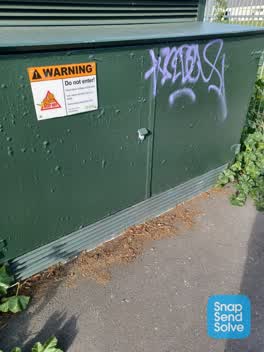 Graffiti —
 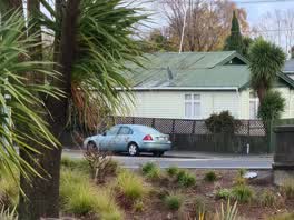 Roading/Streets —
 vehicle parked facing the wrong way corner of Radley st and Clarendon Terrace
Rubbish/Recycling —
supermarket trolley of rubbish north east corner of Radley & Clarendon
Graffiti —
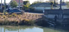 Parking - Illegal —
 the moron is whitebating !!
Parks —
the riverbank is STILL overgrown and untidy. The opposite bank has been tidied up.
Graffiti —
multiple tags on bridge over river on Radley street. graffiti visible from pedistrian side on Clarendon tce, kinda underneath by river bank
Graffiti —
Cnr Radley Clarendon
Graffiti —
Graffiti —
6 radley
Also reported on Clarendon Terrace
- 91A Clarendon Terrace — 101 reports
- 141 Clarendon Terrace — 70 reports
- 115 Clarendon Terrace — 23 reports
- 91 Clarendon Terrace — 17 reports
- 153 Clarendon Terrace — 17 reports
- 93 Clarendon Terrace — 16 reports
- 53 Clarendon Terrace — 14 reports
- 25 Clarendon Terrace — 11 reports
The street’s crash record
NZTA’s record names Clarendon Terrace in 6 crashes that hurt somebody since 2006 — 3 seriously hurt, nobody killed.
The green nearby
- Christchurch Quay Reserve — 13 m to the edge · 1 ha
- Connal Reserve — 37 m to the edge · 1 ha
- Woolston Park — 231 m to the edge · Sports ground · 5 ha
- Laura Kent Reserve — 236 m to the edge
- Thistledown Reserve — 362 m to the edge
Parks within half a kilometre, measured to the boundary — the council’s open data.
On the doorstep
- Arcadia Motel — 87 m away · Motels
- Waitomo Woolston — 104 m away · Petrol stations
- A-one Food Mart — 114 m away · Dairies & convenience
- McDonald's — 196 m away · Fast food
Businesses within four hundred metres, measured at the pin — OpenStreetMap and the council directories.
The bus nearby
The closest Metro stops, within four hundred and fifty metres.
The tracks through here
- Walk and bike track through Woolston — 10 m to the line · walk · bike
- Walk and bike track through Woolston — 39 m to the line · walk · bike
- Walk and bike track through Woolston — 60 m to the line · walk · bike
- Walk and bike track through Woolston — 146 m to the line · walk · bike
- Walk and bike track through Woolston — 299 m to the line · walk · bike
Tracks whose line passes within half a kilometre, measured to the line itself — the council’s open data.
The named ground
Named water within 500 m of this address, measured to the line or the edge; the council’s own structure register — bridges, boardwalks and steps standing nearby — the open map’s record.
The remembered names nearby
- Christchurch Quay Est — 115 m away ·
CHRISTCHURCH QUAY EST. 1851
· 2009 - Woolston Proclaimed a Borough July 27th 1893 ‘may IT — 126 m away ·
WOOLSTON PROCLAIMED A BOROUGH JULY 27TH 1893 ‘MAY IT PROSPER’ JOHN RICHARDSON MAYOR
· 2009 - Limestone Landed Here Was … for Use by Tanneries and Brick… — 220 m away ·
Limestone landed here was … for use by tanneries and brick…
· 2009
Inscribed plaques within two hundred and fifty metres — the register’s pins, not surveyed spots. The whole roll is at /plaques.
Renting nearby
new bonds in Woolston ran about $511 a week — $39 below the city median of $550 — the suburb page keeps the rent record →.
What was here — Woolston Borough Monument and Setting
126 m away · located to ±2 m · the place’s own record →
On the register. Nothing researched here yet.
The civic layer
This ground votes in Linwood ward — the Coastal-Burwood-Linwood community board. Ward lines don’t always follow suburb lines; this one is measured at the pin, not the suburb’s centre.
What stood on this ground → · On the map → · From the air — the Crown’s aerials back to 1936; search the address on RetroLens →
Questions, answered briefly
40 council reports on record since December 2018 — most often graffiti (8), dumped rubbish (8), graffiti on a road, footpath or bridge (5).
Woolston, Christchurch — on Clarendon Terrace.
The heritage register names a place at or beside it — Woolston Borough Monument and Setting.
Christchurch Quay Reserve — 13 m to its edge, 1 ha.