St Mark's Anglican Church - Marshland
an Anglican church, Marshland
a church
The record
- The map calls it
- an Anglican church
- Religion
- christian
- Denomination
- Anglican
- Address
- 336 Prestons Road
- Street
- Prestons Road
- Suburb
- Marshland
- Service times
- Su[1,3] 10:00
- Website
- eastchch.church/
- Phone
- +64 3 383 4656
- Heritage
- St Mark's Church and Setting, scheduled in the district plan · its register entry →
In the archive
- Documents naming it on the shelf →
- The record’s own search for it →
- The suburb it stands in →
- The whole roll →
A document a search names is a lead worth reading, not a claim the site makes.
Other places of worship near it 4
The nearest other places of worship by distance, proximity on the map, not a claim of kinship.
The register nearby 1
Heritage-register places within 300 m of the place’s point, proximity, not a claim of place.
The reports nearby
43 council reports pinned within 250 m of the place, most often Roads & footpaths and Rubbish & dumping, 35 with a photograph. A pin is where a reporter stood, not a claim about the place itself.
 Dumped Rubbish
 Pavement - General
 Dumped Rubbish
 Dumped Rubbish
 Poles and Signage - General
 Roads - General
 General Request
 Dumped Rubbish
 Litter
 Overgrown Vegetation
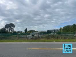 Animal - General
 Pothole
Getting there
The nearest stop the Metro map carries, measured to the pin, not the door.
Questions, answered briefly
336 Prestons Road, Marshland, Christchurch, on the map →.
The map calls it an Anglican church. That is the mapper’s tag, not this site’s own survey.
The map’s service times read: Su[1,3] 10:00, as tagged, worth checking against the congregation’s own page before turning up.
The pin falls inside the district plan’s scheduled item "St Mark's Church and Setting".
Source: OpenStreetMap way/642450913 (ODbL) · the district plan heritage schedule (CC BY 4.0). A directory, not a census of faith: name, religion, denomination and address are the tags OpenStreetMap’s mappers give each place, and a tag the map does not carry stays unstated here rather than guessed from a name. A listing is a lead, not a claim, it says a place of worship is mapped on this ground, not that a congregation meets there this week. Coordinates pin the building as the map draws it.