7 Mandeville Street, Addington
57 reports on record since July 2016 · 31 with photographs. The most-reported address on Mandeville Street. Indicative rating valuation and school zones, hazards, bin day and what stood here before.
What gets reported here
Photographed here 31 on record


Reported here
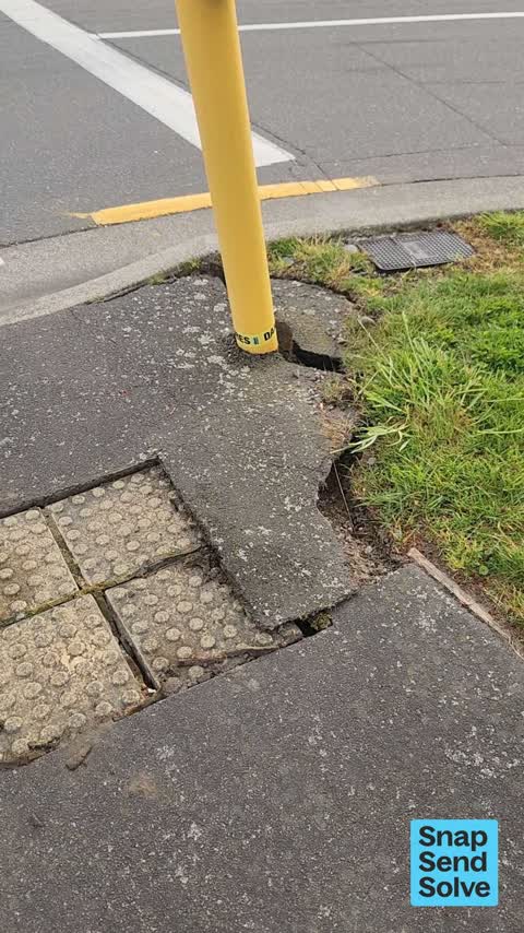
 Pavement - Damaged —
 traffic light looks like its going to fall over and pavement all cracked
- Traffic Signals —
traffic lights not going green for traffic turning from the eastbound lane on Blenheim road onto Mandeville Street to head north. cycle ligh
- Traffic Signals —
when I turn left from Blenheim Road onto Mandeville Street late at night, the light doesn't turn green ever unless a car happens to be comin
 Pavement - Damaged —
 Broken global
 Graffiti on a sign, mural or public art —
 Graffiti on a sign
 Street Cleaning —
 Loads of gravel and debris in the cycle lanes.
 Graffiti on a sign, mural or public art —
 Tagged Tile Direct sign
 Graffiti on a sign, mural or public art —
  Graffiti on a fence, building or structure —
  Graffiti on a traffic light pole or cabinet, or wa —
 Cnr Lowe & Mandeville 2 x traffic light control boxes tagged
- Traffic Signals —
There are two sets of traffic signals heading towards Blenheim road from Mandeville St. Both sets used to go green together, allowing traffi
 Graffiti on a traffic light pole or cabinet, or wa —
  Graffiti on a fence, building or structure —
  Graffiti on a fence, building or structure —
  Graffiti on a fence, building or structure —
  Graffiti somewhere else —
  Graffiti on a cabinet, pole or railway asset —
 Graffiti on cabinet
 Graffiti somewhere else —
 Two separate urilitu boxes KP also tags as Kae Pae are consistent and prolific in lots of Christchurch.
 Graffiti somewhere else —
  Graffiti somewhere else —
  Graffiti on a cabinet, pole or railway asset —
  Graffiti on a cabinet, pole or railway asset —
  Graffiti on a cabinet, pole or railway asset —
  Graffiti somewhere else —
 Graffiti on two blue traffic control cabinets on this corner
 General Request —
 Can you please relook at the traffic light phasing for the cycleway here? I use this intersection often and am usually left waiting too long
 Street Gutters / Storm Water —
 Storwater sump lid gone, hazard for bikes and cars
 Poles and Signage - General —
 Broken barrier
- Poles and Signage - General —
- Graffiti —
- Graffiti —
- Graffiti —
- Graffiti —
- Graffiti —
- General Request —
- Overgrown Vegetation —
- Graffiti —
- Graffiti —
- Graffiti —
- Roads - General —
- Abandoned Vehicle —
- Poles and Signage - General —
- Water Leak —
- Pavement - General —
- Damaged Street Sign —
- Accessibility —
- Graffiti —
- Road Signage —
- Pavement - General —
- Graffiti —
- Graffiti —
Green spray paint tag on galvanised steel pole. No photo sorry. Located just before the free turn into Foster St from Bleinheim Road when a
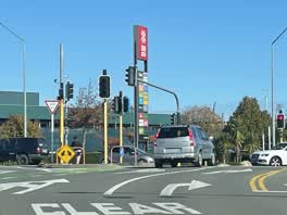 Roading/Streets —
 Red light not working
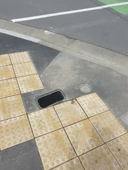 Water Leak —
 Still leaking water reported before Christmas but still leaking and lid has fallen through - trip hazard!
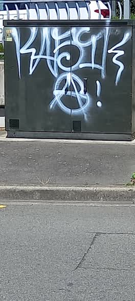 Graffiti —
 Lowe St - Graffiti on utility box, backing onto Blenheim Rd, near Mandeville/Foster intersection
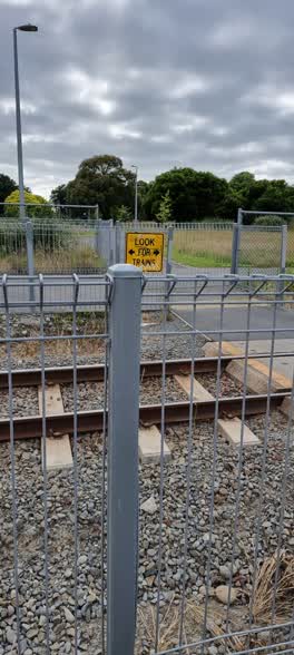 Graffiti —
 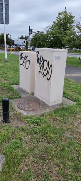 Graffiti —
 Two weeks it's been there I guess
Graffiti —
71 Mandeville street
Graffiti —
Also reported on Mandeville Street
- 2 Mandeville Street — 2 reports
- 7A Mandeville Street — 1 report
The street’s crash record
NZTA’s record names Mandeville Street in 13 crashes that hurt somebody since 2006 — 1 seriously hurt, nobody killed.
The green nearby
- Christchurch Railway Station Reserve — 285 m to the edge · Botanic
- Hagley Park South — 428 m to the edge · Sports ground · 71 ha
Parks within half a kilometre, measured to the boundary — the council’s open data.
On the doorstep
- Plumb'In Bathroom & Kitchen Factory Shop — 50 m away · Clothing
- Kitchen Express — 63 m away · Kitchen
- Macpac — 74 m away · Outdoor gear
- Evo Cycles — 75 m away · Bike shops
Businesses within four hundred metres, measured at the pin — OpenStreetMap and the council directories.
The bus nearby
The closest Metro stops, within four hundred and fifty metres.
The tracks through here
- Walk and bike track through Addington — 5 m to the line · walk · bike
- Walk and bike track through Addington — 50 m to the line · walk · bike
- Walk and bike track through Addington — 211 m to the line · walk · bike
- Walk and bike track through Addington — 222 m to the line · walk · bike
- Walk and bike track through Addington — 229 m to the line · walk · bike
Tracks whose line passes within half a kilometre, measured to the line itself — the council’s open data.
The named ground
Named water within 500 m of this address, measured to the line or the edge; Named places within 1.5 km of this address — the open map’s record.
Renting nearby
new bonds in Addington ran about $502 a week — $48 below the city median of $550 — the suburb page keeps the rent record →.
What was here — Former Dwelling and Setting
127 m away · 23 Mandeville Street · located to ±8 m · the place’s own record →
On the register. Nothing researched here yet.
The civic layer
This ground votes in Riccarton ward — the Halswell-Hornby-Riccarton community board. Ward lines don’t always follow suburb lines; this one is measured at the pin, not the suburb’s centre.
What stood on this ground → · On the map → · From the air — the Crown’s aerials back to 1936; search the address on RetroLens →
Questions, answered briefly
57 council reports on record since July 2016 — most often graffiti (16), graffiti somewhere else (5), graffiti on a fence, building or structure (4).
Addington, Christchurch — on Mandeville Street.
The heritage register names a place at or beside it — Former Dwelling and Setting.
Christchurch Railway Station Reserve — 285 m to its edge.