259 Beach Road, Akaroa
11 reports on record since July 2019 · 3 with photographs. The street’s heaviest record is 49 Beach Road — 28 reports on file. Indicative rating valuation and school zones, hazards, bin day and what stood here before.
What gets reported here
Photographed here 3 on record


Reported here
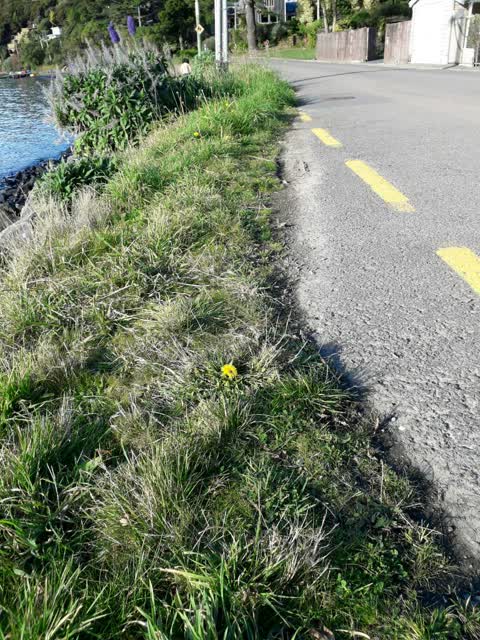
 Overgrown Vegetation —
 Overgrown weeds encroaching on parking area and trapping rubbish
 Rubbish and Bins - General —
 Green bin lid hinge is broken Bin no. 289358 257 Beach Road, Akaroa
- Street Light Outage —
- Roads - General —
- General Request —
- Rubbish and Bins - General —
- Rubbish and Bins - General —
- Water General —
- Rubbish and Bins - General —
- Water Leak —
Roading/Streets —
This road verge needs attention, is it under a contract
Also reported on Beach Road
- 49 Beach Road — 28 reports
- 83 Beach Road — 10 reports
- 82 Beach Road — 9 reports
- 221 Beach Road — 8 reports
- 273 Beach Road — 7 reports
- 11–49 Beach Road — 7 reports
- 77/87 Beach Road — 6 reports
- 75 Beach Road — 6 reports
The street’s crash record
NZTA’s record names Beach Road in 3 crashes that hurt somebody since 2006 — 3 seriously hurt, nobody killed.
The green nearby
- Green Point Park — 83 m to the edge · 4 ha
- Britomart Memorial — 89 m to the edge · Botanic
- Beach Road Park — 262 m to the edge
- Takapuneke Reserve — 303 m to the edge · Regional · 10 ha
- Clare Reserve — 368 m to the edge
Parks within half a kilometre, measured to the boundary — the council’s open data.
The named ground
Named places within 1.5 km of this address; the council’s own structure register — bridges, boardwalks and steps standing nearby — the open map’s record.
The remembered names nearby
- To Mark 150 Years Since the Landing of Chief Police — 122 m away ·
TO MARK 150 YEARS SINCE THE LANDING OF CHIEF POLICE MAGISTRATE MICHAEL MURPHY AND NEW SOUT
· 2008 - Here on 11 August 1840 Captain Owen Stanley — 122 m away ·
HERE ON 11 AUGUST 1840 CAPTAIN OWEN STANLEY H.M.S. BRITOMART RAISED THE UNION JACK TO DEMO
· 2008 - Britomart Monument plaque — 123 m away ·
(Heavily weathered memorial – majority illegible)
· 2008
Inscribed plaques within two hundred and fifty metres — the register’s pins, not surveyed spots. The whole roll is at /plaques.
The civic layer
This ground votes in Banks Peninsula ward — the Banks Peninsula community board. Ward lines don’t always follow suburb lines; this one is measured at the pin, not the suburb’s centre.
What stood on this ground → · On the map → · From the air — the Crown’s aerials back to 1936; search the address on RetroLens →
Questions, answered briefly
11 council reports on record since July 2019 — most often rubbish and bins - general (4), water leak (1), water general (1).
Akaroa, Christchurch — on Beach Road.
Nothing on the heritage register at this exact spot — the record around this ground →
Green Point Park — 83 m to its edge, 4 ha.