Takapuneke Reserve
Regional · 10 ha
From the air
Where it sits
Its centre falls inside Akaroa, suburb membership is a centroid call, not a claim the whole park lies inside the outline.
The camping bylaw names this ground, Akaroa Prohibited Area: no camping. The zone drawings sit at /rules.
More green in Akaroa
- Misty Peaks Reserve, Regional · 500 ha
- L'aube Hill Reserve · 7 ha
- Stanley Park · 7 ha
- Garden Of Tane, Botanic · 6 ha
- Green Point Park · 4 ha
- Akaroa Recreation Ground, Sports ground · 3 ha
- Akaroa Boat Park · 2 ha
- Takamatua Stream Esplanade Reserve · 1 ha
What’s built on this ground
No playground is on the register here, the asset layers name none for this ground.
Also on the register: 7 seats (4 benches and 3 seats) and 1 drinking fountain (bottle filler).
The register’s commission dates run 2021 to 2025.
The register’s own site tag puts every item on this ground; the pins themselves can drift a few metres.
The reports on this ground
2 reports pinned inside the park's drawn outline, most often Roads & footpaths and Water & drains, 2 with a photograph. A pin is where a reporter stood, not a claim about the whole park.
 Water Leak, 68–326 Onuku Rd, Canterbury, Akaroa 7581, New Zealand · 29 May 2026
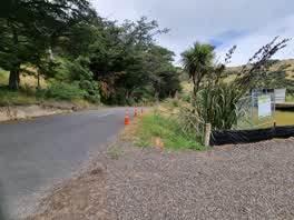 Roading/Streets, 64 Onuku Road, Canterbury 7520, New Zealand · 12 January 2022
Environment Canterbury / Canterbury Maps, Parks layer · refreshed 10 October 2026.
What stood on this ground before → · On the map →
Questions, answered briefly
10 hectares by the layer’s own polygon.
Its centre falls inside Akaroa, a centroid call, not a claim the whole park lies inside the outline.
Regional.
Environment Canterbury’s open Parks layer, kind, size and suburb read straight from it.