61 Woodills Road
4 council reports since December 2025, 4 carrying a photograph. The street’s heaviest record is 1 Woodills Road, 7 reports on file.
The green nearby
- Wackerle Green, 234 m to the edge
- L'aube Hill Reserve, 332 m to the edge · 7 ha
- Jubilee Park, 355 m to the edge · Botanic
- Akaroa Recreation Ground, 366 m to the edge · Sports ground · 3 ha
- Akaroa Boat Park, 423 m to the edge · 2 ha
Parks within half a kilometre, measured to the boundary, the council’s open data. The whole roll is at /parks.
On the doorstep
- Beaufort House, 276 m away · B&Bs
- La Rive Motel, 303 m away · Motels
- The Grand Hotel, 347 m away · Bars & pubs
- Akaroa Top 10 Holiday Park, 349 m away · Campgrounds
Businesses within four hundred metres, measured at the pin, OpenStreetMap and the council directories.
The named ground
Named water within 500 m of this address, measured to the line or the edge; Named places within 1.5 km of this address; the council’s own structure register, bridges, boardwalks and steps standing nearby, the open map’s record.
What gets reported here
Photographed here 4 on record

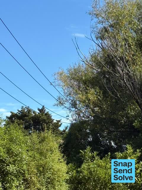


What’s on record
 Overgrown Vegetation, 25 Mar 2026
 This steep part of Woodills road has 2 blind corners due to overgrown foliage one at the bottom and one at the hairpin bend at the top. Ther
 Overgrown Vegetation, 12 Mar 2026
 Tree in council road verge growing up into LV power lines, as this is council land it is their responsibility to ensure the trees and pruned
 Overgrown Vegetation, 6 Dec 2025
 This is a dangerous corner on Woodills Road Akaroa . The road is narrow and steep with a tight bend . The visibility coming up or down to th
 Overgrown Vegetation, 2 Dec 2025
 I’m a resident in Felthams Road Vegetation growing across bends in the road making Turning corners hazardous from the bottom of Woodhillls
Elsewhere on Woodills Road
- 1 Woodills Road, 7 reports
- 59 Woodills Road, 4 reports
- 9 Woodills Road, 3 reports
- 80 Woodills Road, 3 reports
- 34A Woodills Road, 3 reports
- 63 Woodills Road, 2 reports
- 45 Woodills Road, 2 reports
- 41 Woodills Road, 2 reports
The civic layer
This ground votes in Banks Peninsula ward, the Banks Peninsula community board is its local layer. Ward lines don’t always follow suburb lines; this one is measured at the pin, not the suburb’s centre. The whole roll is at /wards.
Woodills Road, the whole record → · Everything about Akaroa → · What stood on this ground → · On the map → · From the air, RetroLens holds the Crown’s aerials back to 1936; search the address there →
Questions, answered briefly
4 council reports on record since December 2025, most often overgrown vegetation (4).
Akaroa, Christchurch, on Woodills Road.
Nothing on the heritage register at this exact spot, the record around this ground →
Wackerle Green, 234 m to its edge.