6692 Christchurch Akaroa Road
1 council report since August 2021, 1 carrying a photograph. The street’s heaviest record is 6892 Christchurch Akaroa Road, 7 reports on file.
The green nearby
- Takamatua Stream Esplanade Reserve, 81 m to the edge · 1 ha
- Takamatua Domain, 91 m to the edge
- Takamatua Foreshore, 164 m to the edge
- Takamatua Reserve, 170 m to the edge
Parks within half a kilometre, measured to the boundary, the council’s open data. The whole roll is at /parks.
The civic shelf nearby
- Takamatua Collection Point, 443 m away · Transfer station
Libraries, halls and the rest within half a kilometre, the council’s open data.
The named ground
Named water within 500 m of this address, measured to the line or the edge; Named places within 1.5 km of this address, the open map’s record.
The remembered names nearby
- Roll of Honour Armstrong Armstrong Armstrong Curry Hammond, 203 m away ·
ROLL OF HONOUR ARMSTRONG ARMSTRONG ARMSTRONG CURRY HAMMOND HAMMOND HAMMOND HAMMOND HIGGINS
· 2008 - Takamatua War Memorial 1939 - 1945 in Memory a Kingston, 206 m away ·
TAKAMATUA WAR MEMORIAL 1939 - 1945 IN MEMORY A KINGSTON
· 2008
Inscribed plaques within two hundred and fifty metres, the register’s pins, not surveyed spots. The whole roll is at /plaques.
What gets reported here
- Flooding, 1
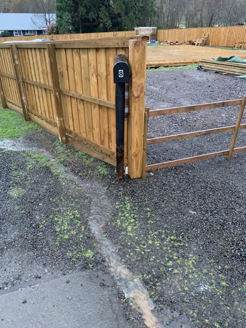
Photographed here 1 on record
What’s on record
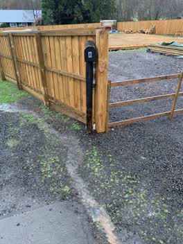 Flooding, 3 Aug 2021
Water runs off Takamatua Bay Road down our drive at number 8. Couldn’t get this to verify to number 8
Elsewhere on Christchurch Akaroa Road
- 6892 Christchurch Akaroa Road, 7 reports
- 6920 Christchurch Akaroa Road, 4 reports
- 6461 Christchurch Akaroa Road, 3 reports
- 6528 Christchurch Akaroa Road, 2 reports
- 6490 Christchurch Akaroa Road, 2 reports
- 688 Christchurch Akaroa Road, 1 report
- 6676 Christchurch Akaroa Road, 1 report
- 6352 Christchurch-Akaroa Road, 1 report
The street’s crash record
NZTA’s record names Christchurch Akaroa Road in 5 crashes that hurt somebody since 2006, 1 person killed, 0 seriously hurt.
The civic layer
This ground votes in Banks Peninsula ward, the Banks Peninsula community board is its local layer. Ward lines don’t always follow suburb lines; this one is measured at the pin, not the suburb’s centre. The whole roll is at /wards.
Christchurch Akaroa Road, the whole record → · Everything about Akaroa → · What stood on this ground → · On the map → · From the air, RetroLens holds the Crown’s aerials back to 1936; search the address there →
Questions, answered briefly
1 council report on record since August 2021, most often flooding (1).
Akaroa, Christchurch, on Christchurch Akaroa Road.
Nothing on the heritage register at this exact spot, the record around this ground →
Takamatua Stream Esplanade Reserve, 81 m to its edge, 1 ha.