6892 Christchurch Akaroa Road
7 council reports since January 2022, 3 carrying a photograph. The most-reported address on Christchurch Akaroa Road.
The green nearby
- Jubilee Park, 271 m to the edge · Botanic
- Akaroa Boat Park, 316 m to the edge · 2 ha
- Akaroa Recreation Ground, 395 m to the edge · Sports ground · 3 ha
Parks within half a kilometre, measured to the boundary, the council’s open data. The whole roll is at /parks.
The civic shelf nearby
- Akaroa Service Centre, 466 m away · Service centre
Libraries, halls and the rest within half a kilometre, the council’s open data.
On the doorstep
- The Children's Bay Woolshed, 93 m away · Guest houses
- Boat Wash, 372 m away · Car washes
- Self-contained only, 394 m away · Campgrounds
Businesses within four hundred metres, measured at the pin, OpenStreetMap and the council directories.
The named ground
Named water within 500 m of this address, measured to the line or the edge; Named places within 1.5 km of this address, the open map’s record.
What gets reported here
Photographed here 3 on record


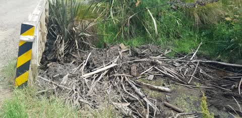
What’s on record
 Road Signage, 20 Feb 2026
 Hi, a slip is partly blocking Childrens Bay Road, Akaroa. Thank you.
- Water Pollution - Sediment, 1 Oct 2023
- Fallen Tree, 28 Sept 2023
- Water Pollution - Sediment, 30 Aug 2023
- Water Pollution - Sediment, 28 Jun 2023
 Road Blockage, 30 Jul 2022
 Risk of further slippage and blocking the road
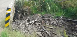 Water Supply, 2 Jan 2022
 The bridge at children's bay akaroa has massive amount of slash and wood blocking the stream
Elsewhere on Christchurch Akaroa Road
- 6920 Christchurch Akaroa Road, 4 reports
- 6461 Christchurch Akaroa Road, 3 reports
- 6528 Christchurch Akaroa Road, 2 reports
- 6490 Christchurch Akaroa Road, 2 reports
- 688 Christchurch Akaroa Road, 1 report
- 6692 Christchurch Akaroa Road, 1 report
- 6676 Christchurch Akaroa Road, 1 report
- 6352 Christchurch-Akaroa Road, 1 report
The street’s crash record
NZTA’s record names Christchurch Akaroa Road in 5 crashes that hurt somebody since 2006, 1 person killed, 0 seriously hurt.
The civic layer
This ground votes in Banks Peninsula ward, the Banks Peninsula community board is its local layer. Ward lines don’t always follow suburb lines; this one is measured at the pin, not the suburb’s centre. The whole roll is at /wards.
Christchurch Akaroa Road, the whole record → · Everything about Akaroa → · What stood on this ground → · On the map → · From the air, RetroLens holds the Crown’s aerials back to 1936; search the address there →
Questions, answered briefly
7 council reports on record since January 2022, most often water pollution - sediment (3), water supply (1), road signage (1).
Akaroa, Christchurch, on Christchurch Akaroa Road.
Nothing on the heritage register at this exact spot, the record around this ground →
Jubilee Park, 271 m to its edge.