88 Withells Road, Avonhead
13 reports on record since December 2019 · 8 with photographs. The most-reported address on Withells Road. Indicative rating valuation and school zones, hazards, bin day and what stood here before.
What gets reported here
- Damaged Street Sign — 5
- Roading/Streets — 3
- Pothole — 2
- Overgrown Vegetation — 1
- General Request — 1
- Damaged Road — 1
Photographed here 8 on record


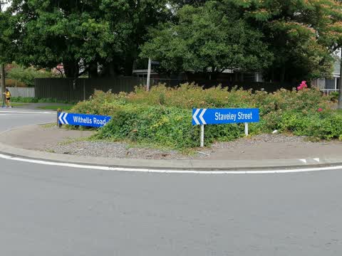
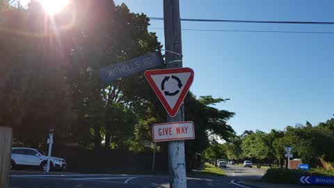
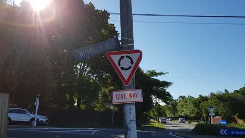
Reported here
 Damaged Street Sign —
 There is (no longer) a sign for Staveley St at its intersection of Withells Rd - only one for Woodbury. There are a number of signs in the s
- Overgrown Vegetation —
Overgrown plants on the roundabout
 Damaged Street Sign —
 Missing road signs on Staveley Street, Woodbury, Withells roundabout
 Damaged Street Sign —
 Missing Staveley Street street sign
 Damaged Street Sign —
  Damaged Street Sign —
 knocked over street sign in round a bout
- General Request —
- Damaged Road —
- Pothole —
- Pothole —
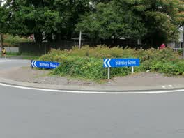 Roading/Streets —
 This roundabout is in need of attention. It is an absolute eye sore and has been for a while. Thank you.
Roading/Streets —
IMPORTANT. To whom it may concern. I dont know what is going on at Council but I reported an unsafe street sign back on the 12 December 20
Roading/Streets —
The Withells Road street sign at the intersection of Staveley Street on the southeast corner is only being held by a single wire support. r
Also reported on Withells Road
- 95 Withells Road — 12 reports
- 91 Withells Road — 12 reports
- 389 Withells Road — 9 reports
- 174 Withells Road — 8 reports
- 393 Withells Road — 7 reports
- 179 Withells Road — 7 reports
- 176 Withells Road — 7 reports
- 183 Withells Road — 6 reports
The street’s crash record
NZTA’s record names Withells Road in 78 crashes that hurt somebody since 2006 — 20 seriously hurt, nobody killed.
The green nearby
- Crosbie Park — 71 m to the edge · Sports ground · 7 ha
- Stewarts Bush — 324 m to the edge
- Staveley Reserve — 378 m to the edge · 1 ha
- Toorak Reserve — 458 m to the edge
- Harkness Reserve — 477 m to the edge
Parks within half a kilometre, measured to the boundary — the council’s open data.
On the doorstep
- Staverly Fish Supply & Hamburger Bar — 66 m away · Fast food
- Dahawi Bakery — 76 m away · Business
- The Sushi House — 77 m away · Fast food
- Staveley Street Dairy — 82 m away · Dairies & convenience
Businesses within four hundred metres, measured at the pin — OpenStreetMap and the council directories.
The bus nearby
The closest Metro stops, within four hundred and fifty metres.
The named ground
Named water within 500 m of this address, measured to the line or the edge; the council’s own structure register — bridges, boardwalks and steps standing nearby — the open map’s record.
Renting nearby
new bonds in Avonhead ran about $596 a week — $46 above the city median of $550 — the suburb page keeps the rent record →.
The civic layer
This ground votes in Waimairi ward — the Fendalton-Waimairi-Harewood community board. Ward lines don’t always follow suburb lines; this one is measured at the pin, not the suburb’s centre.
What stood on this ground → · On the map → · From the air — the Crown’s aerials back to 1936; search the address on RetroLens →
Questions, answered briefly
13 council reports on record since December 2019 — most often damaged street sign (5), roading/streets (3), pothole (2).
Avonhead, Christchurch — on Withells Road.
Nothing on the heritage register at this exact spot — the record around this ground →
Crosbie Park — 71 m to its edge, 7 ha.