95 Withells Road, Avonhead
12 reports on record since May 2021 · 7 with photographs. The street’s heaviest record is 88 Withells Road — 13 reports on file. Indicative rating valuation and school zones, hazards, bin day and what stood here before.
What gets reported here
Photographed here 7 on record


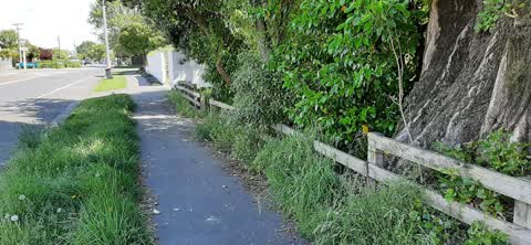
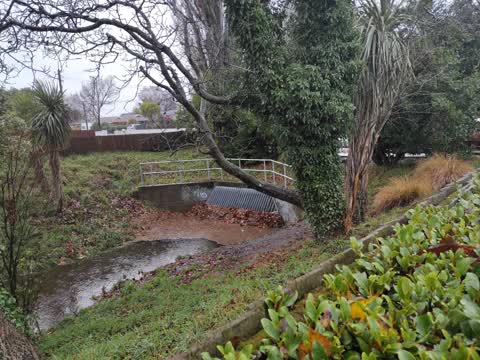
Reported here
 Graffiti on a road, footpath or bridge —
 graffiti on the concrete around the stream
 Street Gutters / Storm Water —
 gully pipe under road is blocked with debris, causing flooding to our property.
 Sewer - Leak / Blockage —
 Avon river waterway, grate blocked
 Graffiti on a fence, building or structure —
 Graffiti on park/property fence. Was a hotspot for graffiti till it was cleaned a year ago, this is the first tag since.
 Hazard — vehicle —
 This camper van has been parked out here for over a week. It has been making it very difficult to get out of the driveway as they also perio
- Street Gutters / Storm Water —
- Abandoned Vehicle —
- Water Leak —
- Water Leak —
- Water Leak —
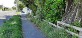 Roading/Streets —
 Berm outside Crosbie Park hasn't been mowed for several weeks and is now up to my knees. Very untidy for outside a council park
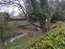 Wastewater/Stormwater —
 drain blocked by leaves again. needs to be cleared asap
Also reported on Withells Road
- 88 Withells Road — 13 reports
- 91 Withells Road — 12 reports
- 389 Withells Road — 9 reports
- 174 Withells Road — 8 reports
- 393 Withells Road — 7 reports
- 179 Withells Road — 7 reports
- 176 Withells Road — 7 reports
- 183 Withells Road — 6 reports
The street’s crash record
NZTA’s record names Withells Road in 78 crashes that hurt somebody since 2006 — 20 seriously hurt, nobody killed.
The green nearby
- Crosbie Park — 45 m to the edge · Sports ground · 7 ha
- Stewarts Bush — 340 m to the edge
- Staveley Reserve — 402 m to the edge · 1 ha
Parks within half a kilometre, measured to the boundary — the council’s open data.
On the doorstep
- Staverly Fish Supply & Hamburger Bar — 93 m away · Fast food
- The Sushi House — 95 m away · Fast food
- Dahawi Bakery — 103 m away · Business
- Staveley Street Dairy — 105 m away · Dairies & convenience
Businesses within four hundred metres, measured at the pin — OpenStreetMap and the council directories.
The bus nearby
The closest Metro stops, within four hundred and fifty metres.
The named ground
Named water within 500 m of this address, measured to the line or the edge; the council’s own structure register — bridges, boardwalks and steps standing nearby — the open map’s record.
Renting nearby
new bonds in Avonhead ran about $596 a week — $46 above the city median of $550 — the suburb page keeps the rent record →.
The civic layer
This ground votes in Waimairi ward — the Fendalton-Waimairi-Harewood community board. Ward lines don’t always follow suburb lines; this one is measured at the pin, not the suburb’s centre.
What stood on this ground → · On the map → · From the air — the Crown’s aerials back to 1936; search the address on RetroLens →
Questions, answered briefly
12 council reports on record since May 2021 — most often water leak (3), street gutters / storm water (2), wastewater/stormwater (1).
Avonhead, Christchurch — on Withells Road.
Nothing on the heritage register at this exact spot — the record around this ground →
Crosbie Park — 45 m to its edge, 7 ha.