101 Fisher Avenue, Beckenham
20 reports on record since October 2018 · 16 with photographs. The most-reported address on Fisher Avenue. Indicative rating valuation and school zones, hazards, bin day and what stood here before.
What gets reported here
Photographed here 16 on record




Reported here
 Street Gutters / Storm Water —
 The two drains outside 101 Fisher look blocked/full of water even though it has been a few days since the last rain.
 Dumped Rubbish —
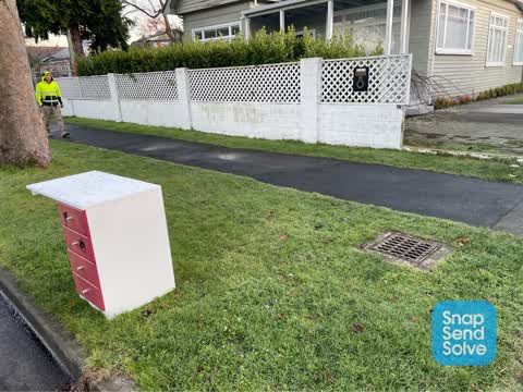
 Dumped rubbish, often in the same spot.
 Dumped Rubbish —
  Street Gutters / Storm Water —
 Blocked drain.
 Street Gutters / Storm Water —
 Kia ora Team, it looks like this drain is pretty full of leaves and debris causing the water to overflow.
 Dumped Rubbish —
 Kia ora, it seems like someone has dumped some rubbish (squares of old carpet) on the berm outside 58 Norwood. Let me know if you need any m
 Pavement - Damaged —
 There are exposed holes on Norwood st where someone has removed the metal covers… looks like some have been stashed by a tree on fisher aven
 Damaged Road —
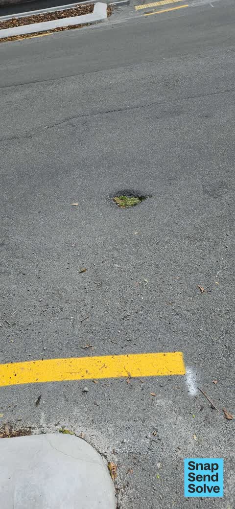
 Hole in the road growing grass
 Dumped Rubbish —
 Broken bike dumped at corner of Norwood St and Fisher Avenue (Christchurch).
 Poles and Signage - General —
 X 2 signs corner of Fisher ave and Tennyson st bent over/not straight
 Hazard — vehicle —
 Abandoned car with no plates, 12 month + expired rego. Here for at least two days.
- Pothole —
- Water Leak —
- Water Leak —
- Rubbish and Bins - General —
 Rubbish/Recycling —
 Water Supply —
Water Supply —
Water flowing out of fire hydrant in middle of Fisher Ave and Norwood street intersection.
Water Supply —
Leakage
Water Supply —
Water flowing from fire hydrant cover in the middle of Fisher/Norwood intersection
Also reported on Fisher Avenue
- 160 Fisher Avenue — 14 reports
- 147 Fisher Avenue — 11 reports
- 106 Fisher Avenue — 10 reports
- 104 Fisher Avenue — 10 reports
- 143 Fisher Avenue — 9 reports
- 38 Fisher Avenue — 8 reports
- 123 Fisher Avenue — 7 reports
- 97 Fisher Avenue — 6 reports
The street’s crash record
NZTA’s record names Fisher Avenue in 8 crashes that hurt somebody since 2006 — 3 seriously hurt, nobody killed.
The green nearby
- Beckenham Park — 149 m to the edge · Sports ground · 5 ha
- Waimea Reserve — 215 m to the edge
- Heathcote Riverbank True Left — 312 m to the edge · 4 ha
- Palatine Native Reserve — 342 m to the edge
Parks within half a kilometre, measured to the boundary — the council’s open data.
On the doorstep
- Beckenham Bowling Club — 294 m away · Sports centres
- Southern Districts Cricket Club — 326 m away · Clubs
Businesses within four hundred metres, measured at the pin — OpenStreetMap and the council directories.
The tracks through here
- Walk and bike track through Beckenham — 9 m to the line · walk · bike
- Walk and bike track through Beckenham — 214 m to the line · walk · bike
- Walk and bike track through Beckenham — 307 m to the line · walk · bike
- Walk and bike track through Beckenham — 331 m to the line · walk · bike
- Walk and bike track through Beckenham — 352 m to the line · walk · bike
Tracks whose line passes within half a kilometre, measured to the line itself — the council’s open data.
The named ground
Named water within 500 m of this address, measured to the line or the edge; the council’s own structure register — bridges, boardwalks and steps standing nearby — the open map’s record.
Renting nearby
new bonds in Beckenham ran about $620 a week — $70 above the city median of $550 — the suburb page keeps the rent record →.
The civic layer
This ground votes in Cashmere ward — the Spreydon-Cashmere-Heathcote community board. Ward lines don’t always follow suburb lines; this one is measured at the pin, not the suburb’s centre.
What stood on this ground → · On the map → · From the air — the Crown’s aerials back to 1936; search the address on RetroLens →
Questions, answered briefly
20 council reports on record since October 2018 — most often water supply (4), dumped rubbish (4), street gutters / storm water (3).
Beckenham, Christchurch — on Fisher Avenue.
Nothing on the heritage register at this exact spot — the record around this ground →
Beckenham Park — 149 m to its edge, 5 ha.