160 Fisher Avenue, Beckenham
14 reports on record since October 2019 · 12 with photographs. The street’s heaviest record is 101 Fisher Avenue — 20 reports on file. Indicative rating valuation and school zones, hazards, bin day and what stood here before.
What gets reported here
Photographed here 12 on record




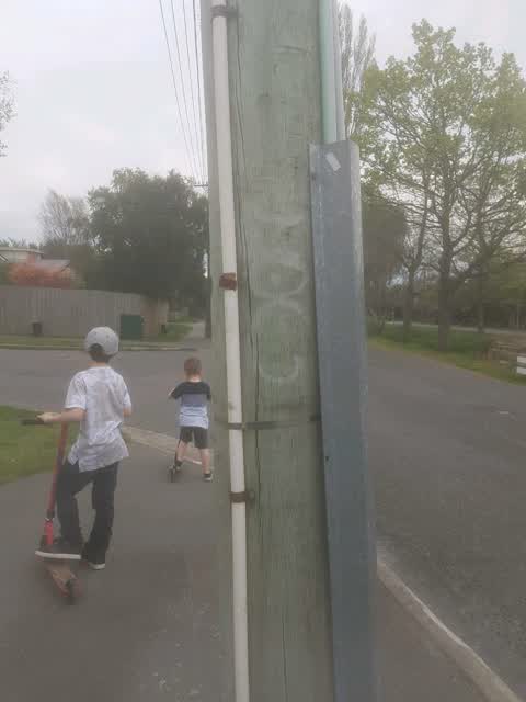
Reported here
 Graffiti on a fence, building or structure —
  Graffiti on a fence, building or structure —
  Street Gutters / Storm Water —
 Smells of sewer. I think the flap on the sewer overflow pipe into the river is not closing
 Water Leak —
 Saturated berm
 Water Leak —
 Another leak only 100m away. Two old style covers by the looks, I'd say they must be past their life span
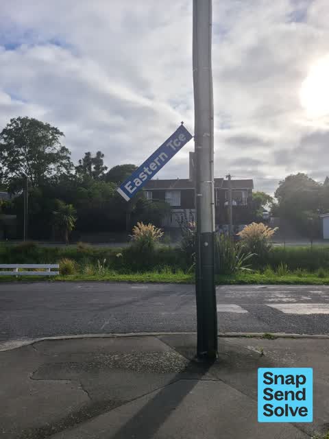
 Damaged Street Sign —
 Broken street sign cnr fisher ave and Eastern tce
- Damaged Street Sign —
- Water Leak —
 Pavement - General —
 Water leak from underneath driveway
 Graffiti —
 Graffiti on road signs at the end of Fisher Ave, on Eastern TCE Beckenham
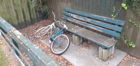
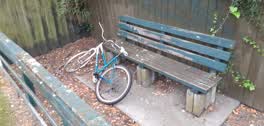 Rubbish/Recycling —
 An un=ridable bike has been dumped on the public seat outside 86 Palatine Tce.
 Graffiti —
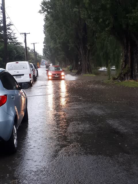
 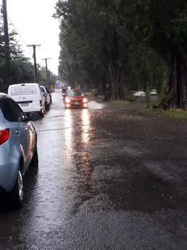 Flooding —
 Eastern Terrace flooding - which is the detour for Tennyson west-travelling traffic (potholing works). Tennyson St looks like it could be op
Graffiti —
Lamppost corner of Fisher and Eastern terrace
Also reported on Fisher Avenue
- 101 Fisher Avenue — 20 reports
- 147 Fisher Avenue — 11 reports
- 106 Fisher Avenue — 10 reports
- 104 Fisher Avenue — 10 reports
- 143 Fisher Avenue — 9 reports
- 38 Fisher Avenue — 8 reports
- 123 Fisher Avenue — 7 reports
- 97 Fisher Avenue — 6 reports
The street’s crash record
NZTA’s record names Fisher Avenue in 8 crashes that hurt somebody since 2006 — 3 seriously hurt, nobody killed.
The green nearby
- Heathcote Riverbank True Left — 18 m to the edge · 4 ha
- Palatine Native Reserve — 34 m to the edge
- Beckenham Park — 105 m to the edge · Sports ground · 5 ha
- St Martins Park — 280 m to the edge · Sports ground · 2 ha
- Waimea Reserve — 462 m to the edge
Parks within half a kilometre, measured to the boundary — the council’s open data.
On the doorstep
- Southern Districts Cricket Club — 210 m away · Clubs
- Saint Martins Croquet Club — 318 m away · Sports centres
- St Martins Bowls — 334 m away · Clubs
Businesses within four hundred metres, measured at the pin — OpenStreetMap and the council directories.
The bus nearby
- Gamblins Rd near Ngaio St — 307 m away · the Orbiter (clockwise)
- Centaurus Rd near St Martins Rd — 312 m away · the Orbiter (anticlockwise)
The closest Metro stops, within four hundred and fifty metres.
The tracks through here
- Walk and bike track through Beckenham — 8 m to the line · walk · bike
- Walk and bike track through Beckenham — 29 m to the line · walk · bike
- Walk and bike track through Beckenham — 167 m to the line · walk · bike
- Walk and bike track through Beckenham — 195 m to the line · walk · bike
- Walk and bike track through Beckenham — 234 m to the line · walk · bike
Tracks whose line passes within half a kilometre, measured to the line itself — the council’s open data.
The named ground
Named water within 500 m of this address, measured to the line or the edge; the council’s own structure register — bridges, boardwalks and steps standing nearby — the open map’s record.
The remembered names nearby
- In Memory of Owen Wilkes 1940 — 2005 International Peace — 144 m away ·
IN MEMORY OF OWEN WILKES 1940 — 2005 INTERNATIONAL PEACE ACTIVIST, RESEARCHER, ARCHAEOLOGI
· 2008 - This Tree Was Planted in Loving Memory of Lynn Taylor 1950 — 189 m away ·
This tree was planted in loving memory of Lynn Taylor 1950 - 2005 who loved Beckenham and
· 2008
Inscribed plaques within two hundred and fifty metres — the register’s pins, not surveyed spots. The whole roll is at /plaques.
Renting nearby
new bonds in Beckenham ran about $620 a week — $70 above the city median of $550 — the suburb page keeps the rent record →.
The civic layer
This ground votes in Cashmere ward — the Spreydon-Cashmere-Heathcote community board. Ward lines don’t always follow suburb lines; this one is measured at the pin, not the suburb’s centre.
What stood on this ground → · On the map → · From the air — the Crown’s aerials back to 1936; search the address on RetroLens →
Questions, answered briefly
14 council reports on record since October 2019 — most often water leak (3), graffiti (3), graffiti on a fence, building or structure (2).
Beckenham, Christchurch — on Fisher Avenue.
Nothing on the heritage register at this exact spot — the record around this ground →
Heathcote Riverbank True Left — 18 m to its edge, 4 ha.