434A Linwood Avenue, Bromley
25 reports on record since June 2016 · 20 with photographs. The street’s heaviest record is 701 Linwood Avenue — 141 reports on file. Indicative rating valuation and school zones, hazards, bin day and what stood here before.
What gets reported here
- Graffiti — 12
- Water Leak — 3
- Roading/Streets — 1
- Pavement - Damaged — 1
- Overgrown Vegetation — 1
- Graffiti somewhere else — 1
Photographed here 20 on record


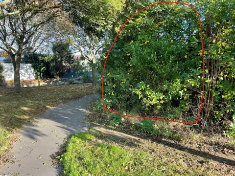
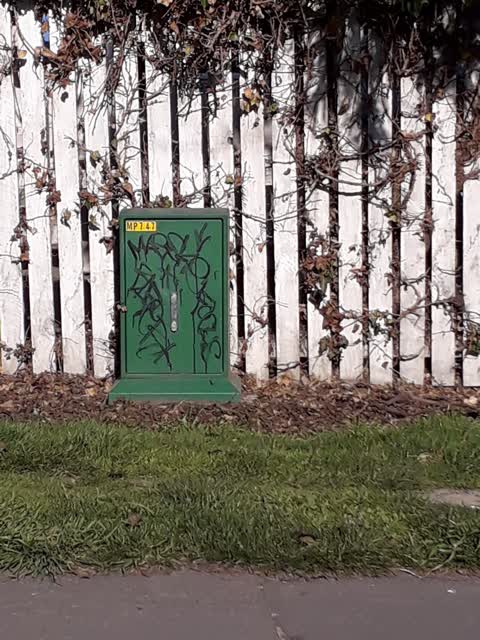
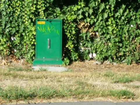
Reported here
 Graffiti on a traffic light pole or cabinet, or wa —
 grafetti on electric box linwood and hargood traffic lights
 Bus Shelter Issue —
 Smashed bus shelter has police emergency tape
 Graffiti on a fence, building or structure —
 Multiple tags on walkway beside the Linwood drain between Hsr Hargood and Tilford Streets - most at end sections rather than central area.
 General Request —
 Back in the 90s I think, the council designed Port Hilks Drive and Scenic Drive. Most of the signs have gone but 4 remain along Linwood Ave.
 Pavement - Damaged —
 The path is broken which traps leafs etc and creates grass over growth
 Graffiti somewhere else —
  Graffiti —
  Graffiti —
 - Overgrown Vegetation —
- Water Leak —
- Water Leak —
- Dumped Rubbish —
- Water Leak —
 General - Abandoned Trolley —
  Roading/Streets —
 Hi Team, Dangerous blind corner. Cyclists have been involved in head on collisions here. Broken bicycle parts can be found in this area. F
Graffiti —
Graffiti —
Graffiti —
Graffiti —
Graffiti —
Graffiti —
Graffiti —
Graffiti —
Graffiti —
Graffiti —
Also reported on Linwood Avenue
- 701 Linwood Avenue — 141 reports
- 429 Linwood Avenue — 36 reports
- 560 Linwood Avenue — 21 reports
- 487 Linwood Avenue — 18 reports
- 427 Linwood Avenue — 15 reports
- 434 Linwood Avenue — 13 reports
- 359 Linwood Avenue — 12 reports
- 379A Linwood Avenue — 9 reports
The street’s crash record
NZTA’s record names Linwood Avenue in 107 crashes that hurt somebody since 2006 — 1 person killed, 29 seriously hurt.
The green nearby
- Cutler Park — 244 m to the edge
- Linwood Esplanade Reserve — 386 m to the edge
- Cypress Garden Reserve — 401 m to the edge · Sports ground · 4 ha
Parks within half a kilometre, measured to the boundary — the council’s open data.
The civic shelf nearby
- Bromley Cemetery — 56 m away · Cemetery
Libraries, halls and the rest within half a kilometre — the council’s open data.
On the doorstep
- Glenbyre Liquor Centre — 273 m away · Bottle stores
- Chicken To Go — 278 m away · Fast food
- BP Linwood — 284 m away · Petrol stations
- BP 2go — 288 m away · Dairies & convenience
Businesses within four hundred metres, measured at the pin — OpenStreetMap and the council directories.
The bus nearby
- Hargood St and Linwood Ave — 28 m away · route 140
- Linwood Ave near Keighleys Rd — 49 m away · route 140
The closest Metro stops, within four hundred and fifty metres.
The tracks through here
- Walk and bike track through Bromley — 22 m to the line · walk · bike
- Walk and bike track through Bromley — 27 m to the line · walk · bike
- Walk and bike track through Bromley — 90 m to the line · walk · bike
- Walk and bike track through Bromley — 228 m to the line · walk · bike
- Walk and bike track through Bromley — 414 m to the line · walk · bike
Tracks whose line passes within half a kilometre, measured to the line itself — the council’s open data.
The named ground
the council’s own structure register — bridges, boardwalks and steps standing nearby — the open map’s record.
The remembered names nearby
- In Memory of Rita Brown & Nerissa Beauty That Love — 163 m away ·
IN MEMORY OF RITA BROWN & NERISSA BEAUTY THAT LOVE HAD CREATED NOW OUR PRESENT FAMILY GRIE
· 2009 - A Tiny Little Moonbeam That Danced Inside our Hearts — 164 m away ·
A tiny little moonbeam that danced inside our hearts A little life is taken before it even
· 2009 - Albert Wilson — 196 m away ·
ALBERT WILSON
· 2013
Inscribed plaques within two hundred and fifty metres — the register’s pins, not surveyed spots. The whole roll is at /plaques.
Renting nearby
new bonds in Bromley ran about $560 a week — $10 above the city median of $550 — the suburb page keeps the rent record →.
What was here — Canterbury Crematorium and Setting
161 m away · 447 Linwood Avenue · located to ±27 m · the place’s own record →
On the register. Nothing researched here yet.
The civic layer
This ground votes in Linwood ward — the Coastal-Burwood-Linwood community board. Ward lines don’t always follow suburb lines; this one is measured at the pin, not the suburb’s centre.
What stood on this ground → · On the map → · From the air — the Crown’s aerials back to 1936; search the address on RetroLens →
Questions, answered briefly
25 council reports on record since June 2016 — most often graffiti (12), water leak (3), roading/streets (1).
Bromley, Christchurch — on Linwood Avenue.
The heritage register names a place at or beside it — Canterbury Crematorium and Setting.
Cutler Park — 244 m to its edge.