487 Linwood Avenue, Bromley
18 reports on record since February 2017 · 8 with photographs. The street’s heaviest record is 701 Linwood Avenue — 141 reports on file. Indicative rating valuation and school zones, hazards, bin day and what stood here before.
What gets reported here
- Water Leak — 5
- Pothole — 3
- Pavement - Damaged — 2
- Graffiti somewhere else — 2
- Rubbish/Recycling — 1
- Graffiti — 1
Photographed here 8 on record


Reported here
 Damaged Street Sign —
 outside Oderings - top bracket broken
 Graffiti somewhere else —
 On st John street just along for Linwood ave near oderings
 Graffiti somewhere else —
 Corner st John's and Linwood ave ladder required due to height
 Pavement - Damaged —
 Fabric covering is loose and dangerous in a gentle wind
 General Request —
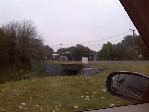
 Wastewater was observed in the stream and appears to be a long-standing issue. Floating, intact poo in this instance. Previously, there has
 Damaged Road —
 Dangerous rut in road and 30m section of very rough cycle way. Causing cyclists to have to swing out towards traffic to avoid it.
- Pothole —
- Accessibility —
- Pothole —
- Pavement - Damaged —
- Water Leak —
- Water Leak —
- Water Leak —
- Water Leak —
- Pothole —
- Water Leak —
Rubbish/Recycling —
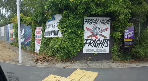
lots of advertising signs on ccc property.
Graffiti —
Also reported on Linwood Avenue
- 701 Linwood Avenue — 141 reports
- 429 Linwood Avenue — 36 reports
- 434A Linwood Avenue — 25 reports
- 560 Linwood Avenue — 21 reports
- 427 Linwood Avenue — 15 reports
- 434 Linwood Avenue — 13 reports
- 359 Linwood Avenue — 12 reports
- 379A Linwood Avenue — 9 reports
The street’s crash record
NZTA’s record names Linwood Avenue in 107 crashes that hurt somebody since 2006 — 1 person killed, 29 seriously hurt.
The green nearby
- Bayswater Reserve — 189 m to the edge · 2 ha
- St Lukes East Drainage Reserve — 191 m to the edge
- St Florian Reserve — 205 m to the edge
- St Lukes Reserve — 306 m to the edge
- Cutler Park — 374 m to the edge
Parks within half a kilometre, measured to the boundary — the council’s open data.
On the doorstep
- Haka Lodge Backpackers — 73 m away · Hostels
- Oderings Garden Centre — 93 m away · Garden centres
- Christchurch Kiwi Holiday Park and Motels — 156 m away · Campgrounds
- Kidbrooke Convenience — 209 m away · Dairies & convenience
Businesses within four hundred metres, measured at the pin — OpenStreetMap and the council directories.
The bus nearby
- Linwood Ave near Wanstead Pl — 105 m away · route 140
- Linwood Ave near Wanstead Pl — 107 m away · route 140
The closest Metro stops, within four hundred and fifty metres.
The tracks through here
- Walk and bike track through Bromley — 4 m to the line · walk · bike
- Walk and bike track through Bromley — 49 m to the line · walk · bike
- Walk and bike track through Bromley — 357 m to the line · walk · bike
Tracks whose line passes within half a kilometre, measured to the line itself — the council’s open data.
The named ground
Named water within 500 m of this address, measured to the line or the edge — the open map’s record.
Renting nearby
new bonds in Bromley ran about $560 a week — $10 above the city median of $550 — the suburb page keeps the rent record →.
The civic layer
This ground votes in Linwood ward — the Coastal-Burwood-Linwood community board. Ward lines don’t always follow suburb lines; this one is measured at the pin, not the suburb’s centre.
What stood on this ground → · On the map → · From the air — the Crown’s aerials back to 1936; search the address on RetroLens →
Questions, answered briefly
18 council reports on record since February 2017 — most often water leak (5), pothole (3), pavement - damaged (2).
Bromley, Christchurch — on Linwood Avenue.
Nothing on the heritage register at this exact spot — the record around this ground →
Bayswater Reserve — 189 m to its edge, 2 ha.