3 Roydvale Avenue, Burnside
12 reports on record since December 2021 · 8 with photographs. The most-reported address on Roydvale Avenue. Indicative rating valuation and school zones, hazards, bin day and what stood here before.
What gets reported here
- Water Leak — 3
- Rubbish and Bins - General — 3
- Hazard — vehicle — 2
- Water General — 1
- Parks — 1
- Park - General Request — 1
Photographed here 8 on record


Reported here
 Park - General Request —
 chain fence been hit, post bent and chain broken
 Water Leak —
 2 × water leaks at Burnside rugby sprinklers
 Hazard — vehicle —
 By Burnside Park, clearly hard to find a park with sports but this parking is very dangerous.
 Hazard — vehicle —
 Car parked over driveway, very dangerous and hard for me to exit property.
 Graffiti on a sign, mural or public art —
 Road signs on island where roydvale meets avonhead road.
- Rubbish and Bins - General —
Our red bin wasn’t collected this morning, so we have a full red bin.
 Water Leak —
 Our leaky meter got fixed maybe 6 months ago, and today noticed it’s leaking again. No one has touched it, obviously didn’t get repaired co
- Rubbish and Bins - General —
Hi there, our red bin didn’t get collected today so still full. Assume we leave this out and someone will come and empty? Thanks
 Rubbish and Bins - General —
 Hi there, as per photo. There is roadworks on Roydvale Ave and as you can see none of the bins have been collected. As there was no commun
- Water Leak —
- Water General —
 Parks —
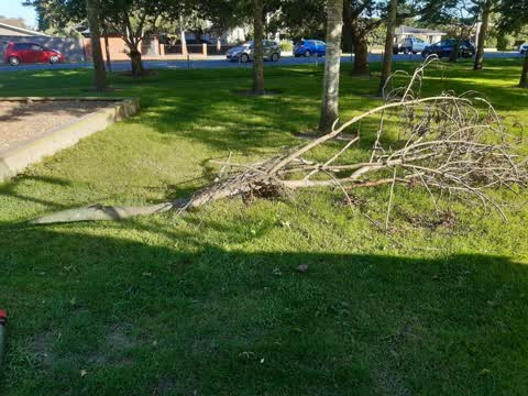
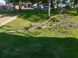
 Wind blowing branches
Also reported on Roydvale Avenue
- 25 Roydvale Avenue — 10 reports
- 19 Roydvale Avenue — 8 reports
- 127 Roydvale Avenue — 8 reports
- 97 Roydvale Avenue — 7 reports
- 37 Roydvale Avenue — 7 reports
- 33 Roydvale Avenue — 7 reports
- 55 Roydvale Avenue — 6 reports
- 21 Roydvale Avenue — 6 reports
The street’s crash record
NZTA’s record names Roydvale Avenue in 32 crashes that hurt somebody since 2006 — 1 person killed, 6 seriously hurt.
The green nearby
- Burnside Park — 21 m to the edge · Sports ground · 29 ha
- Coringa Reserve — 110 m to the edge
- Avice Hill Reserve — 251 m to the edge · Botanic
- Lavendula Reserve — 279 m to the edge
Parks within half a kilometre, measured to the boundary — the council’s open data.
On the doorstep
- Mike Pero's Motorcycle Gallery — 188 m away · Museums
- Burnside Rugby Football Club — 268 m away · Sports centres
- Burnside Squash club — 297 m away · Sports centres
- Avice Hill Arts and Craft Centre — 329 m away · Venues & events
Businesses within four hundred metres, measured at the pin — OpenStreetMap and the council directories.
The bus nearby
- Memorial Ave near Roydvale Ave — 305 m away · route 29
- Memorial Ave near Roydvale Ave — 316 m away · route 29
The closest Metro stops, within four hundred and fifty metres.
The tracks through here
- Walk and bike track through Burnside — 408 m to the line · walk · bike
- Walk and bike track through Burnside — 412 m to the line · walk · bike
- Walk and bike track through Burnside — 493 m to the line · walk · bike
Tracks whose line passes within half a kilometre, measured to the line itself — the council’s open data.
The named ground
the council’s own structure register — bridges, boardwalks and steps standing nearby — the open map’s record.
Renting nearby
new bonds in Burnside ran about $641 a week — $91 above the city median of $550 — the suburb page keeps the rent record →.
The civic layer
This ground votes in Waimairi ward — the Fendalton-Waimairi-Harewood community board. Ward lines don’t always follow suburb lines; this one is measured at the pin, not the suburb’s centre.
What stood on this ground → · On the map → · From the air — the Crown’s aerials back to 1936; search the address on RetroLens →
Questions, answered briefly
12 council reports on record since December 2021 — most often water leak (3), rubbish and bins - general (3), hazard — vehicle (2).
Burnside, Christchurch — on Roydvale Avenue.
Nothing on the heritage register at this exact spot — the record around this ground →
Burnside Park — 21 m to its edge, 29 ha.